City of Warwick
| City of Warwick Queensland | |||||||||||||
|---|---|---|---|---|---|---|---|---|---|---|---|---|---|
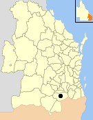 Location within Queensland | |||||||||||||
| Population | 10,393 (1991 census)[1] | ||||||||||||
| • Density | 414.1/km2 (1,072.4/sq mi) | ||||||||||||
| Established | 1861 | ||||||||||||
| Area | 25.1 km2 (9.7 sq mi) | ||||||||||||
| Council seat | Warwick | ||||||||||||
| Region | Darling Downs | ||||||||||||
| |||||||||||||
The City of Warwick was a local government area administering the regional centre of Warwick in the Darling Downs region of Queensland. The City covered an area of 25.1 square kilometres (9.7 sq mi), and existed as a local government entity from 1861 until 1994, when it was dissolved and amalgamated with Shire of Allora, Shire of Rosenthal and Shire of Glengallan to form the Shire of Warwick.
History
The Borough of Warwick came into being on 25 May 1861 under the Municipalities Act 1858, a piece of New South Wales legislation inherited by Queensland at its separation two years earlier.[2]
With the passage of the Local Authorities Act 1902, the Borough of Warwick became the Town of Warwick.[2][3]
On 4 April 1936 it was proclaimed as the City of Warwick.[3][4]
On 19 March 1992, the Electoral and Administrative Review Commission, created two years earlier, produced its report External Boundaries of Local Authorities, and recommended that local government boundaries in the Warwick area be rationalised into 3 new local government areas.[5] That recommendation was not implemented, but the outcome was that the City of Warwick was merged with the Shires of Allora, Glengallan and Rosenthal to form a new Shire of Warwick. The Local Government (Allora, Glengallan, Rosenthal and Warwick) Regulation 1994 was gazetted on 20 May 1994. On 25 June, an election was held for the new council, and on 1 July 1994, the City of Warwick was abolished.[4][6]
Mayors
- 1861-1862: James Jones Kingsford [7]
- 1863: Thomas McEvoy [7]
- 1864: William Marshall [7]
- 1865: S. W. Alfred [7]
- 1866: Thomas McEvoy [7]
- 1866-1867 James Morgan [7]
- 1868: John Liddell Ross [7]
- 1869: Edmund L. Thornton [7]
- 1870 John Liddell Ross [7]
- 1871-1872: Samuel Evenden [7]
- 1873-1874: John Liddell Ross [7][7]
- 1875: Frederick Morgan [7]
- 1876: Frederick Hudson [7]
- 1876-1877: Jacob Horwitz [7]
- 1878: John W. Quinn [7]
- 1879-1880: James M'Keachie [7]
- 1881-1884: T. A. Johnson [7]
- 1885: W.D. Wilson [7]
- 1886-1889: Arthur Morgan [7][8]
- 1890: John Archibald [7]
- 1891: John Healy [7]
- 1892: Francis Grayson [7]
- 1893: William Morgan [7]
- 1894: William Collins [7]
- 1895: Jeremiah Allman [7]
- 1896: Francis Grayson [7][9]
- 1897: John Archibald [7]
- 1898: Arthur Morgan [7]
- 1899: William Wallace [7]
- 1900-1901: William Morgan [7]
- 1910: D. Connolly [10]
- 1913: John Allman [11]
- 1923: D. Connolly [10]
- 1927: D. Connolly [12]
- 1936: John Allman [13]
- 1988: Stanley Richard Walsh[14]
Population
| Year | Population |
|---|---|
| 1933 | 6,664 |
| 1947 | 7,129 |
| 1954 | 9,151 |
| 1961 | 9,843 |
| 1966 | 10,065 |
| 1971 | 9,303 |
| 1976 | 9,169 |
| 1981 | 8,853 |
| 1986 | 9,435 |
| 1991 | 10,393 |
| 1996 | 10,947 |
References
- ↑ Australian Bureau of Statistics (1993). 2730.3 Census counts for small areas : Queensland. ISBN 0-642-17236-6.
- 1 2 "Agency ID2505, Warwick Municipal Council". Queensland State Archives. Retrieved 3 February 2014.
- 1 2 "Agency ID2507, Warwick Town Council". Queensland State Archives. Retrieved 3 February 2014.
- 1 2 "Agency ID10419, Warwick City Council". Queensland State Archives. Retrieved 3 February 2014.
- ↑ "External Boundaries of Local Authorities" (PDF). Electoral and Administrative Review Commission. Retrieved 3 February 2014.
- ↑ "Agency ID6067, Warwick Shire Council". Queensland State Archives. Retrieved 10 September 2013.
- 1 2 3 4 5 6 7 8 9 10 11 12 13 14 15 16 17 18 19 20 21 22 23 24 25 26 27 28 29 30 31 "Mayors of Warwick to Date.". Warwick Examiner and Times (Qld. : 1867 - 1919). Qld.: National Library of Australia. 13 February 1901. p. 3. Retrieved 1 October 2015.
- ↑ "Local Government Elections.". The Western Star and Roma Advertiser. Toowoomba, Qld.: National Library of Australia. 15 February 1888. p. 3. Retrieved 4 October 2013.
- ↑ "WARWICK MUNICIPAL COUNCIL.". Warwick Argus (Qld. : 1879 - 1901). Qld.: National Library of Australia. 11 February 1896. p. 2. Retrieved 1 October 2015.
- 1 2 Australian History Publishing Co (1936), Queensland and Queenslanders : incorporating 'Prominent Queenslanders', Australian History Publishing Co, p. 80, retrieved 1 October 2015 — available online
- ↑ Australian History Publishing Co (1936), Queensland and Queenslanders : incorporating 'Prominent Queenslanders', Australian History Publishing Co, p. 75, retrieved 1 October 2015 — available online
- ↑ Pugh, Theophilus Parsons (1927). Pugh's Almanac for 1927. Retrieved 13 June 2014.
- ↑ Australian History Publishing Co (1936), Queensland and Queenslanders : incorporating 'Prominent Queenslanders', Australian History Publishing Co, retrieved 1 October 2015 — available online
- ↑ "Warwick Town Hall Centenary". Monument Australia. Retrieved 1 October 2015.
External links
- "External Boundaries of Local Authorities" (PDF). Electoral and Administrative Review Commission. 19 March 1992.
- Local Government (Allora, Glengallan, Rosenthal and Warwick) Regulation 1994
Coordinates: 28°12′59.98″S 152°01′00.01″E / 28.2166611°S 152.0166694°E