Shire of Cardwell
| Shire of Cardwell Queensland | |||||||||||||
|---|---|---|---|---|---|---|---|---|---|---|---|---|---|
 Location within Queensland | |||||||||||||
| Population | 9,529 (2006 census)[1] | ||||||||||||
| • Density | 3.11182/km2 (8.0596/sq mi) | ||||||||||||
| Established | 1884 | ||||||||||||
| Area | 3,062.2 km2 (1,182.3 sq mi) | ||||||||||||
| Council seat | Tully | ||||||||||||
| Region | Far North Queensland | ||||||||||||
|
| |||||||||||||
| |||||||||||||
The Shire of Cardwell was a local government area of Queensland. It was located on the Coral Sea coast about halfway between the cities of Cairns and Townsville. The shire, administered from the town of Tully, covered an area of 3,062.2 square kilometres (1,182.3 sq mi), and existed as a local government entity from 1884 until 2008, when it amalgamated with the Shire of Johnstone to form the Cassowary Coast Region.
The shire also had responsibility for some Great Barrier Reef islands, including Dunk Island, Goold Island and Hinchinbrook Island.
The area's economy is based on agriculture, in particular sugar and bananas, and tourism. Part of the Wet Tropics of Queensland and Great Barrier Reef World Heritage Sites are located in Cardwell Shire.
History

The Hinchinbrook Division was created on 11 November 1879 as one of 74 divisions around Queensland under the Divisional Boards Act 1879. On 18 January 1884, part of the Hinchinbrook Division was separated to create the new Cardwell Division.[2][3][4]
In 1892, the Cardwell Divisional Board built the Cardwell Divisional Board Hall (now heritage-listed) at 51 Victoria Street, Cardwell. At that time, Cardwell was regarded as the major town in the division (as reflected in the division's name).[5]
With the passage of the Local Authorities Act 1902, Cardwell Division became the Shire of Cardwell on 31 March 1903.[4][6] The divisional board hall then became known as the Cardwell Shire Council Chambers.[5]
To commemorate those who served in World War I, an honour board was erected in the Shire Council Chambers in 1922. Composed of marble, it lists 26 servicemen and 2 nurses from the local community. The inclusion of nurses is such a memorial is relatively uncommon.[5]

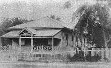
In 1929, the decision was taken to relocate the shire council's headquarters to the newer but more populous town of Tully. The first council meeting held in Tully was on 27 June 1929. A new shire chambers was built in 1930 on the south-east corner of Bryant and Morris Streets in Tully. The former shire chambers in Cardwell was then used by the Queensland Country Women's Association (QCWA) and later by the Returned Sailors' Soldiers' and Airmen's Imperial League of Australia (RSSAILA). From 1989 to 2008, the building was used as a library. Later it became the J. C. Hubinger Memorial Museum. The presence of the honour board means that the building has been the community focus for Anzac Day ceremonies throughout the years. Given its historical and cultural significance, the building was listed on the Queensland Heritage Register on 21 March 2013.[5]
In 1978, the shire chambers in Tully were replaced with the present council chambers.
On 15 March 2008, under the Local Government (Reform Implementation) Act 2007 passed by the Parliament of Queensland on 10 August 2007, the Shire of Cardwell merged with the Shire of Johnstone (also formerly part of the Hinchinbrook Division) to form the Cassowary Coast Region.[6]
Towns and localities
The Shire of Cardwell included the following settlements:
|
Greater Tully area:
|
Localities:
|
Population
| Year | Population |
|---|---|
| 1933 | 4,416 |
| 1947 | 4,346 |
| 1954 | 5,045 |
| 1961 | 5,183 |
| 1966 | 5,640 |
| 1971 | 5,736 |
| 1976 | 6,478 |
| 1981 | 7,853 |
| 1986 | 8,666 |
| 1991 | 9,882 |
| 1996 | 10,130 |
| 2001 | 10,634 |
| 2006 | 10,584 |
Chairmen
- 1884: James Thorn Senior
- 1902: Peter Smith
- 1903—1904: Johann Christian Hubinger (chairman 15 times)[5][7]
- 1908: Johann Christian Hubinger (again, but died September 1908)[8][9]
- 1909: Mr Hubinger[10]
- 1910: Mr Kennedy[11]
- 1914: Mr Stamp[12]
- 1915: Arthur Henry[13]
- 1921—1924: Brice Henry[14][15][16]
- 1924—1931: James Thorn[17][18][19][20][21][22][23]
- 1931—1933: Julius August Winter[24]
- 1933—1936: Chris Teitzel[25]
- 1936—1940: Brice Henry (died February 1940)[26][27][27]
- 1940: P. White[28]
- 1943—1954: Charles Dickinson[29][30][31][32][33]
- 1985—1991: Atte Raccanello (first and only female council leader)[34]
- 2004—2008: Giuseppe (Joe) Galeano
Gladys Henry was the first female council member, serving between 1976 and 1982.
References
- ↑ Australian Bureau of Statistics (25 October 2007). "Cardwell (S) (Local Government Area)". 2006 Census QuickStats. Retrieved 13 June 2011.
- ↑ "Proclamation [Cardwell Division constituted]". Queensland Government Gazette. 19 January 1884. p. 34:170.
- ↑ "Proclamation [Hinchinbrook Division amended]". Queensland Government Gazette. 19 January 1884. p. 34:169.
- 1 2 "Agency ID743, Cardwell Divisional Board". Queensland State Archives. Retrieved 12 September 2013.
- 1 2 3 4 5 "Cardwell Divisional Board Hall (former) and Honour Board (entry 601768)". Queensland Heritage Register. Queensland Heritage Council. Retrieved 18 May 2014.
- 1 2 "Agency ID555, Cardwell Shire Council". Queensland State Archives. Retrieved 12 September 2013.
- ↑ Consolidated Index to Queensland Government Gazette 1859–1919. Queensland Family History Society. 2004. ISBN 1 876613 79 3.
- ↑ "LICENSING AUTHORITIES.". Townsville Daily Bulletin. Qld.: National Library of Australia. 4 April 1908. p. 3. Retrieved 19 May 2014.
- ↑ "PERSONAL.". The Northern Miner. Charters Towers, Qld.: National Library of Australia. 17 September 1908. p. 4. Retrieved 19 May 2014.
- ↑ "Tully River District.". The Northern Miner. Charters Towers, Qld.: National Library of Australia. 3 July 1909. p. 11. Retrieved 19 May 2014.
- ↑ "GOVERNMENT'S RAILWAY POLICY.". The Brisbane Courier. Qld.: National Library of Australia. 3 August 1910. p. 5. Retrieved 19 May 2014.
- ↑ "Cardwell Council Minutes.". Townsville Daily Bulletin. Qld.: National Library of Australia. 17 August 1914. p. 2. Retrieved 19 May 2014.
- ↑ "CARDWELL.". The Cairns Post. Qld.: National Library of Australia. 2 August 1915. p. 2. Retrieved 19 May 2014.
- ↑ "Practical Sympathy.". The Cairns Post. Qld.: National Library of Australia. 24 September 1921. p. 5. Retrieved 19 May 2014.
- ↑ "Cardwell Notes.". Townsville Daily Bulletin. Qld.: National Library of Australia. 30 March 1922. p. 5. Retrieved 19 May 2014.
- ↑ "BRICE HENRY'S POLICY.". The Cairns Post. Qld.: National Library of Australia. 5 March 1924. p. 7. Retrieved 19 May 2014.
- ↑ "Cardwell's New Chairman.". The Cairns Post. Qld.: National Library of Australia. 26 April 1924. p. 4. Retrieved 19 May 2014.
- ↑ Unidentified (1925), VIPs at the official opening of the new Tully Mill, 1925, John Oxley Library, State Library of Queensland, retrieved 19 May 2014
- ↑ "CARDWELL NOTES.". Townsville Daily Bulletin. Qld.: National Library of Australia. 21 April 1926. p. 10. Retrieved 19 May 2014.
- ↑ "CARDWELL SHIRE COUNCIL.". Townsville Daily Bulletin. Qld.: National Library of Australia. 22 April 1927. p. 8. Retrieved 19 May 2014.
- ↑ "CARDWELL SHIRE.". The Cairns Post. Qld.: National Library of Australia. 30 May 1930. p. 4. Retrieved 19 May 2014.
- ↑ "CARDWELL SHIRE.". The Cairns Post. Qld.: National Library of Australia. 16 March 1931. p. 5. Retrieved 19 May 2014.
- ↑ Pugh, Theophilus Parsons (1927). Pugh's Almanac for 1927. Retrieved 13 June 2014.
- ↑ "CARDWELL SHIRE.". The Cairns Post. Qld.: National Library of Australia. 26 March 1931. p. 7. Retrieved 19 May 2014.
- ↑ "CARDWELL.". The Cairns Post. Qld.: National Library of Australia. 1 May 1933. p. 6. Retrieved 19 May 2014.
- ↑ "CARDWELL SHIRE.". The Cairns Post. Qld.: National Library of Australia. 20 April 1936. p. 6. Retrieved 19 May 2014.
- 1 2 "LOCAL AUTHORITIES.". Townsville Daily Bulletin. Qld.: National Library of Australia. 24 April 1939. p. 5. Retrieved 19 May 2014.
- ↑ "LOAN FOR CROW'S NEST STREET IMPROVEMENTS.". The Courier-Mail. Brisbane: National Library of Australia. 2 March 1940. p. 13. Retrieved 19 May 2014.
- ↑ "TULLY NOTES.". Townsville Daily Bulletin. Qld.: National Library of Australia. 8 May 1943. p. 4. Retrieved 19 May 2014.
- ↑ "CARDWELL SHIRE.". The Cairns Post. Qld.: National Library of Australia. 1 May 1946. p. 2. Retrieved 19 May 2014.
- ↑ "Advertising.". The Cairns Post. Qld.: National Library of Australia. 6 June 1949. p. 7. Retrieved 19 May 2014.
- ↑ "CATDWELL SHIRE.". The Cairns Post. Qld.: National Library of Australia. 2 June 1952. p. 3. Retrieved 19 May 2014.
- ↑ "CANE PESTS AND DISEASES.". The Cairns Post. Qld.: National Library of Australia. 24 March 1953. p. 4. Retrieved 19 May 2014.
- ↑ "Automation signs death warrant for Cardstone.". The Canberra Times. National Library of Australia. 10 March 1991. p. 21. Retrieved 19 May 2014.
Further reading
- Jones, Dorothy; Sabourn, Bill; Cardwell (Qld. : Shire). Council (1961). Cardwell Shire story. Published for the Cardwell Shire Council [by] the Jacaranda Press. ISBN 978-0-7016-0406-6.
External links
Coordinates: 17°55′58″S 145°55′27″E / 17.93278°S 145.92417°E