Shire of Laidley
| Shire of Laidley Queensland | |||||||||||||
|---|---|---|---|---|---|---|---|---|---|---|---|---|---|
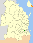 Location within Queensland | |||||||||||||
| Population | 14,311 (2006 census)[1] | ||||||||||||
| • Density | 20.4268/km2 (52.905/sq mi) | ||||||||||||
| Established | 1888 | ||||||||||||
| Area | 700.6 km2 (270.5 sq mi) | ||||||||||||
| Council seat | Laidley | ||||||||||||
| Region | Lockyer Valley | ||||||||||||
|
| |||||||||||||
| Website | Shire of Laidley | ||||||||||||
| |||||||||||||
The Shire of Laidley was a local government area located in the Lockyer Valley region between the cities of Toowoomba and Ipswich, and about 70 kilometres (43 mi) west of Brisbane, the state capital of Queensland, Australia. The shire covered an area of 700.6 square kilometres (270.5 sq mi), and existed from 1888 until its merger with the Shire of Gatton to form the Lockyer Valley Region on 15 March 2008.
History
Prior to European settlement, the area around Laidley was home to the Kitabul Aboriginal people.
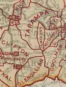
The district was originally part of the Tarampa Divisional Board, which was created on 15 January 1880 under the Divisional Boards Act 1879. On 25 April 1888, the Laidley district broke away and separately incorporated as the Laidley Division, and on 25 January 1890, the Forest Hill area moved from Tarampa to Laidley.[2] On 1 July 1902, the town of Laidley was created as a separate municipality with its own Borough Council.
With the passage of the Local Authorities Act 1902, the borough became a Town and the division a Shire on 31 March 1903. The town council was dissolved on 8 February 1917, and Laidley absorbed part of the Shire of Rosewood.
On 15 March 2008, under the Local Government (Reform Implementation) Act 2007 passed by the Parliament of Queensland on 10 August 2007, Laidley merged with the Shire of Gatton to form the Lockyer Valley Region.
Structure
The Shire of Laidley initially had three divisions each electing three councillors, but from 1917 onwards had five divisions each electing two councillors. The chairman and clerk were chosen from amongst the councillors.
Towns and localities
The Shire of Laidley included the following settlements:
- Laidley
- Blenheim
- Forest Hill
- Glenore Grove
- Regency Downs
- Hatton Vale
- Kentville
- Laidley Heights
- Lockrose
- Mulgowie
- Plainland
Population
| Year | Population |
|---|---|
| 1933 | 5,100 |
| 1947 | 4,755 |
| 1954 | 4,617 |
| 1961 | 4,793 |
| 1966 | 4,847 |
| 1971 | 4,493 |
| 1976 | 4,635 |
| 1981 | 5,380 |
| 1986 | 6,812 |
| 1991 | 8,463 |
| 1996 | 12,116 |
| 2001 | 12,636 |
| 2006 | 14,311 |
Chairmen and mayors
- 1927: A. Schlecht [3]
- 1970—1973: William Angus (Bill) Gunn [4]
- 1997-2008: Shirley Pitt
References
- ↑ Australian Bureau of Statistics (25 October 2007). "Laidley (S) (Local Government Area)". 2006 Census QuickStats. Retrieved 2008-03-18.
- ↑ Queensland Government Gazette, 25 April 1888, p.1403.
- ↑ Pugh, Theophilus Parsons (1927). Pugh's Almanac for 1927. Retrieved 13 June 2014.
- ↑ "Gunn, Hon. William Angus (Bill)". Re-Member Database. Queensland Parliament. Retrieved 18 June 2014.
Further reading
- Blake, William (1991). A story of the Laidley Shire : from 1829 onwards to all this. Laidley Shire Council. (116 pages)
External links
- "Laidley Shire". Queensland Places. Centre for the Government of Queensland, University of Queensland.
Coordinates: 27°38′07″S 152°23′24″E / 27.6353°S 152.3901°E