Shire of Balonne
| Shire of Balonne Queensland | |||||||||||||
|---|---|---|---|---|---|---|---|---|---|---|---|---|---|
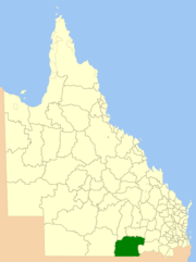 Location within Queensland | |||||||||||||
| Population | 4,847 (2010)[1] | ||||||||||||
| • Density | 0.155600/km2 (0.40300/sq mi) | ||||||||||||
| Established | 1879 | ||||||||||||
| Area | 31,150.3 km2 (12,027.2 sq mi) | ||||||||||||
| Mayor | Donna Stewart | ||||||||||||
| Council seat | St George | ||||||||||||
| Region | Maranoa | ||||||||||||
| State electorate(s) | Warrego | ||||||||||||
| Federal Division(s) | Division of Maranoa | ||||||||||||
|
| |||||||||||||
| Website | Shire of Balonne | ||||||||||||
| |||||||||||||
The Shire of Balonne is a local government area in South West Queensland, Australia, over 500 kilometres (310 mi) from the state capital, Brisbane. It covers an area of 31,150.3 square kilometres (12,027.2 sq mi), and has existed as a local government entity since 1879. It is headquartered in its main town, St George.
History

Ula Ula Division was created on 11 November 1879 as one of 74 divisions around Queensland under the Divisional Boards Act 1879 with a population of 1271.[2][3] The name Ula Ula is believed to be derived from an Aboriginal word meaning water lilies.[4] or ripples on water[5]
A separate municipality, the Borough of St George was gazetted on 31 July 1884,[6] but on 13 March 1886 it was abolished and amalgamated back into Ula Ula Division.[7]
On 11 March 1903, Ula Ula Division was renamed Balonne Division after the Balonne River.[8] The name Balonne is believed to be of Aboriginal origin meaning water or running stream.[9]
With the passage of the Local Authorities Act 1902, Balonne Division became Shire of Balonne on 31 March 1903.[3][10]
Rivers
The area contains the Balonne, Barwon, Boomi, Culgoa, Little Weir, Maranoa, Moonie, and Narran rivers, which attract fishermen seeking both the Yellow belly and Murray Cod.
Towns and localities
The Shire of Balonne includes the following settlements:
- St George
- Alton
- Bollon
- Boolba
- Dirranbandi
- Hebel
- Mungindi
- Nindigully
- Thallon
Annual events
Annual events include:
- Fishing Competitions,
- A Golf Carnival,
- Motorbike Endurance Rallies,
- Country Shows & Rodeos
- Wool, Craft & Flower Shows
Chairmen
- 1927: David Robert Roberts[11]
Other notable members of the council include:
- Eddie Beardmore, council member for 15 years and deputy chairman for 8 years, also Member of the Queensland Legislative Assembly for Balonne[12]
Population
| Year | Population |
|---|---|
| 1933 | 4,452 |
| 1947 | 4,040 |
| 1954 | 5,527 |
| 1961 | 6,105 |
| 1966 | 5,849 |
| 1971 | 5,354 |
| 1976 | 4,580 |
| 1981 | 4,678 |
| 1986 | 5,056 |
| 1991 | 5,112 |
| 1996 | 4,830 |
| 2001 | 5,414 |
| 2006 | 4,599 |
References
- ↑ Australian Bureau of Statistics (31 March 2011). "Regional Population Growth, Australia, 2009–10". Retrieved 11 June 2011.
- ↑ "Proclamation [Ula Ula Division]". Queensland Government Gazette. 11 November 1879. p. 25:998.
- 1 2 "Agency ID306, Balonne Divisional Board". Queensland State Archives. Retrieved 21 September 2013.
- ↑ "Balonne Shire". Queensland Places. Centre for the Government of Queensland, University of Queensland.
- ↑ "Ula Ula (entry 35729)". Queensland Place Names. Queensland Government. Retrieved 21 September 2013.
- ↑ "Official Notification.". The Queenslander (Brisbane, Qld. : 1866 - 1939). Brisbane, Qld.: National Library of Australia. 9 August 1884. p. 236. Retrieved 23 March 2014.
- ↑ "Proclamation [St George & Ula Ula Division]". Queensland Government Gazette. 13 March 1886. p. 38:951.
- ↑ "OFFICIAL NOTIFICATIONS.". The Queenslander (Brisbane, Qld. : 1866 - 1939). Brisbane, Qld.: National Library of Australia. 14 March 1903. p. 564. Retrieved 2 January 2014.
- ↑ "Balonne River (entry 1434)". Queensland Place Names. Queensland Government. Retrieved 21 September 2013.
- ↑ "Agency ID308, Balonne Shire Council". Queensland State Archives. Retrieved 21 September 2013.
- ↑ Pugh, Theophilus Parsons (1927). Pugh's Almanac for 1927. Retrieved 13 June 2014.
- ↑ "Beardmore, Mr Edwin James, MBE (Eddie)". Re-Member Database. Queensland Parliament. Retrieved 18 June 2014.
External links
- "Balonne Shire". Queensland Places. Centre for the Government of Queensland, University of Queensland.
Coordinates: 28°02′14″S 148°34′28″E / 28.03722°S 148.57444°E