City of Hervey Bay
| City of Hervey Bay Queensland | |||||||||||||
|---|---|---|---|---|---|---|---|---|---|---|---|---|---|
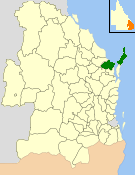 Location within Queensland | |||||||||||||
| Population | 56,427 (2006 census)[1] | ||||||||||||
| • Density | 23.9473/km2 (62.0232/sq mi) | ||||||||||||
| Established | 1879 | ||||||||||||
| Abolished | 2008 | ||||||||||||
| Area | 2,356.3 km2 (909.8 sq mi) | ||||||||||||
| Location | |||||||||||||
| Council seat | Torquay | ||||||||||||
| Region | Wide Bay–Burnett | ||||||||||||
|
| |||||||||||||
| Website | City of Hervey Bay | ||||||||||||
| |||||||||||||
The City of Hervey Bay was a local government area located in the Wide Bay–Burnett region of Queensland, Australia, containing the urban centre of Hervey Bay as well as the northern half of Fraser Island. The City covered an area of 2,356.3 square kilometres (909.8 sq mi), and has existed as a local government entity in various forms from 1879 until 2008, when it was amalgamated with the City of Maryborough, Shire of Woocoo and the 1st and 2nd divisions of the Shire of Tiaro to form the Fraser Coast Region.
History

The area now known as City of Hervey Bay first received local government with the Divisional Boards Act 1879, where on 11 November 1879, the Antigua (population 1636) and Burrum (population 1511) Divisions were created.[2][2][3][4]
A later division, Howard, was split away from the Division of Isis in 1900.[5]
With the passage of the Local Authorities Act 1902, the Antigua, Burrum and Howard Divisions became the Shires of Antigua, Burrum and Howard on 31 March 1903.[3][4][5][6][7][8]
On 3 June 1905, the Shire of Degilbo, later renamed Biggenden, split away from the Shire of Burrum.[9][10]
On 23 December 1905, the Shire of Burrum was renamed Shire of Pialba.[7][11]
Reorganisation of the Maryborough area in 1917
On 17 February 1917, there was a reorganisation of local government in the Maryborough area. Five shires were abolished:[12]
The resulting local government areas were:
- a recreated Shire of Burrum, comprising all of the Shires of Howard and Pialba and part of the Shire of Antigua and part of the City of Maryborough
- an altered Shire of Kilkivan, losing parts to the Shire of Tiaro and the Shire of Tinana but gaining part of the Shire of Tiaro and part of the Shire of Woocoo
- an altered City of Maryborough, losing a small part to the Shire of Burrum but gaining part of the Shire of Granville
- an altered Shire of Tiaro, losing part to Shire of Kilkivan, but gaining parts of the Shires of Granville, Kilkivan and Widgee
- an altered Shire of Tinana, gaining parts of the Shires of Granville, Kilkivan and Widgee
- an altered Shire of Widgee, losing part to Shire of Kilkivan, but gaining part of the Shire of Tiaro
- an enlarged Shire of Woocoo, losing part to the Shire of Kilkivan, but gaining parts of the Shires of Antigua and Howard
A coastal focus in the 1970s
By the 1920s the Hervey Bay area was rapidly expanding due to continuing growth in the primary industries such as sugar cane, citrus, pineapples, beef cattle and fishing, as well as investment in transport infrastructure. In the 1950s and 1960s, population and development increased, and the coastal settlements slowly merged into a single urban area.
On 20 December 1975, the Shire of Burrum was renamed the Shire of Hervey Bay with effect from the local government elections of 27 March 1976. With the new focus on the coastal region, 1,086.4 km2 (419.5 sq mi) of its area, with an estimated population of 1,119, was annexed by the City of Maryborough, while 1,269.0 km2 (490.0 sq mi) with an estimated population of 2,629 was annexed by the Shire of Woocoo.
In September 1977, the Shire of Hervey Bay became the Town of Hervey Bay, and on 18 February 1984 it became a City.
Amalgamations of 2008
On 15 March 2008, under the Local Government (Reform Implementation) Act 2007 passed by the Parliament of Queensland on 10 August 2007, Hervey Bay merged with the City of Maryborough, Shire of Woocoo and part of Tiaro to form the Fraser Coast Region.
Suburbs and localities
The City of Hervey Bay included the following settlements:
|
Urban Hervey Bay: |
Rural Hervey Bay:
|
Population
| Year | Population |
|---|---|
| 1921 | 6,838 |
| 1933 | 6,835 |
| 1947 | 8,642 |
| 1954 | 8,408 |
| 1961 | 8,991 |
| 1966 | 9,271 |
| 1971 | 6,960 |
| 1976 | 10,304 |
| 1981 | 16,402 |
| 1986 | 20,660 |
| 1991 | 30,867 |
| 1996 | 42,391 |
| 2001 | 45,959 |
| 2006 | 56,427 |
Chairmen and mayors
Chairmen of Burrum Divisional Board
Chairmen of Shire of Burrum / Pialba
- 1905: Hans Jacob Fevre[14]
- 1916: H. Hansen[14]
- 1918: Henry Bashford[14]
- 1927: Edward James Stafford[15]
Mayors of City of Hervey Bay
- Fred Kleinschmidt (1988–1997)
- Bill Brennan (1997–2000)
- Ted Sorensen (2000–2008)
References
- ↑ Australian Bureau of Statistics (25 October 2007). "Hervey Bay (C) (Local Government Area)". 2006 Census QuickStats. Retrieved 18 March 2008.
- 1 2 "Proclamation [Antigua Division]". Queensland Government Gazette. 11 November 1879. p. 25:1002.
- 1 2 "Agency ID294, Antigua Divisional Board". Queensland State Archives. Retrieved 17 September 2013.
- 1 2 "Agency ID547, Burrum Divisional Board". Queensland State Archives. Retrieved 17 September 2013.
- 1 2 "Agency ID955, Howard Divisional Board". Queensland State Archives. Retrieved 17 September 2013.
- ↑ "Agency ID295, Antigua Shire Council". Queensland State Archives. Retrieved 17 September 2013.
- 1 2 "Agency ID548, Burrum Shire Council". Queensland State Archives. Retrieved 17 September 2013.
- ↑ "Agency ID956, Howard Shire Council". Queensland State Archives. Retrieved 17 September 2013.
- ↑ "Agency ID817, Degilbo Shire Council". Queensland State Archives. Retrieved 17 September 2013.
- ↑ "Agency ID331, Biggenden Shire Council". Queensland State Archives. Retrieved 17 September 2013.
- ↑ "Agency ID1481, Pialba Shire Council". Queensland State Archives. Retrieved 17 September 2013.
- ↑ "LOCAL GOVERNMENT.". The Brisbane Courier. National Library of Australia. 16 February 1917. p. 8. Retrieved 17 September 2013.
- ↑ "QUEENSLAND NEWS.". The Brisbane Courier. National Library of Australia. 11 February 1888. p. 6. Retrieved 4 October 2013.
- 1 2 3 4 Consolidated Index to Queensland Government Gazette 1859–1919. Queensland Family History Society. 2004. ISBN 1 876613 79 3.
- ↑ Pugh, Theophilus Parsons (1927). Pugh's Almanac for 1927. Retrieved 13 June 2014.
External links
- "Burrum Shire". Queensland Places. Centre for the Government of Queensland, University of Queensland.