Watford City, North Dakota
| Watford City, North Dakota | |
|---|---|
| City | |
|
Business district of Watford City | |
| Motto: "Come be our guest" | |
 Location in North Dakota | |
| Coordinates: 47°48′9″N 103°16′50″W / 47.80250°N 103.28056°WCoordinates: 47°48′9″N 103°16′50″W / 47.80250°N 103.28056°W | |
| Country | United States |
| State | North Dakota |
| County | McKenzie |
| Founded | 1914 |
| Government | |
| • Mayor | Brent Sanford |
| Area[1] | |
| • Total | 1.41 sq mi (3.65 km2) |
| • Land | 1.40 sq mi (3.63 km2) |
| • Water | 0.01 sq mi (0.03 km2) |
| Elevation | 2,119 ft (646 m) |
| Population (2010)[2] | |
| • Total | 1,744 |
| • Estimate (2015)[3] | 6,708 |
| • Density | 1,245.7/sq mi (481.0/km2) |
| Time zone | CST (UTC-6) |
| • Summer (DST) | CDT (UTC-5) |
| ZIP code | 58854 |
| Area code(s) | 701 |
| FIPS code | 38-83860 |
| GNIS feature ID | 1032701[4] |
| Highways | US 85, ND 23, ND 23 Alt. |
| Website | City website |

Watford City (Hidatsa: abaʔaruʔush),[5] founded in 1914, is a city in and the county seat of McKenzie County, North Dakota, United States.[6] The population was 1,744 at the 2010 census.[7] and the Census Bureau gave the 2015 estimated population as 6,708, making Watford City the twelfth largest city in North Dakota. Because Watford City is part of the Bakken field, the North Dakota oil boom has significantly increased population and construction since the 2010 census.[8]
The main offices of Frontier Energy Group, First International Bank, and the headquarters of McKenzie Electric Cooperative are in Watford City. The local newspaper is the McKenzie County Farmer.
History
In 1913, a few prospective businessmen located on the townsite of the future Watford City in anticipation of the arrival of the first Great Northern Railroad train. The Northern Land and Townsite Company, a division of the Great Northern, platted the town and sold lots in June 1914. Building began immediately, and many businesses and homes were moved from Schafer, which eventually became a ghost town. Watford was incorporated in June 1915, and was named by Dr. Vaughan G. Morris (1879–1940) for his hometown of Watford, Ontario.[9][10] A year later the town added "City" to its name to differentiate itself from Wolford in Pierce County.[11]
The Great Northern planned to extend its line to New Rockford and in 1914 began building the "Madson Grade," one of the longest dirt filled railroad grades in the country about a mile west of town. Two years later the grade was ninety feet high and nearly a mile long, but the project was abandoned shortly before the United States entered World War I.[9]
Village officers were elected in 1915, and they concerned themselves with such tasks as impounding stray horses and cattle, prohibiting swine and chickens from town, locating hitching posts, and removing hay stacks from Main Street.[9] The town had a band and baseball team from its founding. A school and several churches were also constructed almost immediately. During the Great Depression, a water and sanitary system was completed using labor mostly paid by the Public Works Administration.[9]
In 1940, Watford City won a hotly contested campaign for county seat, defeating Alexander and Arnegard and taking the prize from Schafer. At first there was difficulty finding suitable office space, and a recently constructed hospital was sold to the county for use as a courthouse. A new hospital was dedicated in 1952.[9] Watford City Air Force Station (formally Alexander) was opened nearby in 1979.
Geography
Watford City is located at 47°48′9″N 103°16′50″W / 47.80250°N 103.28056°W (47.802603, -103.280505).[12]
According to the United States Census Bureau, the city has a total area of 1.41 square miles (3.65 km2), of which, 1.40 square miles (3.63 km2) is land and 0.01 square miles (0.03 km2) is water.[1]
Demographics
| Historical population | |||
|---|---|---|---|
| Census | Pop. | %± | |
| 1920 | 260 | — | |
| 1930 | 769 | 195.8% | |
| 1940 | 1,023 | 33.0% | |
| 1950 | 1,371 | 34.0% | |
| 1960 | 1,865 | 36.0% | |
| 1970 | 1,768 | −5.2% | |
| 1980 | 2,119 | 19.9% | |
| 1990 | 1,784 | −15.8% | |
| 2000 | 1,435 | −19.6% | |
| 2010 | 1,744 | 21.5% | |
| Est. 2015 | 6,708 | [13] | 284.6% |
| U.S. Decennial Census[14] 2015 Estimate[3] | |||
2010 census
As of the census[2] of 2010, there were 1,744 people, 733 households, and 445 families residing in the city. The population density was 1,245.7 inhabitants per square mile (481.0/km2). There were 873 housing units at an average density of 623.6 per square mile (240.8/km2). The racial makeup of the city was 93.6% White, 0.1% African American, 3.4% Native American, 0.7% Asian, 0.1% Pacific Islander, 0.3% from other races, and 1.6% from two or more races. Hispanic or Latino of any race were 1.9% of the population.
There were 733 households of which 30.8% had children under the age of 18 living with them, 47.7% were married couples living together, 7.1% had a female householder with no husband present, 5.9% had a male householder with no wife present, and 39.3% were non-families. 34.7% of all households were made up of individuals and 15.7% had someone living alone who was 65 years of age or older. The average household size was 2.30 and the average family size was 2.94.
The median age in the city was 40.2 years. 24.8% of residents were under the age of 18; 6.9% were between the ages of 18 and 24; 23.6% were from 25 to 44; 26.8% were from 45 to 64; and 17.8% were 65 years of age or older. The gender makeup of the city was 51.1% male and 48.9% female.
2000 census
As of the census of 2000, there were 1,435 people, 619 households, and 378 families residing in the city. The population density was 964.8 people per square mile (371.9/km²). There were 790 housing units at an average density of 531.2 per square mile (204.7/km²). The racial makeup of the city was 94.91% White, 0.21% African American, 3.83% Native American, 0.07% Asian, and 0.98% from two or more races. Hispanic or Latino of any race were 1.11% of the population.
There were 619 households out of which 28.4% had children under the age of 18 living with them, 48.9% were married couples living together, 8.7% had a female householder with no husband present, and 38.8% were non-families. 37.5% of all households were made up of individuals and 22.0% had someone living alone who was 65 years of age or older. The average household size was 2.22 and the average family size was 2.91.
In the city the population was spread out with 24.8% under the age of 18, 5.7% from 18 to 24, 20.4% from 25 to 44, 24.8% from 45 to 64, and 24.3% who were 65 years of age or older. The median age was 44 years. For every 100 females there were 88.8 males. For every 100 females age 18 and over, there were 83.8 males.
The median income for a household in the city was $29,688, and the median income for a family was $36,850. Males had a median income of $32,250 versus $21,193 for females. The per capita income for the city was $18,084. About 9.8% of families and 12.2% of the population were below the poverty line, including 15.0% of those under age 18 and 13.9% of those age 65 or over.
Education
- Watford City Elementary School
- Watford City High School
Sites of interest
- Theodore Roosevelt National Park (North Unit)
- Maah Daah Hey Trail
- McKenzie County Heritage Park
- Long X Trading Post Visitor Center
- Pioneer Museum of McKenzie County
Climate
This climatic region is typified by large seasonal temperature differences, with warm to hot (and often humid) summers and cold (sometimes severely cold) winters. According to the Köppen Climate Classification system, Watford City has a humid continental climate, abbreviated "Dfb" on climate maps.[15]
References
- 1 2 "US Gazetteer files 2010". United States Census Bureau. Retrieved 2012-06-14.
- 1 2 "American FactFinder". United States Census Bureau. Retrieved 2012-06-14.
- 1 2 "Population Estimates". United States Census Bureau. Retrieved June 1, 2016.
- ↑ "US Board on Geographic Names". United States Geological Survey. 2007-10-25. Retrieved 2008-01-31.
- ↑ "Hidatsa Lessons Vocab2". Hidatsa Language Program. Retrieved 2012-07-17.
- ↑ "Find a County". National Association of Counties. Retrieved 2011-06-07.
- ↑ "2010 Census Redistricting Data (Public Law 94-171) Summary File". American FactFinder. United States Census Bureau. Retrieved 2 May 2011.
- ↑ http://www.watfordcitynd.com/?id=10&nid=2021
- 1 2 3 4 5 Watford City diamond jubilee, Watford City, North Dakota: 75 years of progress. Watford City, ND: The Committee. 1989. OCLC 23135720.
- ↑ After graduating from Wayne State University, Morris first homesteaded near Schafer and then became Watford City's first doctor. Eventually Morris moved to Beach. He is buried in a cemetery between Watford City and Schafer.
- ↑ Wick, Douglas A. (1988). North Dakota Place Names. Bismarck, North Dakota: Hedemarken Collectibles. ISBN 0-9620968-0-6. OCLC 191277027.
- ↑ "US Gazetteer files: 2010, 2000, and 1990". United States Census Bureau. 2011-02-12. Retrieved 2011-04-23.
- ↑ "Annual Estimates of the Resident Population for Incorporated Places: April 1, 2010 to July 1, 2015". Retrieved July 2, 2016.
- ↑ "U.S. Decennial Census". Census.gov. Retrieved May 21, 2014.
- ↑ Climate Summary for Watford City, North Dakota
External links
![]() Media related to Watford City, North Dakota at Wikimedia Commons
Media related to Watford City, North Dakota at Wikimedia Commons
- City website
- McKenzie County Farmer website
- Watford City golden jubilee, Watford City, North Dakota :50 years of progress (1964) from the Digital Horizons website
Municipalities and communities of McKenzie County, North Dakota, United States | ||
|---|---|---|
| Cities | 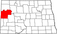 | |
| Townships |
| |
| CDPs | ||
| Unorganized territories |
| |
| Unincorporated communities |
| |