Stanley, North Dakota
| Stanley, North Dakota | |
|---|---|
| City | |
|
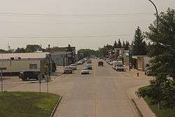
Downtown Stanley on ND 8 | |
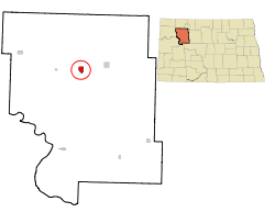 Location of Stanley, North Dakota | |
| Coordinates: 48°18′53″N 102°23′18″W / 48.31472°N 102.38833°WCoordinates: 48°18′53″N 102°23′18″W / 48.31472°N 102.38833°W | |
| Country | United States |
| State | North Dakota |
| County | Mountrail |
| Area[1] | |
| • Total | 1.83 sq mi (4.74 km2) |
| • Land | 1.82 sq mi (4.71 km2) |
| • Water | 0.01 sq mi (0.03 km2) |
| Elevation | 2,244 ft (684 m) |
| Population (2010)[2] | |
| • Total | 1,458 |
| • Estimate (2015)[3] | 2,721 |
| • Density | 801.1/sq mi (309.3/km2) |
| Time zone | Central (CST) (UTC-6) |
| • Summer (DST) | CDT (UTC-5) |
| ZIP code | 58784 |
| Area code(s) | 701 |
| FIPS code | 38-75380 |
| GNIS feature ID | 1032284[4] |
| Highways | US 2, ND 8 |
| Website | http://www.stanleynd.com |
Stanley is a city in Mountrail County, North Dakota, United States. It is the county seat of Mountrail County.[5] The population was 1,458 at the 2010 census.[6] making it the eighteenth largest city in North Dakota. Stanley was founded in 1902.
History
Stanley was platted in 1902.[7]
Geography
Stanley is located at 48°18′53″N 102°23′18″W / 48.31472°N 102.38833°W (48.314716, -102.388410).[8]
According to the United States Census Bureau, the city has a total area of 1.83 square miles (4.74 km2), of which, 1.82 square miles (4.71 km2) is land and 0.01 square miles (0.03 km2) is water.[1]
Transportation
Rail
Amtrak, the national passenger rail system, serves a station in Stanley via its Empire Builder, a once-daily train in each direction between Portland, Oregon/Seattle, Washington and Chicago.
Economy
Oil
Stanley is situated on the Bakken Formation, which encompasses northwestern North Dakota, northeastern Montana, and southern Saskatchewan, Canada. The formation is a rich source of oil, first discovered in the 1950s. Until the late 2000s the cost of oil extraction was too high to retrieve the oil profitably. With new technologies in oilfield production and the rising price of oil, the field has now become economically viable. The field may be the largest producing onshore field in the Continental United States outside of Texas and California, with the U.S. Geological Survey estimating that it contains between 3 billion and 4,300,000,000 barrels (680,000,000 m3) of oil, sixth overall in the lower 48, and could hold as much as 200 billion barrels (32×109 m3) of oil.[9]
Demographics
| Historical population | |||
|---|---|---|---|
| Census | Pop. | %± | |
| 1910 | 518 | — | |
| 1920 | 591 | 14.1% | |
| 1930 | 936 | 58.4% | |
| 1940 | 1,058 | 13.0% | |
| 1950 | 1,486 | 40.5% | |
| 1960 | 1,795 | 20.8% | |
| 1970 | 1,581 | −11.9% | |
| 1980 | 1,631 | 3.2% | |
| 1990 | 1,371 | −15.9% | |
| 2000 | 1,279 | −6.7% | |
| 2010 | 1,458 | 14.0% | |
| Est. 2015 | 2,721 | [10] | 86.6% |
| U.S. Decennial Census[11] 2015 Estimate[3] | |||
2010 census
As of the census[2] of 2010, there were 1,458 people, 629 households, and 362 families residing in the city. The population density was 801.1 inhabitants per square mile (309.3/km2). There were 718 housing units at an average density of 394.5 per square mile (152.3/km2). The racial makeup of the city was 97.4% White, 0.2% African American, 0.5% Native American, 0.5% Asian, 0.6% from other races, and 0.8% from two or more races. Hispanic or Latino of any race were 3.9% of the population.
There were 629 households of which 24.0% had children under the age of 18 living with them, 47.5% were married couples living together, 5.7% had a female householder with no husband present, 4.3% had a male householder with no wife present, and 42.4% were non-families. 35.8% of all households were made up of individuals and 16.5% had someone living alone who was 65 years of age or older. The average household size was 2.21 and the average family size was 2.89.
The median age in the city was 44.1 years. 21% of residents were under the age of 18; 6.5% were between the ages of 18 and 24; 23.2% were from 25 to 44; 26.5% were from 45 to 64; and 22.9% were 65 years of age or older. The gender makeup of the city was 50.2% male and 49.8% female.
2000 census
As of the census of 2000, there were 1,279 people, 576 households, and 332 families residing in the city. The population density was 740.3 people per square mile (285.4/km²). There were 664 housing units at an average density of 384.3 per square mile (148.2/km²). The racial makeup of the city was 98.98% White, 0.55% Native American, 0.31% Asian, 0.08% Pacific Islander, and 0.08% from two or more races. Hispanic or Latino of any race were 0.55% of the population.
There were 576 households out of which 24.0% had children under the age of 18 living with them, 48.1% were married couples living together, 6.8% had a female householder with no husband present, and 42.2% were non-families. 39.8% of all households were made up of individuals and 24.0% had someone living alone who was 65 years of age or older. The average household size was 2.12 and the average family size was 2.84.
In the city the population was spread out with 22.3% under the age of 18, 5.9% from 18 to 24, 18.8% from 25 to 44, 22.8% from 45 to 64, and 30.3% who were 65 years of age or older. The median age was 47 years. For every 100 females there were 86.2 males. For every 100 females age 18 and over, there were 82.7 males.
The median income for a household in the city was $23,993, and the median income for a family was $35,074. Males had a median income of $26,250 versus $17,813 for females. The per capita income for the city was $15,349. About 5.7% of families and 10.7% of the population were below the poverty line, including 12.6% of those under age 18 and 14.3% of those age 65 or over.
Notable people
- Ann Nicole Nelson, a victim of the September 11, 2001 attacks[12][13]
Climate
This climatic region is typified by large seasonal temperature differences, with warm to hot (and often humid) summers and cold (sometimes severely cold) winters. According to the Köppen Climate Classification system, Stanley has a humid continental climate, abbreviated "Dfb" on climate maps.[14]
References
- 1 2 "US Gazetteer files 2010". United States Census Bureau. Retrieved 2012-06-14.
- 1 2 "American FactFinder". United States Census Bureau. Retrieved 2012-06-14.
- 1 2 "Population Estimates". United States Census Bureau. Retrieved June 2, 2016.
- ↑ "US Board on Geographic Names". United States Geological Survey. 2007-10-25. Retrieved 2008-01-31.
- ↑ "Find a County". National Association of Counties. Retrieved 2011-06-07.
- ↑ "2010 Census Redistricting Data (Public Law 94-171) Summary File". American FactFinder. United States Census Bureau. Retrieved 2 May 2011.
- ↑ History of North Dakota, Embracing a Relation of the History of the State from the Earliest Times Down to the Present Day. Bismarck Tribune Company. 1910. p. 631.
- ↑ "US Gazetteer files: 2010, 2000, and 1990". United States Census Bureau. 2011-02-12. Retrieved 2011-04-23.
- ↑ Davey, Monica. - "Oil in North Dakota Brings Job Boom and Burdens". - New York Times. - January 1, 2008. - | - "Tiny North Dakota Town Sitting on Oil Jackpot". - Nightline. - ABC News. - | - Gutierrez, Thelma, and Wayne Drash. - "North Dakota's real-life Jed Clampett". - CNN. - August 6, 2008. - | - Retrieved: 2008-08-07
- ↑ "Annual Estimates of the Resident Population for Incorporated Places: April 1, 2010 to July 1, 2015". Retrieved July 2, 2016.
- ↑ United States Census Bureau. "Census of Population and Housing". Retrieved July 29, 2013.
- ↑ "CNN.com". CNN.
- ↑ "Remembering September 11, 2001: Ann Nicole Nelson Obituary". Retrieved 26 September 2016.
- ↑ "Stanley, North Dakota Köppen Climate Classification (Weatherbase)". Retrieved 26 September 2016.
External links
Municipalities and communities of Mountrail County, North Dakota, United States | ||
|---|---|---|
| Cities | 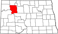 | |
| Townships |
| |
| Unorganized territory |
| |
| Unincorporated communities | ||
| Ghost town | ||