Rolette County, North Dakota
| Rolette County, North Dakota | |
|---|---|
 Location in the U.S. state of North Dakota | |
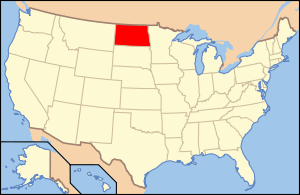 North Dakota's location in the U.S. | |
| Founded | October 14, 1884 |
| Seat | Rolla |
| Largest community | Belcourt |
| Area | |
| • Total | 939 sq mi (2,432 km2) |
| • Land | 903 sq mi (2,339 km2) |
| • Water | 36 sq mi (93 km2), 3.9% |
| Population (est.) | |
| • (2015) | 14,649 |
| • Density | 15/sq mi (6/km²) |
| Congressional district | At-large |
| Time zone | Central: UTC-6/-5 |
| Website |
www |
Rolette County is a county located in the U.S. state of North Dakota. As of the 2010 census, the population was 13,937.[1] Its county seat is Rolla.[2] The county was created by the 1872-73 territorial legislature and named for Joseph Rolette, Jr., a fur trader and politician from Pembina. The county government was first organized on October 14, 1884.[3] Before becoming Rolla, the county seat was Dunseith from 1884 to 1885 and St. John from 1885 to 1889.[4]
The International Peace Garden is located in the northwest corner of the county along the Canada–United States border with Manitoba.
Geography
According to the U.S. Census Bureau, the county has a total area of 939 square miles (2,430 km2), of which 903 square miles (2,340 km2) is land and 36 square miles (93 km2) (3.9%) is water.[5]
Rolette County contains one of only six exclaves contained on the Canada–US border. It is an unnamed peninsula located at 48°59′53″N 99°52′44″W / 48.99806°N 99.87889°W.
Part of the Turtle Mountain plateau lies in the northwestern part of the county.
Major highways
 U.S. Highway 281
 North Dakota Route 3
 North Dakota Route 30
 North Dakota Route 66
 North Dakota Route 43
 North Dakota Route 89
 North Dakota Route 5
Adjacent counties and rural municipalities
- Rural Municipality of Morton, Manitoba (north)
- Rural Municipality of Turtle Mountain, Manitoba (north)
- Towner County (east)
- Pierce County (south)
- Bottineau County (west)
National protected areas
- Lords Lake National Wildlife Refuge (part)
- Rabb Lake National Wildlife Refuge
- School Section Lake National Wildlife Refuge
- Willow Lake National Wildlife Refuge
Demographics
| Historical population | |||
|---|---|---|---|
| Census | Pop. | %± | |
| 1890 | 2,427 | — | |
| 1900 | 7,995 | 229.4% | |
| 1910 | 9,558 | 19.5% | |
| 1920 | 10,061 | 5.3% | |
| 1930 | 10,760 | 6.9% | |
| 1940 | 12,583 | 16.9% | |
| 1950 | 11,102 | −11.8% | |
| 1960 | 10,641 | −4.2% | |
| 1970 | 11,549 | 8.5% | |
| 1980 | 12,177 | 5.4% | |
| 1990 | 12,772 | 4.9% | |
| 2000 | 13,674 | 7.1% | |
| 2010 | 13,937 | 1.9% | |
| Est. 2015 | 14,649 | [6] | 5.1% |
| U.S. Decennial Census[7] 1790-1960[8] 1900-1990[9] 1990-2000[10] 2010-2015[1] | |||
2000 census
As of the census of 2000, there were 13,674 people, 4,556 households, and 3,366 families residing in the county. The population density was 15 people per square mile (6/km²). There were 5,027 housing units at an average density of 6 per square mile (2/km²). The racial makeup of the county was 25.12% White, 0.07% Black or African American, 73.01% Native American, 0.07% Asian, 0.12% from other races, and 1.61% from two or more races. 0.80% of the population were Hispanic or Latino of any race. 9.3% were of Norwegian and 7.4% German ancestry. 94.6% spoke English, 1.3% Ojibwa, 1.0% French Cree and 1.0% Cree as their first language.
There were 4,556 households out of which 43.80% had children under the age of 18 living with them, 44.00% were married couples living together, 22.70% had a female householder with no husband present, and 26.10% were non-families. 22.60% of all households were made up of individuals and 9.50% had someone living alone who was 65 years of age or older. The average household size was 2.97 and the average family size was 3.45.
In the county the population was spread out with 36.50% under the age of 18, 9.50% from 18 to 24, 25.80% from 25 to 44, 18.50% from 45 to 64, and 9.70% who were 65 years of age or older. The median age was 29 years. For every 100 females there were 97.20 males. For every 100 females age 18 and over, there were 91.90 males.
The median income for a household in the county was $26,232, and the median income for a family was $29,744. Males had a median income of $24,288 versus $20,383 for females. The per capita income for the county was $10,873. About 28.00% of families and 31.00% of the population were below the poverty line, including 39.20% of those under age 18 and 19.60% of those age 65 or over.
2010 census
As of the 2010 United States Census, there were 13,937 people, 4,783 households, and 3,413 families residing in the county.[11] The population density was 15.4 inhabitants per square mile (5.9/km2). There were 5,372 housing units at an average density of 5.9 per square mile (2.3/km2).[12] The racial makeup of the county was 77.2% American Indian, 20.3% white, 0.2% black or African American, 0.1% Asian, 0.1% from other races, and 2.1% from two or more races. Those of Hispanic or Latino origin made up 1.0% of the population.[11] In terms of ancestry, 48.5% were French Canadian, 7.0% were German, 6.8% were Norwegian, and 0.3% were American.[13]
Of the 4,783 households, 44.9% had children under the age of 18 living with them, 39.1% were married couples living together, 23.2% had a female householder with no husband present, 28.6% were non-families, and 25.0% of all households were made up of individuals. The average household size was 2.89 and the average family size was 3.39. The median age was 30.5 years.[11]
The median income for a household in the county was $28,265 and the median income for a family was $35,523. Males had a median income of $35,595 versus $27,459 for females. The per capita income for the county was $13,632. About 25.9% of families and 31.8% of the population were below the poverty line, including 41.5% of those under age 18 and 24.8% of those age 65 or over.[14]
Politics
Like many counties with Native American majority populations it is historically Democratic, but more consistently so than other such counties in North Dakota. Since 1928 the only Republican to carry the county was Dwight D. Eisenhower in 1952.[15] It was the only county in the state to support George McGovern in 1972 and is additionally the only North Dakota county to have supported Jimmy Carter in 1980.[16] In the last four elections the Democratic candidate has consistently received over 60% of the vote.[17]
Communities
Cities
Townships
- Kohlmeier
- Maryville
- Shell Valley
- South Valley
Holmes
Census-designated places
Unincorporated communities
See also
References
- 1 2 "State & County QuickFacts". United States Census Bureau. Retrieved November 1, 2013.
- ↑ "Find a County". National Association of Counties. Retrieved 2011-06-07.
- ↑ "Dakota Territory, South Dakota, and North Dakota: Individual County Chronologies". Dakota Territory Atlas of Historical County Boundaries. The Newberry Library. 2006. Retrieved February 4, 2015.
- ↑ "County History". Official Portal for North Dakota State Government. Retrieved 4 May 2011.
- ↑ "2010 Census Gazetteer Files". United States Census Bureau. August 22, 2012. Retrieved February 1, 2015.
- ↑ "County Totals Dataset: Population, Population Change and Estimated Components of Population Change: April 1, 2010 to July 1, 2015". Retrieved July 2, 2016.
- ↑ "U.S. Decennial Census". United States Census Bureau. Retrieved February 1, 2015.
- ↑ "Historical Census Browser". University of Virginia Library. Retrieved February 1, 2015.
- ↑ Forstall, Richard L., ed. (April 20, 1995). "Population of Counties by Decennial Census: 1900 to 1990". United States Census Bureau. Retrieved February 1, 2015.
- ↑ "Census 2000 PHC-T-4. Ranking Tables for Counties: 1990 and 2000" (PDF). United States Census Bureau. April 2, 2001. Retrieved February 1, 2015.
- 1 2 3 "DP-1 Profile of General Population and Housing Characteristics: 2010 Demographic Profile Data". United States Census Bureau. Retrieved 2016-04-03.
- ↑ "Population, Housing Units, Area, and Density: 2010 - County". United States Census Bureau. Retrieved 2016-04-03.
- ↑ "DP02 SELECTED SOCIAL CHARACTERISTICS IN THE UNITED STATES – 2006-2010 American Community Survey 5-Year Estimates". United States Census Bureau. Retrieved 2016-04-03.
- ↑ "DP03 SELECTED ECONOMIC CHARACTERISTICS – 2006-2010 American Community Survey 5-Year Estimates". United States Census Bureau. Retrieved 2016-04-03.
- ↑ Geographie Electorale
- ↑ David Leip's Presidential Atlas (Maps for North Dakota by election)
- ↑ The New York Times electoral map (Zoom in on North Dakota)
 |
R.M. of Morton, Manitoba, Canada and R.M. of Turtle Mountain, Manitoba, Canada | | ||
| Bottineau County | |
Towner County | ||
| ||||
| | ||||
| Pierce County |
Municipalities and communities of Rolette County, North Dakota, United States | ||
|---|---|---|
| Cities | | |
| Townships |
| |
| CDPs | ||
| Unorganized territories |
| |
| Unincorporated communities | ||
Coordinates: 48°46′N 99°50′W / 48.77°N 99.84°W