Sylvania, Pennsylvania
| Sylvania, Pennsylvania | |
|---|---|
| Borough | |
|
Sylvania, Pennsylvania | |
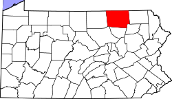
 Map of Bradford County with Sylvania highlighted | |
 Sylvania Location of Sylvania in the state of Pennsylvania | |
| Coordinates: 41°48′20″N 76°51′19″W / 41.80556°N 76.85528°WCoordinates: 41°48′20″N 76°51′19″W / 41.80556°N 76.85528°W | |
| Country | United States |
| State | Pennsylvania |
| County | Bradford |
| Settled | 1795 |
| Incorporated | 1853 |
| Area | |
| • Total | 1.1 sq mi (2.8 km2) |
| Elevation | 1,378 ft (420 m) |
| Population (2010) | |
| • Total | 219 |
| • Density | 199.1/sq mi (77.8/km2) |
| Time zone | Eastern (EST) (UTC-5) |
| • Summer (DST) | EDT (UTC-4) |
| Zip code | 16945 |
| Area code(s) | 570 |

Sylvania is a borough in Bradford County, Pennsylvania, United States. The population was 219 at the 2010 census. Children residing in the borough are assigned to attend the Troy Area School District.
Geography
Sylvania is located at 41°48′20″N 76°51′19″W / 41.80556°N 76.85528°W (41.805563, -76.855353).[1]
According to the United States Census Bureau, the borough has a total area of 1.1 square miles (2.8 km2), all of it land.
Demographics
| Historical population | |||
|---|---|---|---|
| Census | Pop. | %± | |
| 1860 | 215 | — | |
| 1870 | 212 | −1.4% | |
| 1880 | 227 | 7.1% | |
| 1890 | 241 | 6.2% | |
| 1900 | 203 | −15.8% | |
| 1910 | 217 | 6.9% | |
| 1920 | 188 | −13.4% | |
| 1930 | 194 | 3.2% | |
| 1940 | 196 | 1.0% | |
| 1950 | 211 | 7.7% | |
| 1960 | 243 | 15.2% | |
| 1970 | 241 | −0.8% | |
| 1980 | 236 | −2.1% | |
| 1990 | 203 | −14.0% | |
| 2000 | 200 | −1.5% | |
| 2010 | 219 | 9.5% | |
| Est. 2015 | 216 | [2] | −1.4% |
| Sources:[3][4][5] | |||
2010
As of the census[6] of 2010, there were 219 people, 82 households, and 61 families residing in the borough. The population density was 199.1 people per square mile (77.8/km²). There were 88 housing units at an average density of 80 per square mile (31.2/km²). The racial makeup of the borough was 96.3% White, 0.5% American Indian, 0.9% Asian and 2.3% two or more races.
There were 82 households, out of which 37.8% had children under the age of 18 living with them, 56.1% were married couples living together, 9.8% had a female householder with no husband present, and 25.6% were non-families. 23.2% of all households were made up of individuals, and 12.2% had someone living alone who was 65 years of age or older. The average household size was 2.67 and the average family size was 3.02.
In the borough the population was spread out, with 26% under the age of 18, 58.5% from 18 to 64, and 15.5% who were 65 years of age or older. The median age was 39.6 years.
The median income for a household in the borough was $42,813, and the median income for a family was $48,125. Males had a median income of $45,521 versus $23,750 for females. The per capita income for the borough was $22,699. About 20.5% of families and 18.3% of the population were below the poverty line, including 29.4% of those under the age of eighteen and none of those sixty five or over.
2000
As of the census[4] of 2000, there were 200 people, 76 households, and 55 families residing in the borough. The population density was 322.5 people per square mile (124.5/km²). There were 85 housing units at an average density of 137.1 per square mile (52.9/km²). The racial makeup of the borough was 100.00% White.
There were 76 households, out of which 36.8% had children under the age of 18 living with them, 53.9% were married couples living together, 11.8% had a female householder with no husband present, and 27.6% were non-families. 21.1% of all households were made up of individuals, and 10.5% had someone living alone who was 65 years of age or older. The average household size was 2.63 and the average family size was 2.93.
In the borough the population was spread out, with 25.5% under the age of 18, 9.0% from 18 to 24, 28.0% from 25 to 44, 27.0% from 45 to 64, and 10.5% who were 65 years of age or older. The median age was 38 years. For every 100 females there were 108.3 males. For every 100 females age 18 and over, there were 98.7 males.
The median income for a household in the borough was $35,000, and the median income for a family was $41,750. Males had a median income of $27,083 versus $20,179 for females. The per capita income for the borough was $15,181. About 7.5% of families and 11.8% of the population were below the poverty line, including 11.4% of those under the age of eighteen and 14.3% of those sixty five or over.
References
- ↑ "US Gazetteer files: 2010, 2000, and 1990". United States Census Bureau. 2011-02-12. Retrieved 2011-04-23.
- ↑ "Annual Estimates of the Resident Population for Incorporated Places: April 1, 2010 to July 1, 2015". Retrieved July 2, 2016.
- ↑ "Census of Population and Housing". U.S. Census Bureau. Retrieved 11 December 2013.
- 1 2 "American FactFinder". United States Census Bureau. Retrieved 2008-01-31.
- ↑ "Incorporated Places and Minor Civil Divisions Datasets: Subcounty Resident Population Estimates: April 1, 2010 to July 1, 2012". Population Estimates. U.S. Census Bureau. Retrieved 11 December 2013.
- ↑ "American FactFinder". United States Census Bureau. Retrieved 2011-05-14.