Athens, Pennsylvania
| Athens, Pennsylvania | |
|---|---|
| Borough | |
|
Downtown Athens | |
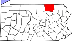
 Map of Bradford County with Athens highlighted | |
 Athens Location of Athens in the state of Pennsylvania | |
| Coordinates: 41°57′50″N 76°31′21″W / 41.96389°N 76.52250°WCoordinates: 41°57′50″N 76°31′21″W / 41.96389°N 76.52250°W | |
| Country | United States |
| State | Pennsylvania |
| County | Bradford |
| Settled | 1783 |
| Incorporated | 1831 |
| Area | |
| • Total | 1.82 sq mi (4.72 km2) |
| • Land | 1.80 sq mi (4.65 km2) |
| • Water | 0.03 sq mi (0.07 km2) |
| Elevation | 755 ft (230 m) |
| Population (2010) | |
| • Total | 3,367 |
| • Density | 1,874/sq mi (723.5/km2) |
| Time zone | Eastern (EST) (UTC-5) |
| • Summer (DST) | EDT (UTC-4) |
| Zip code | 18810 |
| Area code(s) | 570, 272 |
| Designated | May 12, 1947[1] |

Athens is a borough in Bradford County, Pennsylvania, United States, located 2 miles (3 km) south of the New York state line on the Susquehanna and Chemung rivers. The population was 3,749 in 1900 and 3,796 in 1910. The population was 3,367 at the 2010 census.[2] Athens is in a small area locally known as "The Valley", a group of four contiguous communities in Pennsylvania and New York: Waverly, New York; South Waverly, Pennsylvania; Sayre, Pennsylvania; and Athens. The Valley has a population near 30,000.
In September 2011, Athens was heavily damaged by river flooding from Tropical Storm Lee. Much of Athens was under water, with the most damage in the downtown area along the river. Damage in nearby Tioga County, New York, was estimated at $100 million.[3]
History
The Athens Historic District, Protection of the Flag Monument, and Spalding Memorial Library-Tioga Point Museum are listed on the National Register of Historic Places.[4]
Geography
Athens is located in northern Bradford County at 41°57′50″N 76°31′21″W / 41.96389°N 76.52250°W (41.963809, -76.522608).[5] It lies on land between the Susquehanna River to the east and the Chemung River to the west, extending southward to their confluence at Tioga Point. The borough of Sayre borders Athens to the north, and Athens Township borders the remainder of the borough, to the east, west, and south.
U.S. Route 220 passes through the west part of the borough as a four-lane limited access highway, with one exit (West Pine Street) within the borough limits. US-220 leads north to its terminus at Interstate 86 near the New York state line in South Waverly and south to Towanda. Pennsylvania Route 199 forms the borough's Main Street, leading north through Sayre to I-86, where it crosses the state line and becomes New York State Route 34. To the south, PA-199 crosses the Chemung River and ends at US-220. Front Street crosses the Susquehanna River to the east into unincorporated East Athens.
According to the United States Census Bureau, the borough has a total area of 1.8 square miles (4.7 km2), of which 0.027 square miles (0.07 km2), or 1.51%, is water.[2]
Demographics
| Historical population | |||
|---|---|---|---|
| Census | Pop. | %± | |
| 1840 | 435 | — | |
| 1850 | 796 | 83.0% | |
| 1860 | 837 | 5.2% | |
| 1870 | 965 | 15.3% | |
| 1880 | 1,592 | 65.0% | |
| 1890 | 3,274 | 105.7% | |
| 1900 | 3,749 | 14.5% | |
| 1910 | 3,796 | 1.3% | |
| 1920 | 4,384 | 15.5% | |
| 1930 | 4,372 | −0.3% | |
| 1940 | 4,215 | −3.6% | |
| 1950 | 4,430 | 5.1% | |
| 1960 | 4,515 | 1.9% | |
| 1970 | 4,173 | −7.6% | |
| 1980 | 3,622 | −13.2% | |
| 1990 | 3,468 | −4.3% | |
| 2000 | 3,415 | −1.5% | |
| 2010 | 3,367 | −1.4% | |
| Est. 2015 | 3,255 | [6] | −3.3% |
| Sources:[7][8] | |||
2010
As of the census[9] of 2010, there were 3,367 people, 1,422 households, and 833 families residing in the borough. The population density was 1,870.5 people per square mile (730.7/km²). There were 1,477 housing units at an average density of 820.5 per square mile (320.5/km²). The racial makeup of the borough was 97.1% White, 0.9% African American, 0.1% Native American, 0.5% Asian, 0.2% from other races, and 1.2% from two or more races. Hispanic or Latino of any race were 1.4% of the population.
There were 1,422 households, out of which 30.2% had children under the age of 18 living with them, 41.1% were married couples living together, 13.3% had a female householder with no husband present, and 41.4% were non-families. 36.2% of all households were made up of individuals, and 16.8% had someone living alone who was 65 years of age or older. The average household size was 2.28 and the average family size was 3.00.
In the borough the population was spread out, with 23.8% under the age of 18, 58.1% from 18 to 64, and 18.1% who were 65 years of age or older. The median age was 41.4 years.
The median income for a household in the borough was $31,146, and the median income for a family was $45,441. Males had a median income of $39,514 versus $25,476 for females. The per capita income for the borough was $19,453. About 9.2% of families and 14.5% of the population were below the poverty line, including 17.5% of those under age 18 and 12.4% of those age 65 or over.
2000
As of the census[10] of 2000, there were 3,415 people, 1,427 households, and 857 families residing in the borough. The population density was 1,934.9 people per square mile (749.2/km²). There were 1,500 housing units at an average density of 849.9 per square mile (329.1/km²). The racial makeup of the borough was 97.83% White, 0.91% African American, 0.15% Native American, 0.29% Asian, 0.23% from other races, and 0.59% from two or more races. Hispanic or Latino of any race were 1.00% of the population.
There were 1,427 households, out of which 31.2% had children under the age of 18 living with them, 43.3% were married couples living together, 13.9% had a female householder with no husband present, and 39.9% were non-families. 35.5% of all households were made up of individuals, and 18.4% had someone living alone who was 65 years of age or older. The average household size was 2.29 and the average family size was 2.98.
In the borough the population was spread out, with 24.6% under the age of 18, 7.4% from 18 to 24, 26.4% from 25 to 44, 22.0% from 45 to 64, and 19.6% who were 65 years of age or older. The median age was 39 years. For every 100 females there were 79.5 males. For every 100 females age 18 and over, there were 74.5 males.
The median income for a household in the borough was $32,246, and the median income for a family was $42,837. Males had a median income of $33,625 versus $22,361 for females. The per capita income for the borough was $20,874. About 9.0% of families and 11.7% of the population were below the poverty line, including 10.0% of those under age 18 and 18.0% of those age 65 or over.
Notable people
- Horatio Bridge (1806–1893), commodore of the United States Navy
- Lauren Cohen, Professor at Harvard Business School
- Joshua Reed Giddings (1795–1864), congressman from Ohio
- William Maxwell (railroad executive) (1794–1856), railroad executive
- Brian Schlosser Jr (1982-Present) Master of "That's not my job"
- Nicholas Rosenbloom (1999-Present), Rusty Rail streaker
- Aron Singerhoff (1998-Present), Recipient of Athens Area Swag Award - 2016
References
- ↑ "PHMC Historical Markers Search" (Searchable database). Pennsylvania Historical and Museum Commission. Commonwealth of Pennsylvania. Retrieved 2014-01-25.
- 1 2 "Geographic Identifiers: 2010 Demographic Profile Data (G001): Athens borough, Pennsylvania". U.S. Census Bureau, American Factfinder. Retrieved March 12, 2014.
- ↑ Staff Writer (2011-09-16). "Exact cost of flood damage will take time". Ithica Journal. Retrieved 2011-09-17.
- ↑ National Park Service (2010-07-09). "National Register Information System". National Register of Historic Places. National Park Service.
- ↑ "US Gazetteer files: 2010, 2000, and 1990". United States Census Bureau. 2011-02-12. Retrieved 2011-04-23.
- ↑ "Annual Estimates of the Resident Population for Incorporated Places: April 1, 2010 to July 1, 2015". Retrieved July 2, 2016.
- ↑ "Census of Population and Housing: Decennial Censuses". United States Census Bureau. Retrieved 2012-03-04.
- ↑ "Incorporated Places and Minor Civil Divisions Datasets: Subcounty Resident Population Estimates: April 1, 2010 to July 1, 2012". Population Estimates. U.S. Census Bureau. Archived from the original on 17 June 2013. Retrieved 11 December 2013.
- ↑ "American FactFinder". United States Census Bureau. Archived from the original on 2013-09-11. Retrieved 2011-05-14.
- ↑ "American FactFinder". United States Census Bureau. Archived from the original on 2013-09-11. Retrieved 2008-01-31.
![]() Media related to Athens, Pennsylvania at Wikimedia Commons
Media related to Athens, Pennsylvania at Wikimedia Commons