Alba, Pennsylvania
| Alba, Pennsylvania | |
|---|---|
| Borough | |
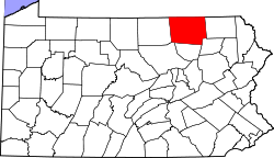
 Map of Bradford County with Alba highlighted | |
 Alba Location of Alba in the state of Pennsylvania | |
| Coordinates: 41°42′16″N 76°49′39″W / 41.70444°N 76.82750°WCoordinates: 41°42′16″N 76°49′39″W / 41.70444°N 76.82750°W | |
| Country | United States |
| State | Pennsylvania |
| County | Bradford |
| Settled | 1803 |
| Incorporated | 1864 |
| Area | |
| • Total | 0.7 sq mi (1.7 km2) |
| • Land | 0.7 sq mi (1.7 km2) |
| • Water | 0.0 sq mi (0.0 km2) |
| Elevation | 1,572 ft (479 m) |
| Population (2010) | |
| • Total | 157 |
| • Density | 234/sq mi (90.3/km2) |
| Time zone | Eastern (EST) (UTC-5) |
| • Summer (DST) | EDT (UTC-4) |
| Zip code | 16910 |
| Area code(s) | 570 |
Alba is a borough in Bradford County, Pennsylvania, United States. The population was 157 at the 2010 census.[1]
Geography
Alba is located in southwestern Bradford County at 41°42′16″N 76°49′39″W / 41.70444°N 76.82750°W (41.704343, -76.827519).[2] It is bordered by Canton Township on the west, south, and east, and by Troy Township on the north.
Pennsylvania Route 14 passes through the borough, leading north 6 miles (10 km) to Troy and U.S. Route 6, and south 4 miles (6 km) to Canton.
According to the United States Census Bureau, the borough has a total area of 0.66 square miles (1.7 km2), all of it land.[1]
Demographics
| Historical population | |||
|---|---|---|---|
| Census | Pop. | %± | |
| 1870 | 222 | — | |
| 1880 | 189 | −14.9% | |
| 1890 | 163 | −13.8% | |
| 1900 | 154 | −5.5% | |
| 1910 | 150 | −2.6% | |
| 1920 | 146 | −2.7% | |
| 1930 | 121 | −17.1% | |
| 1940 | 154 | 27.3% | |
| 1950 | 190 | 23.4% | |
| 1960 | 192 | 1.1% | |
| 1970 | 184 | −4.2% | |
| 1980 | 222 | 20.7% | |
| 1990 | 170 | −23.4% | |
| 2000 | 186 | 9.4% | |
| 2010 | 157 | −15.6% | |
| Est. 2015 | 153 | [3] | −2.5% |
| Sources:[4][5] | |||
As of the census[6] of 2000, there were 186 people, 70 households, and 49 families residing in the borough. The population density was 274.1 people per square mile (105.6/km²). There were 75 housing units at an average density of 110.5 per square mile (42.6/km²). The racial makeup of the borough was 94.09% White, 3.76% African American, 2.15% from other races. Hispanic or Latino of any race were 2.15% of the population.
There were 70 households, out of which 32.9% had children under the age of 18 living with them, 61.4% were married couples living together, 5.7% had a female householder with no husband present, and 30.0% were non-families. 21.4% of all households were made up of individuals, and 10.0% had someone living alone who was 65 years of age or older. The average household size was 2.66 and the average family size was 3.24.
In the borough the population was spread out, with 29.6% under the age of 18, 5.4% from 18 to 24, 25.8% from 25 to 44, 25.8% from 45 to 64, and 13.4% who were 65 years of age or older. The median age was 36 years. For every 100 females there were 97.9 males. For every 100 females age 18 and over, there were 84.5 males.
The median income for a household in the borough was $26,250, and the median income for a family was $34,375. Males had a median income of $26,500 versus $18,750 for females. The per capita income for the borough was $11,453. About 6.1% of families and 8.6% of the population were below the poverty line, including none of those under the age of eighteen or sixty five or over.
References
- 1 2 "Geographic Identifiers: 2010 Demographic Profile Data (G001): Alba borough, Pennsylvania". U.S. Census Bureau, American Factfinder. Retrieved March 12, 2014.
- ↑ "US Gazetteer files: 2010, 2000, and 1990". United States Census Bureau. 2011-02-12. Retrieved 2011-04-23.
- ↑ "Annual Estimates of the Resident Population for Incorporated Places: April 1, 2010 to July 1, 2015". Retrieved July 2, 2016.
- ↑ "Census of Population and Housing: Decennial Censuses". United States Census Bureau. Retrieved 2012-03-04.
- ↑ "Incorporated Places and Minor Civil Divisions Datasets: Subcounty Resident Population Estimates: April 1, 2010 to July 1, 2012". Population Estimates. U.S. Census Bureau. Archived from the original on 17 June 2013. Retrieved 11 December 2013.
- ↑ "American FactFinder". United States Census Bureau. Archived from the original on 2013-09-11. Retrieved 2008-01-31.