San Cristóbal Verapaz
| San Cristóbal Verapaz | ||
|---|---|---|
|
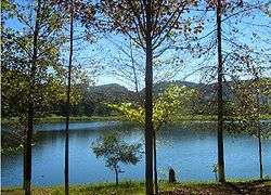
Chicoj Lake in San Cristóbal Verapaz | ||
| ||
 San Cristóbal Verapaz Location in Guatemala | ||
| Coordinates: 15°21′54″N 90°28′45″W / 15.36500°N 90.47917°W | ||
| Country |
| |
| Department | Alta Verapaz Department | |
| Climate | Cfb | |

San Cristóbal Verapaz (Spanish pronunciation: [san kɾisˈtoβal βeɾaˈpas]) is a municipality in the Guatemalan department of Alta Verapaz. It is at approximately 29 km from Cobán, capital of Alta Verapaz and about 210 km from Guatemala City. San Cristóbal belongs to the Pokimchi' linguistic area.[1] Its main income source is the «Cobán» shoe factory, which specializes in industrial rubber boots, which are sold both locally and internationally.
History
Franja Transversal del Norte
The Northern Transversal Strip was officially created during the government of General Carlos Arana Osorio in 1970, by Legislative Decree 60-70, for agricultural development.[2] The decree literally said: "It is of public interest and national emergency, the establishment of Agrarian Development Zones in the area included within the municipalities: San Ana Huista, San Antonio Huista, Nentón, Jacaltenango, San Mateo Ixtatán, and Santa Cruz Barillas in Huehuetenango; Chajul and San Miguel Uspantán in Quiché; Cobán, Chisec, San Pedro Carchá, Lanquín, Senahú, Cahabón and Chahal, in Alta Verapaz and the entire department of Izabal."[3]
San Cristóbal Verapaz was not part of the Strip, but it was bordering it and felt the devastating effects of the Guatemala Civil War which was fought mainly in the Strip during the 1980s.
Religious celebrations and town fairs
| Days | Neighborhood |
|---|---|
| 13–15 January | Esquipulas |
| 17–20 January | San Sebastian |
| 20–25 July | San Cristóbal |
| 24–26 April | San Felipe |
| 20–25 July | Santa Ana |
Famous citizens
- Erick Barrondo: Olympic silver medalist in London 2012
- Rodolfo Narciso Chavarría: music composer
Climate
San Cristóbal Verapaz has temperate climate (Köppen: Cfb).
| Climate data for San Cristóbal Verapaz | |||||||||||||
|---|---|---|---|---|---|---|---|---|---|---|---|---|---|
| Month | Jan | Feb | Mar | Apr | May | Jun | Jul | Aug | Sep | Oct | Nov | Dec | Year |
| Average high °C (°F) | 21.7 (71.1) |
23.2 (73.8) |
24.8 (76.6) |
25.5 (77.9) |
25.4 (77.7) |
24.5 (76.1) |
23.9 (75) |
24.2 (75.6) |
24.1 (75.4) |
23.2 (73.8) |
22.3 (72.1) |
22.1 (71.8) |
23.74 (74.74) |
| Daily mean °C (°F) | 16.1 (61) |
17.1 (62.8) |
18.4 (65.1) |
19.4 (66.9) |
19.8 (67.6) |
19.9 (67.8) |
19.4 (66.9) |
19.4 (66.9) |
19.3 (66.7) |
18.5 (65.3) |
17.5 (63.5) |
16.9 (62.4) |
18.48 (65.24) |
| Average low °C (°F) | 10.6 (51.1) |
11.1 (52) |
12.1 (53.8) |
13.4 (56.1) |
14.3 (57.7) |
15.3 (59.5) |
14.9 (58.8) |
14.6 (58.3) |
14.6 (58.3) |
13.9 (57) |
12.7 (54.9) |
11.7 (53.1) |
13.27 (55.88) |
| Average precipitation mm (inches) | 70 (2.76) |
45 (1.77) |
62 (2.44) |
59 (2.32) |
139 (5.47) |
300 (11.81) |
270 (10.63) |
238 (9.37) |
290 (11.42) |
244 (9.61) |
150 (5.91) |
79 (3.11) |
1,946 (76.62) |
| Source: Climate-Data.org[4] | |||||||||||||
Geographic location
Municipal distribution
The rural area of the municipality has eighty nine communities, while the villa has five neighborhoods: Santa Ana, San Felipe, San Cristóbal, San Sebastián y Esquipulas. The municipality is divided into the following microregions:
- One villa
- Six large settlements
- Fifty seven small settlements
- Sixteen common land areas
- Five neighborhoods
- Four cantones
- Three residential areas[5]
There are eighteen populated locations that are considered the most important due to the number of inhabitants and utility availability and access:
| # | Standout locations by microregion | Converging locations |
|---|---|---|
| 1. | Santa Ana neighborhood | Colonia El Petencito, Finca Nisnic, Cantón Oram, Colonia Paná, Santa Ana Pampur, Tucanjan, Pantup |
| 2. | San Sebastián neighborhood | Agua Bendita, Esquipulas neighborhood, San Cristóbal neighborhood, San Felipe neighborhood, Pankox, Venecia |
| 3. | Vista Hermosa | Chisiram, Villa Nueva |
| 4. | El Salmar | Agua Blanca, San Joaquín, San José Chitusul, Santa Ana Pan Kix, Chisiram, Villa Nueva, Vista Hermosa, Saqlik, Santa María |
| 5. | Chiyuc | Aquil Grande, Chilley, El Alfiler, Finca El Rosario, Caserío la Independencia, Caserío Panek, Pantocan |
| 6. | La Reforma | Pamac, Rexkix, Wachtuhq, Las Arrugas, La Esperanza |
| 7. | La Pacaya | Chirehtzulchituj, Chirexkiche, Chitj Panhux, Najtilabaj |
| 8. | Paniste | Pancaseu |
| 9. | San Lucas Chiacal | |
| 10. | San Inés Chicar | Las Victorias, Pancaseu, Panisté, Secoyon, Tinta |
| 11. | Baleu | Zacatón |
| 12. | Santa Elena | Saqixim, Quejá, Santa Rosa, Chepenal, Las Minas |
| 13. | Pampacche | Mexabaj, Panzal, San Sebastián El Refujio, Wachkob', Pambón Grande |
| 14. | El Rancho | Ceero Verde, Santa María Agua Blanca, Chiworrom, Chipozo, Chisiguan, Wachkuz, Pamboncito, Panajmay, Nuevo Panhux, Santa Cruz del Quetzal |
| 15. | Pantzimaj | Chicuz, Panhux, Cedral |
| 16. | La Providencia | Quixalito, Pampur La Providencia |
| 17. | Cumbre Pamuc | |
| 18. | Navidad |
Source: "Mapas de Guatemala en Línea". SINIT, SEGEPLAN (in Spanish). Guatemala. 2008. Archived from the original on March 5, 2008. Retrieved 5 March 2008.[6]
Borders
 |
Cobán, municipality of Alta Verapaz Department | Cobán, municipality of Alta Verapaz | | |
| Chicamán, municipality of Quiché Department | |
Santa Cruz Verapaz, municipality of Alta Verapaz Department[7] | ||
| ||||
| | ||||
| Chicamán, municipality of Quiché Department[7] |
Notes and references
- ↑ Escalante Herrera, Marco Antonio (2010). "San Cristóbal Verapaz". pbase.com (in Spanish). Guatemala. Archived from the original on March 26, 2015. Retrieved 26 March 2015.
- ↑ "Franja Transversal del Norte". Wikiguate. Guatemala. Retrieved 30 October 2014.
- ↑ Solano 2012, p. 15.
- ↑ "Climate: San Cristóbal Verapaz". Climate-Data.org. Retrieved 21 August 2015.
- ↑ Dirección Municipal de Planificación (2009). Distribución municipal de San Cristóbal Verapaz (in Spanish). Guatemala: Municipalidad de San Cristóbal Verapaz.
- ↑ "Mapas de Guatemala en Línea". SINIT, SEGEPLAN (in Spanish). Guatemala. 2008. Archived from the original on March 5, 2008. Retrieved 5 March 2008.
- 1 2 SEGEPLAN (n.d.). "Municipios de Alta Verapaz, Guatemala". Secretaría General de Planificación y Programación de la Presidencia de la República. Guatemala. Archived from the original on 30 June 2015. Retrieved 30 June 2015.
Further reading
- Asociación Cristiana de Jóvenes (n.d.). Perfil de Proyecto, San Cristóbal Verapaz (in Spanish).
- Albizures Palma, José Rodolfo (1978). Estudio Ecológico de la Laguna Chichoj (in Spanish). Guatemala: Universidad de San Carlos de Guatemala.
- Álvarez Rangel, Nidia (1995). Análisis multielemental por reflexión total de rayos X, en tejido muscular de Micropterus salmonoides (lacepade) y guapote cichlasoma maneguense (Gunter), en la laguna Chichoj, San Cristóbal Verapaz (in Spanish). Guatemala: Universidad de San Carlos de Guatemala.
- Arce Canahuí, Ángel (1992). Caracterización biofísica y socioeconómica de la cuenca de la Laguna Chichoj (in Spanish). Guatemala: Centro Universitario de Nororiente, Universidad de San Carlos de Guatemala.
- Cabrera Cruz, Rudy (2005). Plan de acción e inversiones para el manejo la microcuenca de la Laguna Chichoj. Municipalidad de San Cristóbal Verapaz, Alta Verpaz.
- — (2005). Propuesta de Estudio Técnico de la Laguna Chichoj (in Spanish). Alta Verapaz: Municipalidad de San Cristóbal Verapaz, Alta Verapaz.
- — (2005). Propuesta de Programa de Educación Ambiental y Participación Local (in Spanish). Alta Verapaz: Municipalidad de San Cristóbal Verapaz, Alta Verapaz.
- CALAS (2004). Memoria de la reunión para la creación de la Agenda Ambiental Municipal, 2004-2008 (in Spanish). Alta Verapaz: Municipalidad de San Cristóbal Verapaz, Alta Verapaz.
- Castañeda Salguero, César (1997). Proceso degradativo y proyecto de recuperación de la laguna Chichoj, San Cristóbal Verapaz. Plan de acción forestal para Guatemala (in Spanish). PNUD.
- CONAMA (1999). Estrategia Nacional para la conservación y el uso sostenible de la Biodiversidad y Plan de Acción (in Spanish). Guatemala.
- CONAP (2005) [1989]. Ley de Áreas protegidas y su reglamento Decreto No. 4-89 y sus reformas decretos No. 18-89, 110-96 y 117-97 (in Spanish). Guatemala: Congreso de la República de Guatemala.
- CONAP (2006). Política Nacional de Humedales (in Spanish). Guatemala.
- FOGUAMA (1999). Diagnóstico preliminar de la Laguna Chichoj (in Spanish). Guatemala: FOGUAMA.
- MARN (2003). Informe Nacional del Estado del Ambiente, GEO (in Spanish). Guatemala.
- Mollinedo García, Manuel Sabino (1999). Estudio agrológico de la cuenca de la Laguna Chichoj (in Spanish). Guatemala: Centro Universitario de Nororiente, Universidad de San Carlos de Guatemala.
- INFORME REMHI, Recuperación de la Memoria Histórica (in Spanish). Guatemala. 1999.
External links
![]() Media related to San Cristóbal Verapaz at Wikimedia Commons
Media related to San Cristóbal Verapaz at Wikimedia Commons
Capital: Cobán | ||
| Municipalities | 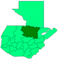 | |