Santa Cruz Verapaz
| Santa Cruz Verapaz | |
|---|---|
| Municipality | |
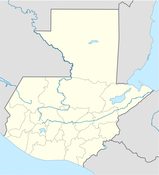 Santa Cruz Verapaz Location in Guatemala | |
| Coordinates: 15°22′25″N 90°25′50″W / 15.37361°N 90.43056°W | |
| Country |
|
| Region | Corredor Seco |
| Department |
|
| Municipality | Santa Cruz Verapaz |
| Government | |
| • Type | Municipal |
| • Mayor | Manuel Quejem (CREO) |
| Area | |
| • Municipality | 48 km2 (19 sq mi) |
| Elevation | 1,406 m (4,613 ft) |
| Population (Census 2002)[1] | |
| • Municipality | 10,012 |
| • Urban | 5,004 |
| • Ethnicities | Q'eqchi, Ladino |
| • Religions | Roman Catholicism, Evangelicalism, Maya |
| Climate | Cfb |
| Website | http://www.inforpressca.com/santacruzav/ |
Santa Cruz Verapaz (Spanish pronunciation: [ˈsanta ˈkɾus βeɾaˈpas]) is a municipality in the Guatemalan department of Alta Verapaz. It is situated at 1406 m above sea level. It contains 19,000 people. It covers a terrain of 48 km². The annual festival is May 1-May 5.
History
Friars Juan de Torres, Pedro de Angulo and Luis de Cancer, O.P. founded the settlement of "Santa Cruz de Santa Elena", in the region of the Munchú territory, and therefore, the town was originally known as "Santa Cruz Munchú". The town was established on 3 May 1543, according to the minutes from 1 May 1546 taken in Ciudad Real de San Juan Chamelco by Juan Matalbatz, governor of the region at the time.
The catholic church was built in the 16th century and therefore it has a high historical value; like the one in Rabinal in Baja Verapaz Department, it was one of the very first catholic temples built in the region during the Capitulaciones de Tezulutlán. The prestiberium design was magnificent, but it has been damaged over the centuries by the constant seismic events that affect the Guatemalan territory.
By an executive order of the Secretary of Education, the church was named as National Historic place on 12 July 1970.
Administrative division
Santa Cruz Verapaz has an urban and a rural area.
| Type | List |
|---|---|
| Urban neighborhoods |
|
| Urban residential areas |
|
| Villages |
|
| Parajes |
|
| Small villages |
|
| Farms and haciendas |
|
Territory configuration
| Tipo | Listado |
|---|---|
| Mountains |
|
| Rivers |
|
Climate
Santa Cruz Verapaz has temperate climate (Köppen: Cfb).
| Climate data for Santa Cruz Verapaz | |||||||||||||
|---|---|---|---|---|---|---|---|---|---|---|---|---|---|
| Month | Jan | Feb | Mar | Apr | May | Jun | Jul | Aug | Sep | Oct | Nov | Dec | Year |
| Average high °C (°F) | 21.1 (70) |
22.6 (72.7) |
24.2 (75.6) |
25.0 (77) |
24.8 (76.6) |
23.9 (75) |
23.3 (73.9) |
23.7 (74.7) |
23.6 (74.5) |
22.8 (73) |
21.6 (70.9) |
21.5 (70.7) |
23.18 (73.72) |
| Daily mean °C (°F) | 15.8 (60.4) |
16.7 (62.1) |
18.0 (64.4) |
19.1 (66.4) |
19.4 (66.9) |
19.4 (66.9) |
19.0 (66.2) |
19.0 (66.2) |
19.0 (66.2) |
18.2 (64.8) |
17.0 (62.6) |
16.5 (61.7) |
18.09 (64.57) |
| Average low °C (°F) | 10.5 (50.9) |
10.9 (51.6) |
11.9 (53.4) |
13.2 (55.8) |
14.1 (57.4) |
15.0 (59) |
14.7 (58.5) |
14.4 (57.9) |
14.5 (58.1) |
13.7 (56.7) |
12.5 (54.5) |
11.6 (52.9) |
13.08 (55.56) |
| Average precipitation mm (inches) | 76 (2.99) |
46 (1.81) |
66 (2.6) |
59 (2.32) |
140 (5.51) |
303 (11.93) |
278 (10.94) |
254 (10) |
302 (11.89) |
254 (10) |
155 (6.1) |
83 (3.27) |
2,016 (79.36) |
| Source: Climate-Data.org[2] | |||||||||||||
Geographic location
 |
Cobán | Cobán | | |
| San Cristóbal Verapaz | |
Tactic[3] | ||
| ||||
| | ||||
| San Miguel Chicaj, municipio de Baja Verapaz[3] |
See also
References
- ↑ "XI Censo Nacional de Poblacion y VI de Habitación (Censo 2002)". INE. 2002.
- ↑ "Climate: Santa Cruz Verapaz". Climate-Data.org. Retrieved 26 August 2015.
- 1 2 SEGEPLAN. "Municipios de Alta Verapaz, Guatemala". Secretaría General de Planificación y Programación de la Presidencia de la República (in Spanish). Guatemala. Archived from the original on 30 June 2015. Retrieved 30 June 2015.
External links
Capital: Cobán | ||
| Municipalities | 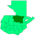 | |
| Departments in the region |  | |
|---|---|---|
| Alta Verapaz municipalities in the region | ||
Coordinates: 15°22′N 90°26′W / 15.367°N 90.433°W