Santa María Cahabón
| Santa María Cahabón Cahabón | |
|---|---|
 Santa María Cahabón Location in Guatemala | |
| Coordinates: 15°36′20″N 89°48′45″W / 15.60556°N 89.81250°WCoordinates: 15°36′20″N 89°48′45″W / 15.60556°N 89.81250°W | |
| Country |
|
| Department |
|
| Municipality | Santa María Cahabón |
| Government | |
| • Mayor | Rúben Darío Rosales (UNE) |
| Area | |
| • Total | 900 km2 (300 sq mi) |
| Elevation | 250 m (820 ft) |
| Population (2005) | |
| • Total | 31,425 |
| Time zone | GMT -6 |
| Climate | Af |
Cahabón is a municipality in the Guatemalan department of Alta Verapaz. It is situated at 250m above sea level. It contains 31,425 people. It covers a terrain of 900km2. The annual festival is September 1-September 8.
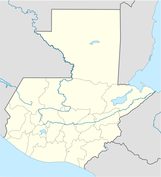
Franja Transversal del Norte
The Northern Transversal Strip was officially created during the government of General Carlos Arana Osorio in 1970, by Legislative Decree 60-70, for agricultural development.[1] The decree literally said: "It is of public interest and national emergency, the establishment of Agrarian Development Zones in the area included within the municipalities: San Ana Huista, San Antonio Huista, Nentón, Jacaltenango, San Mateo Ixtatán, and Santa Cruz Barillas in Huehuetenango; Chajul and San Miguel Uspantán in Quiché; Cobán, Chisec, San Pedro Carchá, Lanquín, Senahú, Cahabón and Chahal, in Alta Verapaz and the entire department of Izabal."[2]
Climate
Cahabón has a tropical climate (Köppen: Af).
| Climate data for Cahabón | |||||||||||||
|---|---|---|---|---|---|---|---|---|---|---|---|---|---|
| Month | Jan | Feb | Mar | Apr | May | Jun | Jul | Aug | Sep | Oct | Nov | Dec | Year |
| Average high °C (°F) | 27.4 (81.3) |
29.3 (84.7) |
30.7 (87.3) |
32.2 (90) |
32.1 (89.8) |
32.1 (89.8) |
30.7 (87.3) |
31.0 (87.8) |
31.0 (87.8) |
30.1 (86.2) |
28.5 (83.3) |
27.7 (81.9) |
30.23 (86.43) |
| Daily mean °C (°F) | 23.4 (74.1) |
24.2 (75.6) |
25.7 (78.3) |
26.8 (80.2) |
27.3 (81.1) |
27.5 (81.5) |
26.7 (80.1) |
26.7 (80.1) |
26.7 (80.1) |
26.0 (78.8) |
24.6 (76.3) |
23.5 (74.3) |
25.76 (78.37) |
| Average low °C (°F) | 19.4 (66.9) |
19.2 (66.6) |
20.7 (69.3) |
21.5 (70.7) |
22.5 (72.5) |
22.9 (73.2) |
22.7 (72.9) |
22.5 (72.5) |
22.4 (72.3) |
22.0 (71.6) |
20.8 (69.4) |
19.4 (66.9) |
21.33 (70.4) |
| Average precipitation mm (inches) | 134 (5.28) |
75 (2.95) |
64 (2.52) |
83 (3.27) |
146 (5.75) |
425 (16.73) |
411 (16.18) |
269 (10.59) |
320 (12.6) |
307 (12.09) |
189 (7.44) |
138 (5.43) |
2,561 (100.83) |
| Source: Climate-Data.org[3] | |||||||||||||
Geographic location
 |
Fray Bartolomé de las Casas, Alta Verapaz municipality | | ||
| San Pedro Carchá and Lanquín, Alta Verapaz municipalities | |
El Estor, Izabal municipality[4] | ||
| ||||
| | ||||
| Senahú, Alta Verapaz municipality[4] |
See also
Notes and references
- ↑ "Franja Transversal del Norte". Wikiguate. Guatemala. Retrieved 30 October 2014.
- ↑ Solano 2012, p. 15.
- ↑ "Climate: Cahabón". Climate-Data.org. Retrieved 19 August 2015.
- 1 2 SEGEPLAN. "Municipios de Alta Verapaz, Guatemala". Secretaría General de Planificación y Programación de la Presidencia de la República (in Spanish). Guatemala. Archived from the original on 30 June 2015. Retrieved 30 June 2015.
Bibliography
- Solano, Luis (2012). "Contextualización histórica de la Franja Transversal del Norte (FTN)" (PDF). Centro de Estudios y Documentación de la Frontera Occidental de Guatemala, CEDFOG (in Spanish). Archived from the original (PDF) on 13 November 2014. Retrieved 31 October 2014.
External links
Capital: Cobán | ||
| Municipalities | 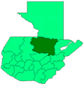 | |
| Departaments in the region | ||
|---|---|---|
| Major rivers and lakes | ||
| International corporation in the area | ||
| Civil War events | ||
| Presidents of Guatemala related to the region | ||