Senahú
| Senahú | |
|---|---|
| Municipality | |
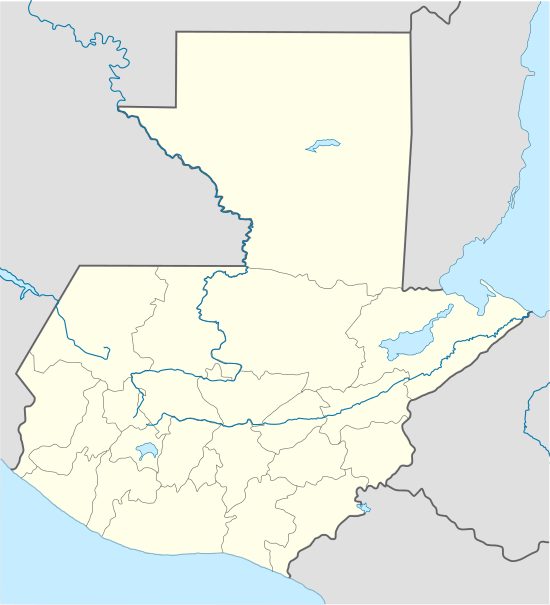 Senahú Location in Guatemala | |
| Coordinates: 15°24′59″N 89°49′13″W / 15.41639°N 89.82028°WCoordinates: 15°24′59″N 89°49′13″W / 15.41639°N 89.82028°W | |
| Country |
|
| Department |
|
| Municipality | Senahú |
| Government | |
| • Type | Municipal |
| • Mayor | Mónica Milián (LIDER) |
| Area | |
| • Municipality | 336 km2 (130 sq mi) |
| Elevation | 970 m (3,180 ft) |
| Population (Census 2002)[1] | |
| • Municipality | 54,471 |
| • Urban | 4,399 |
| • Ethnicities | Q'eqchi', Ladino |
| • Religions | Roman Catholicism, Evangelicalism, Maya |
| Climate | Af |
Senahú is a municipality of the Department of Alta Verapaz in the Republic of Guatemala.
The community of San Antonio Senahú was founded by Q'eqchi' Mayan refugees from a series of 19th century conflicts in the Ishi Mountains of Central Guatemala. By the mid-1870s, it had become a center of German settlement in Guatemala and a major source of coffee for the European market.
The regions wealth is still formed by big coffee farms and other agriculturist products. In the natural resources it can be found the river of the farm "Trece Aguas", the waterfalls Sereizi and a viewpoint in the general cemetery. Other famous places are the ruins of Chijolom and La Providencia. The crafts elaborated in this region are weaves, ceramics, basketwork, rigs, musical instruments, masks, bed rolls of palm, chandler's shop, objects of "tule" and fireworks.
The approximated extension for this municipality is of 336 km², with a total population of 28,550 inhabitants (1981 census). Its neighbours are, at the north boundaries Cahabón and Lanquín (Alta Verapaz), south with Panzos and Tucurú, east with El Estor (Izabal), west with Tucurú and San Pedró Carcha (Alta Verapaz). The municipality is formed by 1 town and 41 communities.
Languages spoken
The chief languages are Q'eqchi' and Spanish.
Important dates
- March 13, 1869 – By Governmental Agreement the region was raised to municipality.
Celebrations
June, 8-13 – In Honor of San Antonio. Each year at the end of August, a festival of San Antonio de Padua celebrating native peoples is held here. The festivities include a beauty contest for Q'eqchi' Maya women, the winner of which is crowned with the title "Miss Senahuk".
Franja Transversal del Norte
The Northern Transversal Strip was officially created during the government of General Carlos Arana Osorio in 1970, by Legislative Decree 60-70, for agricultural development.[2] The decree literally said: "It is of public interest and national emergency, the establishment of Agrarian Development Zones in the area included within the municipalities: San Ana Huista, San Antonio Huista, Nentón, Jacaltenango, San Mateo Ixtatán, and Santa Cruz Barillas in Huehuetenango; Chajul and San Miguel Uspantán in Quiché; Cobán, Chisec, San Pedro Carchá, Lanquín, Senahú, Cahabón and Chahal, in Alta Verapaz and the entire department of Izabal."[3]
Climate
Senahú has a tropical climate (Köppen: Af).
| Climate data for Senahú | |||||||||||||
|---|---|---|---|---|---|---|---|---|---|---|---|---|---|
| Month | Jan | Feb | Mar | Apr | May | Jun | Jul | Aug | Sep | Oct | Nov | Dec | Year |
| Daily mean °C (°F) | 19.3 (66.7) |
20.3 (68.5) |
21.6 (70.9) |
22.8 (73) |
23.2 (73.8) |
23.0 (73.4) |
22.6 (72.7) |
22.7 (72.9) |
22.7 (72.9) |
21.7 (71.1) |
20.6 (69.1) |
19.8 (67.6) |
21.69 (71.05) |
| Average precipitation mm (inches) | 141 (5.55) |
110 (4.33) |
106 (4.17) |
142 (5.59) |
313 (12.32) |
621 (24.45) |
691 (27.2) |
546 (21.5) |
535 (21.06) |
395 (15.55) |
207 (8.15) |
138 (5.43) |
3,945 (155.3) |
| Source: Climate-Data.org[4] | |||||||||||||
Geographic location
 |
Cahabón and Lanquín, Alta Verapaz Department municipalities | | ||
| Tucurú and San Pedro Carchá, Alta Verapaz Department municipalities | |
El Estor, Izabal Department municipality[5] | ||
| ||||
| | ||||
| Panzós and Tucurú, Alta Verapaz Department municipalities[5] |
See also
Notes and references
References
- ↑ "XI Censo Nacional de Poblacion y VI de Habitación (Censo 2002)". INE. 2002.
- ↑ "Franja Transversal del Norte". Wikiguate. Guatemala. Retrieved 30 October 2014.
- ↑ Solano 2012, p. 15.
- ↑ "Climate:Senahú". Climate-Data.org. Retrieved 19 August 2015.
- 1 2 SEGEPLAN. "Municipios de Alta Verapaz, Guatemala". Secretaría General de Planificación y Programación de la Presidencia de la República (in Spanish). Guatemala. Archived from the original on 30 June 2015. Retrieved 30 June 2015.
Bibliography
- Solano, Luis (2012). "Contextualización histórica de la Franja Transversal del Norte (FTN)" (PDF). Centro de Estudios y Documentación de la Frontera Occidental de Guatemala, CEDFOG (in Spanish). Retrieved 31 October 2014.
Further reading
- Mario E. de la Cruz Torres, Monografía de Senahú. Guatemala: Pineda Ibarra 1978.
External links
-
 Media related to Senahú at Wikimedia Commons
 - Información completa sobre Senahú
Capital: Cobán | ||
| Municipalities | 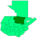 | |
| Departaments in the region | ||
|---|---|---|
| Major rivers and lakes | ||
| International corporation in the area | ||
| Civil War events | ||
| Presidents of Guatemala related to the region | ||