San-Giuliano
| San-Giuliano | |
|---|---|
|
The lighthouse of Alistro, in San-Giuliano | |
 San-Giuliano | |
|
Location within Corsica region 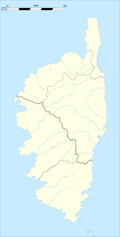 San-Giuliano | |
| Coordinates: 42°18′55″N 9°29′29″E / 42.3153°N 9.4914°ECoordinates: 42°18′55″N 9°29′29″E / 42.3153°N 9.4914°E | |
| Country | France |
| Region | Corsica |
| Department | Haute-Corse |
| Arrondissement | Corte |
| Canton | Campoloro-di-Moriani |
| Intercommunality | Costa Verde |
| Government | |
| • Mayor (2008–2014) | François-Xavier Ceccoli |
| Area1 | 23.93 km2 (9.24 sq mi) |
| Population (2008)2 | 605 |
| • Density | 25/km2 (65/sq mi) |
| Time zone | CET (UTC+1) |
| • Summer (DST) | CEST (UTC+2) |
| INSEE/Postal code | 2B303 / 20230 |
| Elevation |
0–295 m (0–968 ft) (avg. 150 m or 490 ft) |
|
1 French Land Register data, which excludes lakes, ponds, glaciers > 1 km² (0.386 sq mi or 247 acres) and river estuaries. 2 Population without double counting: residents of multiple communes (e.g., students and military personnel) only counted once. | |

San-Giuliano is a commune in the Haute-Corse department of France on the island of Corsica. It is the easternmost commune in European France.
Population
| Historical population | ||
|---|---|---|
| Year | Pop. | ±% |
| 1800 | 336 | — |
| 1806 | 534 | +58.9% |
| 1821 | 503 | −5.8% |
| 1831 | 434 | −13.7% |
| 1836 | 500 | +15.2% |
| 1841 | 503 | +0.6% |
| 1846 | 474 | −5.8% |
| 1851 | 204 | −57.0% |
| 1856 | 442 | +116.7% |
| 1861 | 366 | −17.2% |
| 1866 | 299 | −18.3% |
| 1872 | 213 | −28.8% |
| 1876 | 215 | +0.9% |
| 1881 | 255 | +18.6% |
| 1886 | 185 | −27.5% |
| 1891 | 184 | −0.5% |
| 1896 | 109 | −40.8% |
| 1901 | 197 | +80.7% |
| 1906 | 218 | +10.7% |
| 1911 | 220 | +0.9% |
| 1921 | 201 | −8.6% |
| 1926 | 150 | −25.4% |
| 1931 | 228 | +52.0% |
| 1936 | 224 | −1.8% |
| 1946 | 149 | −33.5% |
| 1954 | 109 | −26.8% |
| 1962 | 252 | +131.2% |
| 1968 | 461 | +82.9% |
| 1975 | 500 | +8.5% |
| 1982 | 542 | +8.4% |
| 1990 | 593 | +9.4% |
| 1999 | 608 | +2.5% |
| 2008 | 605 | −0.5% |
See also
References
| Wikimedia Commons has media related to San-Giuliano. |
This article is issued from Wikipedia - version of the 4/28/2016. The text is available under the Creative Commons Attribution/Share Alike but additional terms may apply for the media files.