Ersa, Haute-Corse
| Ersa | |
|---|---|
|
Boticella, part of Ersa | |
 Ersa | |
|
Location within Corsica region 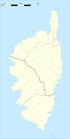 Ersa | |
| Coordinates: 42°58′34″N 9°22′51″E / 42.9761°N 9.3808°ECoordinates: 42°58′34″N 9°22′51″E / 42.9761°N 9.3808°E | |
| Country | France |
| Region | Corsica |
| Department | Haute-Corse |
| Arrondissement | Bastia |
| Canton | Capobianco |
| Intercommunality | Cap Corse |
| Government | |
| • Mayor (2008–2014) | Thomas Micheli |
| Area1 | 20.45 km2 (7.90 sq mi) |
| Population (2008)2 | 150 |
| • Density | 7.3/km2 (19/sq mi) |
| Time zone | CET (UTC+1) |
| • Summer (DST) | CEST (UTC+2) |
| INSEE/Postal code | 2B107 / 20275 |
| Elevation |
0–562 m (0–1,844 ft) (avg. 260 m or 850 ft) |
|
1 French Land Register data, which excludes lakes, ponds, glaciers > 1 km² (0.386 sq mi or 247 acres) and river estuaries. 2 Population without double counting: residents of multiple communes (e.g., students and military personnel) only counted once. | |

Ersa is a commune of the Haute-Corse department of France on the island of Corsica.
Geography
Ersa is the northernmost commune of Corsica. It extends from Centuri to the West, to Rogliano to the East. Ersa is covered with shrubs and arid summits. The coast, which is carved to the West by the Cape Grossu (Cape Grosso) and the Punta of Corno of Becco, has beautiful beaches of sand and pebbles. The commune is watered by the streams Acqua Tignose and Granaghjulu on its undulating slopes of the Mount Maghjore (364 m).
History
The ancient Latin name of Ersa is Arsia. Human occupation predated Roman conquest.
The commune experienced Turkish occupation during 1555 to 1571. In 1592 the Republic of Genoa annexed Ersa, which allied itself to Pasquale Paoli in 1757.
Until the 17th century, the Cape Corse was the target of frequent incursions of barbaric pirates. When Corse joined France at the end of the 17th century there were 1130 inhabitants, highly involved in the cultivation of grapes for wine. Since then the population has dropped to about 135 inhabitants.
Villages
The villages of the commune of Ersa lie between the two summits. They are connected by the departmental route D80.
- 'Rota'
- 'Boticella' - this dominant village is grouped of the chapel Saint Jean-Baptiste;
- 'Cucincu' - in the small hamlet discovers itself the chapel Saint-Peters
- 'Granaghjulu' - the mansions are perched and the lanes compact - the church Saint Andrew and its steeple are historic monuments.
- 'Guadellu'- the vast church Saint Andrew, today ruined, is the intermediate of the chapel of confraternity Santa-Croce.
- 'Gualdu' - this hamlet in the middle of Piazza raises itself to a square tower and the chapel Sainte- Anne
- 'Piazza': Chief town—an ancient convent of Capucins dating to the 17th century and sheltering the town hall, the school and the room of functions - the ancient church of the convent, Santa-Maria-Assunta, is today a parish - with the likewise chapel Saint-Antonie
- 'Poghju'- one discovers here a round tower, hence the chapels Saint-Joseph and Saint-Roch
- 'Suertu'- this village abandon to the ? San Nicolau is always dominated by the ruined chapel of the same name.
The ancient small port of Barcaghju, situated at the rear of the bay, near to the mouth of river Acqua Tignose, offers a panorama of the island of Giraglia. It occupies the location of a pre-Roman village. One finds here the chapel of Saint Peter and 2 km (1.2 mi) to the south the wrecked chapel Saint-Lucie. Its grand beach of fine sand presents a spectacular sand-dune. Near the commune of Rogliano, is the Genoese tower of Agnello, framing on the headland of Cape Agnello.
The second sea-front, Tollare, at the mouth of the River Granaghjulu, extends its ancient mansions around that of its chapel Saint-Anne and its round Genoese tower.
Population
| Historical population | ||
|---|---|---|
| Year | Pop. | ±% |
| 1962 | 226 | — |
| 1968 | 236 | +4.4% |
| 1975 | 148 | −37.3% |
| 1982 | 113 | −23.6% |
| 1990 | 125 | +10.6% |
| 1999 | 132 | +5.6% |
| 2008 | 150 | +13.6% |
Environment
The old garbage dump has been removed. A new garbage recycling site has been created since 1 January 2009.[1][2]
20 wind turbines (aerogenerators) have been erected (13 on Ersa and 7 on the neighbouring Rogliano). Inquiries of the French justice were undertaken because money was stolen for private and political purpose.[3][4]
See also
References
- ↑ (French) SINOE
- ↑ (French)
- ↑ (French) Libération, 25 July 2005
- ↑ (French)"Le Monde 24 July 2005" (PDF). (206 KB)
| Wikimedia Commons has media related to Ersa. |