Tennessee State Route 14
| ||||
|---|---|---|---|---|
| Route information | ||||
| Maintained by TDOT | ||||
| Length: | 55.37 mi (89.11 km) | |||
| Major junctions | ||||
| South end: |
| |||
|
| ||||
| North end: |
| |||
| Location | ||||
| Counties: | Shelby, Tipton | |||
| Highway system | ||||
| ||||


State Route 14 (abbreviated SR-14) is a south–north route from the Mississippi border in Memphis, Tennessee to intersect with State Route 54 in Tipton County.
Route description
State Route 14 begins concurrent to U.S. Route 61 at the Mississippi border. U.S. Route 61 and State Route 14 travel northward into Memphis. After passing Interstate 55 Exit 7, State Route 14 intersects E.H. Crump Boulevard, at which point U.S. Route 61 heads westward to cross the Mississippi River. Up until this point, SR 14 is unsigned. State Route 14 continues north along Second and Third Streets. After passing under Interstate 40 Exit 1A, the route goes eastward along A.W. Willis Avenue, turns north onto Danny Thomas Blvd, and turns east onto Jackson Avenue. On Jackson Avenue, State Route 14 passes through north Memphis, intersecting Interstate 40 / Interstate 240 twice. The route heads north at that point as the Austin Peay Highway, passing through the neighborhood of Raleigh. Outside of Memphis, SR 14 is a two-lane highway with a 55 MPH speed limit. It has an interchange with Interstate 269, formerly part of State Route 385, north of the Loosahatchie River. State Route 14 continues northeast, enters Tipton County, and ends at State Route 54 in the tiny community of Cotton Lake, just before State Route 54 crosses the Hatchie River.[1]
The Tipton County portion from the Shelby County line to just the northeast of State Route 384 is a four-lane divided highway. Long term plans include expanding the Shelby County portion to at least four lanes as well. Construction is currently underway on this expansion between SR 204 (Singleton Parkway/New Covington Pike) and Old Covington Pike.
Major intersections
| County | Location | mi | km | Destinations | Notes |
|---|---|---|---|---|---|
| Shelby | Memphis | Southern terminus of TN 14 at the Mississippi state line; southern end of US 61 concurrency | |||
| Western terminus of TN 175 | |||||
| Northern end of US 61 concurrency; southern end of US 64/US 70/US 79 concurrency | |||||
| Northern end of US 64/US 70/US 79 concurrency; southern end of TN 3 concurrency | |||||
| Northern end of TN 3 concurrency | |||||
| Southern end of US 51 concurrency | |||||
| Northern end of US 51 concurrency | |||||
| Western terminus of TN 15 | |||||
| | |||||
| | |||||
| Tipton | | Southern terminus of TN 384 | |||
| | |||||
| | |||||
| | Northern terminus of TN 14 | ||||
1.000 mi = 1.609 km; 1.000 km = 0.621 mi
| |||||
See also
![]() Tennessee portal
Tennessee portal
![]() U.S. Roads portal
U.S. Roads portal
References
- ↑ Tennessee Atlas & Gazetteer (Map) (2004 ed.). DeLorme.
Roads of Memphis | |||||||||||
|---|---|---|---|---|---|---|---|---|---|---|---|
| Interstate Highways | 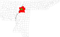 | ||||||||||
| U.S. Highways | |||||||||||
| State Highways |
| ||||||||||
| Other Highways | |||||||||||