Rural City of Wangaratta
| Rural City of Wangaratta Victoria | |||||||||||||
|---|---|---|---|---|---|---|---|---|---|---|---|---|---|
 Location in Victoria | |||||||||||||
| Population | 27,065 (2015 est)[1] | ||||||||||||
| • Density | 7.4375/km2 (19.2630/sq mi) | ||||||||||||
| Established | 1994 | ||||||||||||
| Gazetted | 18 November 1994[2] | ||||||||||||
| Area | 3,639 km2 (1,405.0 sq mi) | ||||||||||||
| Chief Administrator | Mrs Ailsa Fox | ||||||||||||
| Council seat | Wangaratta | ||||||||||||
| Region | Hume | ||||||||||||
| State electorate(s) | Ovens Valley | ||||||||||||
| Federal Division(s) | Indi | ||||||||||||
|
| |||||||||||||
| Website | Rural City of Wangaratta | ||||||||||||
| |||||||||||||
The Rural City of Wangaratta is a local government area in the Hume region of Victoria, Australia, located in the north-east part of the state. It covers an area of 3,639 square kilometres (1,405 sq mi) and, at the 2011 Census, had a population of 26,815.[3] It includes the towns of Cheshunt, Eldorado, Everton, Glenrowan, Greta, Greta West, Milawa, Moyhu, Oxley, Tarrawingee, Wangaratta and Whitfield. It was formed in 1994 from the amalgamation of the City of Wangaratta, Shire of Wangaratta, Shire of Oxley, and parts of the United Shire of Beechworth, Shire of Benalla and Shire of Yarrawonga. When formed the municipality was originally called the Shire of Milawa, but a few months later, was renamed to its current name.[2]
The Rural City is governed and administered by the Wangaratta Rural City Council; its seat of local government and administrative centre is located at the council headquarters in Wangaratta. The Rural City is named after the main urban settlement located in the north of the LGA, that is Wangaratta, which is also the LGA's most populous urban centre with a population of 17,377.[4]
Council
Current composition
The council is composed of seven councillors elected to represent an unsubdivided municipality.[5]
| Ward | Councillor | Notes | |
|---|---|---|---|
| Unsubdivided | N/A | Positions vacated by an Act of Parliament[6] (See below) | |
| N/A | |||
| N/A | |||
| N/A | |||
| N/A | |||
| N/A | |||
| N/A | |||
On 18 September 2013, the councillors were suspended and on 26 September 2013 the councillors were dismissed by an Act of Parliament.[6] The dismissal of the councillors followed allegations of bullying and intimidation by councillors towards other councillors and council staff, resulting in the resignation of one councillor, the Chief Executive Officer and the remaining members of the Executive Management Team.[7] As of 1 November 2013 a panel of three administrators, by an Act of Parliament, has been appointed to oversee the council until the 2016 municipal elections.[6][8]
- Mrs Ailsa Fox – Chief Administrator
- Mrs Irene Grant – Administrator
- Mr Rodney Roscholler – Administrator
Administration and governance
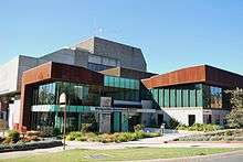
The panel of administrators meets in the council chambers at the council headquarters in the Wangaratta Government Centre, which is also the location of the council's administrative activities. It also provides customer services at its administrative centre in Wangaratta.
See also
References
- ↑ "3218.0 – Regional Population Growth, Australia, 2014–15". Australian Bureau of Statistics. Retrieved 29 September 2016.
- 1 2 Victoria Government Gazette – Online Archive (1837–1997). "S87 of 1994". State Library of Victoria. State Government of Victoria (published 18 November 1994). p. 3. Retrieved 10 January 2014.
|article=ignored (help) - ↑ Census QuickStats (2011). "Wangaratta (RC) – LGA26700". Australian Bureau of Statistics. Government of Australia. Retrieved 10 January 2014.
- ↑ Census QuickStats (2011). "Wangaratta (UCL) – UCL213013". Australian Bureau of Statistics. Government of Australia. Retrieved 10 January 2014.
- ↑ Local Government in Victoria. "Wangaratta Rural City Council". Department of Transport, Planning and Local Infrastructure. State Government of Victoria. Retrieved 10 January 2014.
- 1 2 3 Parliament of Victoria (2013). "Local Government (Rural City of Wangaratta) Act 2013". Australasian Legal Information Institute. State Government of Victoria. Retrieved 20 December 2013.
- ↑ "Wangaratta Council to be dismissed". Premier of Victoria. 18 September 2013. Retrieved 21 December 2013.
- ↑ Wangaratta Rural City Council (2013). "About Council – Councillors". Rural City of Wangaratta. Retrieved 20 December 2013.
External links
- Wangaratta Rural City Council official website
- Metlink local public transport map
- Link to Land Victoria interactive maps
Coordinates: 36°21′21″S 146°19′33″E / 36.35583°S 146.32583°E