Shire of East Gippsland
| Shire of East Gippsland Victoria | |||||||||||||
|---|---|---|---|---|---|---|---|---|---|---|---|---|---|
 Location in Victoria | |||||||||||||
| Population | 43,995 (2015 est)[1] | ||||||||||||
| • Density | 2.10191/km2 (5.44391/sq mi) | ||||||||||||
| Established | 1994 | ||||||||||||
| Gazetted | 2 December 1994[2] | ||||||||||||
| Area | 20,931 km2 (8,081.5 sq mi) | ||||||||||||
| Mayor | Mark Reeves | ||||||||||||
| Council seat | Bairnsdale | ||||||||||||
| Region | Eastern Victoria | ||||||||||||
| State electorate(s) | Gippsland East | ||||||||||||
| Federal Division(s) | Gippsland | ||||||||||||
|
| |||||||||||||
| Website | Shire of East Gippsland | ||||||||||||
| |||||||||||||
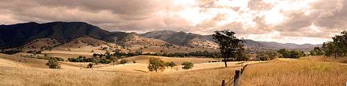
The Shire of East Gippsland is a local government area in Gippsland, Victoria, Australia, located in the eastern part of the state. It covers an area of 20,931 square kilometres (8,082 sq mi) and, at the 2011 Census, had a population of 42,196.[3] It includes the towns of Bairnsdale, Benambra, Bruthen, Buchan, Ensay, Lakes Entrance, Mallacoota, Metung, Omeo, Orbost, Paynesville, Swan Reach and Swifts Creek. It was formed in 1994 from the amalgamation of the City of Bairnsdale, Shire of Bairnsdale, Shire of Omeo, Shire of Orbost, Shire of Tambo and parts of the Shire of Rosedale.[2]
The Shire is governed and administered by the East Gippsland Shire Council; its seat of local government and administrative centre is located at the council headquarters in Bairnsdale, it also has service centres located in Lakes Entrance, Omeo and Orbost. The Shire is named after the Gippsland region, in which the LGA occupies the eastern portion.
Council
Current composition
The council is composed of nine councillors elected to represent an unsubdivided municipality.[4]
| Ward | Councillor | Notes | |
|---|---|---|---|
| Unsubdivided | Ben Buckley (LDP[5]) | ||
| Dick Ellis | |||
| Michael Freshwater | |||
| Jeff McNeill | |||
| Peter Neal | |||
| Marianne Pelz | Mayor (2015–16) | ||
| Mark Reeves | |||
| Jane Rowe | |||
| John Wilkin | |||
Administration and governance
The council meets in the council chambers at the council headquarters in the Bairnsdale Municipal Offices, which is also the location of the council's administrative activities. It also provides customer services at both its administrative centre in Bairnsdale, and its service centres in Lakes Entrance, Omeo and Orbost.
See also
References
- ↑ "3218.0 – Regional Population Growth, Australia, 2014–15". Australian Bureau of Statistics. Retrieved 29 September 2016.
- 1 2 Victoria Government Gazette – Online Archive (1837–1997). "Order estg (Part 4) the Shire of East Gippsland". S94 of 1994. State Library of Victoria. State Government of Victoria (published 2 December 1994). p. 3. Retrieved 10 January 2014.
- ↑ Census QuickStats (2011). "East Gippsland (S) – LGA22110". Australian Bureau of Statistics. Government of Australia. Retrieved 10 January 2014.
- ↑ Local Government in Victoria. "East Gippsland Shire Council". Department of Transport, Planning and Local Infrastructure. State Government of Victoria. Retrieved 10 January 2014.
- ↑ "Gippsland by-election". Liberal Democratic Party. Retrieved 9 February 2016.
External links

- East Gippsland Shire Council official website
- Vic Govt Dept of Natural Resources and Environment: East Gippsland biodiversity management
- Metlink local public transport map
- Link to Land Victoria interactive maps
Coordinates: 37°29′00″S 148°10′00″E / 37.48333°S 148.16667°E