Shire of Southern Grampians
| Shire of Southern Grampians Victoria | |||||||||||||
|---|---|---|---|---|---|---|---|---|---|---|---|---|---|
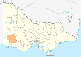 Location in Victoria | |||||||||||||
| Population | 16,359 (2011 census)[1] | ||||||||||||
| • Density | 2.45926/km2 (6.3695/sq mi) | ||||||||||||
| Established | 1994 | ||||||||||||
| Gazetted | 23 September 1994[2] | ||||||||||||
| Area | 6,652 km2 (2,568.4 sq mi) | ||||||||||||
| Mayor | Cr Peter Dark (as of 2014-15) | ||||||||||||
| Council seat | Hamilton | ||||||||||||
| Region | Barwon South West | ||||||||||||
| State electorate(s) | Lowan | ||||||||||||
| Federal Division(s) | Wannon | ||||||||||||
|
| |||||||||||||
| Website | Shire of Southern Grampians | ||||||||||||
| |||||||||||||
The Shire of Southern Grampians is a local government area (LGA) in the Barwon South West region of Victoria, Australia, located in the south-western part of the state. It covers an area of 6,652 square kilometres (2,568 sq mi) and, at the 2011 census, had a population of 16,359.[1] It includes the towns of Coleraine, Hamilton, Dunkeld and Penshurst. It was formed in 1994 from the amalgamation of the City of Hamilton, Shire of Wannon and parts of the Shire of Dundas, Shire of Kowree, Shire of Mount Rouse and Shire of Heywood.[2][3]
The Shire is governed and administered by the Southern Grampians Shire Council; its seat of local government and administrative centre is located at the council headquarters in Hamilton, it also has service centres located in a couple of other locations within Hamilton. The Shire is named after the major geographical feature in the region, The Grampians, and that the southern part of this feature occupies the northern part of the LGA.
Council
Current composition
The council is composed of seven councillors elected to represent an unsubdivided municipality.[4]
| Ward | Councillor | Notes | |
|---|---|---|---|
| Unsubdivided | Cathy Armstrong | ||
| Paul Battista | |||
| Albert Calvano | (Mayor 2013–14) | ||
| Bruach Colliton | |||
| Peter Dark | (Mayor 2014-15) | ||
| Dennis Dawson | |||
| Katrina Rainsford | |||
Administration and governance
The council meets in the council chambers at the council headquarters in the Hamilton Municipal Offices, which is also the location of the council's administrative activities. It also provides customer services at both its administrative centre on Brown Street in Hamilton, and its service centres on Market Pl and Roberts St in Hamilton.
See also
References
- 1 2 Census QuickStats (2011). "Southern Grampians (S) – LGA26260". Australian Bureau of Statistics. Government of Australia. Retrieved 10 January 2014.
- 1 2 Victoria Government Gazette – Online Archive (1837–1997). "S63 of 1994". State Library of Victoria. State Government of Victoria (published 23 September 1994). pp. 4–5. Retrieved 10 January 2014.
|article=ignored (help) - ↑ Victoria Government Gazette – Online Archive (1837–1997). "S4 of 1995". State Library of Victoria. State Government of Victoria (published 20 January 1995). p. 5. Retrieved 10 January 2014.
|article=ignored (help) - ↑ Local Government in Victoria. "Southern Grampians Shire Council". Department of Transport, Planning and Local Infrastructure. State Government of Victoria. Retrieved 10 January 2014.
External links
![]() Media related to Shire of Southern Grampians at Wikimedia Commons
Media related to Shire of Southern Grampians at Wikimedia Commons
- Southern Grampians Shire Council official website
- Metlink local public transport map
- Link to Land Victoria interactive maps
Coordinates: 37°31′00″S 142°02′00″E / 37.51667°S 142.03333°E