Moyhu, Victoria
| Moyhu Victoria | |
|---|---|
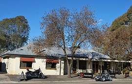 Moyhu Hotel | |
 Moyhu | |
| Coordinates | 36°34′0″S 146°22′0″E / 36.56667°S 146.36667°ECoordinates: 36°34′0″S 146°22′0″E / 36.56667°S 146.36667°E |
| Population | 428 (2011 census)[1] |
| Postcode(s) | 3732 |
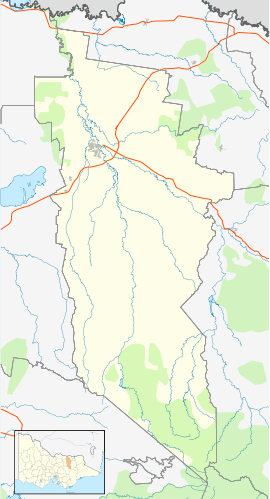
| Location |
|
| LGA(s) | Rural City of Wangaratta |
| State electorate(s) | Ovens Valley |
| Federal Division(s) | Indi |
Moyhu is a small town in North East Victoria, Australia. It is situated approximately 2.5 hours' drive from Melbourne, and 25 minutes from Wangaratta. It is part of the Rural City of Wangaratta. At the 2006 census, Moyhu had a population of 536.[2] At the 2011 census, Moyhu population had declined to 428 - 216 males and 212 females. 50.5% of the population was male; 49.5% female. Aboriginal and Torres Strait Islander people made up 0.7% of the population. Approximately 20% of the Moyhu population consists of children aged 0–14.[1]
Moyhu is situated in the fertile King Valley, near the King River, which flows down from the mountains and joins the Ovens River in Wangaratta.
History
Moyhu was founded between 1856 and 1875, with the first known land sales around the town in 1859, and became the home of several large butter factories, and a timber mill. It is believed the name of the town came from the corruption of the name Moihu, a village in Ireland where several of the early pioneer families came from. The Post Office opened on 1 January 1868.[3]
The first known school at Moyhu was a Rural School No 96 which was granted aid by the Board of Education in mid 1871. It was a bark-roof slab building. From this beginning State School 1335 Moyhu was established in January 1874, with a new building on a 2 acre site. A new building was erected in 1907, with major additions made in 1959. A surveying error made when the township was originally surveyed placed the school a mile from the township. The school became important as a group-leader in the district.[4]
3061 Moyhu North opened in a slab building in September 1890, but closed at the end of 1891 due to low enrolments.[5] 2464 Moyhu South was later named Edi. It opened in May 1882. In July 1888 it operated half time with 2894 Witfield North, and in 1893 with 2676 Boggy Creek. It resumed full-time in 1895. In 1902 the school was relocated to cater for rural and railway families.[6]
During the late 1800s Moyhu was a lively centre, and the home of many race meetings, dances and other social events. Victoria's first narrow gauge railway line (2'6" gauge) was opened in 1899 and connected the King Valley with the broad gauge line at Wangaratta.
The town today
Moyhu is the home of several annual events - the Easter Fair at the local primary school every Easter Monday, a Garden Expo every October, Guy Fawkes bonfire, and a popular New Year's Eve celebration in the Lions Park. It is also a central location for popular tourist attractions in the area such as Glenrowan (the scene of Ned Kelly's last stand) and the King Valley gourmet region.
The town has an Australian Rules football team competing in the Ovens & King Football League.[7]
References
- 1 2 Australian Bureau of Statistics (31 October 2012). "Moyhu (State Suburb)". 2011 Census QuickStats. Retrieved 1 December 2014.
- ↑ Australian Bureau of Statistics (25 October 2007). "Moyhu (L) (Urban Centre/Locality)". 2006 Census QuickStats. Retrieved 24 May 2010.
- ↑ Premier Postal History, Post Office List, retrieved 2008-04-11
- ↑ Vision and Realisation, vol.3, p.937-938.
- ↑ Vision and Realisation, vol.3, p.996.
- ↑ Vision and Realisation, vol.3, p.978.
- ↑ Full Points Footy, Moyhu, archived from the original on May 2, 2008, retrieved 2008-07-25
External links
| Wikimedia Commons has media related to Moyhu, Victoria. |