Rivière-Vaseuse, Quebec
| Rivière-Vaseuse | |
|---|---|
| Unorganized territory | |
 Location within La Matapédia RCM. | |
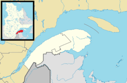 Rivière-Vaseuse Location in eastern Quebec. | |
| Coordinates: 48°13′N 67°28′W / 48.217°N 67.467°WCoordinates: 48°13′N 67°28′W / 48.217°N 67.467°W[1] | |
| Country |
|
| Province |
|
| Region | Bas-Saint-Laurent |
| RCM | La Matapédia |
| Constituted | January 1, 1986 |
| Government[2] | |
| • Federal riding |
Haute-Gaspésie—La Mitis—Matane—Matapédia |
| • Prov. riding | Matane-Matapédia |
| Area[2][3] | |
| • Total | 272.50 km2 (105.21 sq mi) |
| • Land | 275.51 km2 (106.38 sq mi) |
|
There is an apparent contradiction between two authoritative sources | |
| Population (2011)[3] | |
| • Total | 5 |
| • Density | 0.0/km2 (0/sq mi) |
| • Pop 2006-2011 |
|
| • Dwellings | 2 |
| Time zone | EST (UTC-5) |
| • Summer (DST) | EDT (UTC-4) |
| Highways | No major routes |
Rivière-Vaseuse is an unorganized territory in the Bas-Saint-Laurent region of Quebec, Canada.
It is named after the Vaseuse River, a tributary of the Matapédia River via the Milnikek River.
Demographics
Population trend:[4]
- Population in 2011: 5
- Population in 2006: 0
- Population in 2001: 0
- Population in 1996: 0
- Population in 1991: 0
See also
References
- ↑ Reference number 149680 of the Commission de toponymie du Québec (French)
- 1 2 "Rivière-Vaseuse". Répertoire des municipalités (in French). Ministère des Affaires municipales, des Régions et de l'Occupation du territoire. Retrieved 2012-02-06.
- 1 2 "Rivière-Vaseuse census profile". 2011 Census data. Statistics Canada. Retrieved 2012-02-06.
- ↑ Statistics Canada: 1996, 2001, 2006, 2011 census
 |
Saint-Zénon-du-Lac-Humqui, Saint-Léon-le-Grand | Albertville | | |
| Lac-à-la-Croix | |
Sainte-Florence | ||
| ||||
| | ||||
| Rivière-Patapédia-Est | Ruisseau-Ferguson | Routhierville |
| Cities & Towns | |
|---|---|
| Municipalities | |
| Parishes | |
| Villages | |
| Unorganized territories | |
| |
This article is issued from Wikipedia - version of the 11/17/2016. The text is available under the Creative Commons Attribution/Share Alike but additional terms may apply for the media files.