Whitworth, Quebec
| Whitworth | |
|---|---|
| Indian reserve | |
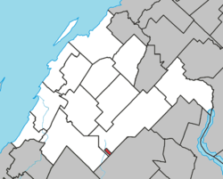 Location within Rivière-du-Loup RCM. | |
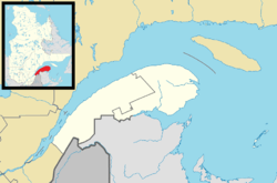 Whitworth Location in eastern Quebec. | |
| Coordinates: 47°42′N 69°17′W / 47.700°N 69.283°WCoordinates: 47°42′N 69°17′W / 47.700°N 69.283°W[1] | |
| Country |
|
| Province |
|
| Region | Bas-Saint-Laurent |
| RCM | None |
| Constituted | unspecified |
| Government[2] | |
| • Federal riding | Montmagny—L'Islet—Kamouraska—Rivière-du-Loup |
| • Prov. riding | Rivière-du-Loup-Témiscouata |
| Area[2][3] | |
| • Total | 1.60 km2 (0.62 sq mi) |
| Time zone | EST (UTC−5) |
| • Summer (DST) | EDT (UTC−4) |
Whitworth is an Indian reserve in the Bas-Saint-Laurent region of Quebec. It is geographically located within the territory of Rivière-du-Loup Regional County Municipality but is not juridically a part of it. Its population was 0 in the Canada 2006 Census and it appears to have been left out of the Canada 2011 Census.[4][3][1]
See also
List of Indian reserves in Quebec
References
- 1 2 Reference number 82096 of the Commission de toponymie du Québec (French)
- 1 2 Geographic code 12802 in the official Répertoire des municipalités (French)
- 1 2 "(Code 2412802) Census Profile". 2011 census. Statistics Canada. 2012.
- ↑ "(Code 2412802) Community Profiles". 2006 census. Statistics Canada. 2007.
External links
- Malécites de Viger First Nation (Aboriginal Affairs and Northern Development Canada)
- Native nations communities of Québec (Secrétariat aux affaires autochtones du Québec)
| Cities & Towns | |
|---|---|
| Municipalities | |
| Parishes | |
| |
This article is issued from Wikipedia - version of the 7/26/2013. The text is available under the Creative Commons Attribution/Share Alike but additional terms may apply for the media files.