Lac-Casault, Quebec
| Lac-Casault | |
|---|---|
| Unorganized territory | |
 Location within La Matapédia RCM. | |
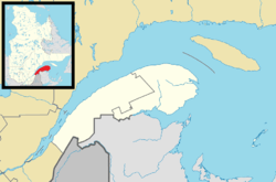 Lac-Casault Location in eastern Quebec. | |
| Coordinates: 48°30′N 67°09′W / 48.500°N 67.150°WCoordinates: 48°30′N 67°09′W / 48.500°N 67.150°W[1] | |
| Country |
|
| Province |
|
| Region | Bas-Saint-Laurent |
| RCM | La Matapédia |
| Constituted | unspecified |
| Government[2] | |
| • Federal riding |
Haute-Gaspésie—La Mitis—Matane—Matapédia |
| • Prov. riding | Matane-Matapédia |
| Area[2][3] | |
| • Total | 1,423.00 km2 (549.42 sq mi) |
| • Land | 1,468.08 km2 (566.83 sq mi) |
| There is an apparent contradiction between two authoritative sources | |
| Population (2011)[3] | |
| • Total | 5 |
| • Density | 0.0/km2 (0/sq mi) |
| • Pop 2006-2011 |
|
| • Dwellings | 137 |
| Time zone | EST (UTC-5) |
| • Summer (DST) | EDT (UTC-4) |
| Highways |
|
Lac-Casault is an unorganized territory in the Bas-Saint-Laurent region of Quebec, Canada.
The small eponymous Lake Casault is located near the village of St-Alexandre-des-Lacs and was named in honour of Louis-Napoléon Casault (1823–1908).[4]
Demographics
Population trend:[5]
- Population in 2011: 5 (2006 to 2011 population change: -75.0 %)
- Population in 2006: 20
- Population in 2001: 0
- Population in 1996: 0
- Population in 1991: 3
Private dwellings occupied by usual residents: 4 (total dwellings: 137)
See also
References
- ↑ Reference number 149682 of the Commission de toponymie du Québec (French)
- 1 2 "Lac-Casault". Répertoire des municipalités (in French). Ministère des Affaires municipales, des Régions et de l'Occupation du territoire. Retrieved 2012-02-01.
- 1 2 "Lac-Casault census profile". 2011 Census data. Statistics Canada. Retrieved 2012-02-01.
- ↑ "Lac Casault" (in French). Commission de toponymie du Québec. Retrieved 2012-02-01.
- ↑ Statistics Canada: 1996, 2001, 2006, 2011 census
 |
Saint-Vianney | Rivière-Bonjour, Ruisseau-des-Mineurs | | |
| Saint-Tharcisius St-Alexandre-des-Lacs Causapscal Sainte-Marguerite-Marie |
|
Mont-Albert | ||
| ||||
| | ||||
| Routhierville | Rivière-Nouvelle | Rivière-Bonaventure |
| Cities & Towns | |
|---|---|
| Municipalities | |
| Parishes | |
| Villages | |
| Unorganized territories | |
| |
This article is issued from Wikipedia - version of the 11/17/2016. The text is available under the Creative Commons Attribution/Share Alike but additional terms may apply for the media files.