Amqui
| Amqui | ||
|---|---|---|
| City | ||
 | ||
| ||
 Location within La Matapédia RCM. | ||
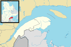 Amqui Location in eastern Quebec. | ||
| Coordinates: 48°28′N 67°26′W / 48.467°N 67.433°WCoordinates: 48°28′N 67°26′W / 48.467°N 67.433°W[1] | ||
| Country |
| |
| Province |
| |
| Region | Bas-Saint-Laurent | |
| RCM | La Matapédia | |
| Settled | 1870s | |
| Constituted | January 16, 1991 | |
| Government[2] | ||
| • Mayor | Gaëtan Ruest | |
| • Federal riding | Avignon—La Mitis—Matane—Matapédia | |
| • Prov. riding | Matane-Matapédia | |
| Area[2][3] | ||
| • Total | 126.80 km2 (48.96 sq mi) | |
| • Land | 120.81 km2 (46.65 sq mi) | |
| Population (2011)[3] | ||
| • Total | 6,322 | |
| • Density | 52.3/km2 (135/sq mi) | |
| • Pop 2006-2011 |
| |
| • Dwellings | 2,925 | |
| Time zone | EST (UTC−5) | |
| • Summer (DST) | EDT (UTC−4) | |
| Postal code(s) | G5J | |
| Area code(s) | 418 and 581 | |
| Highways |
| |
| Website |
www | |
.svg.png)
Amqui (/ɒmkwiː/) is a town in eastern Quebec, Canada, at the base of the Gaspé peninsula in Bas-Saint-Laurent. Located at the confluence of the Humqui and Matapédia Rivers, it is the seat of La Matapédia Regional County Municipality. The main access road is Quebec Route 132.
Etymology
The Mi'kmaq word amgoig, also written humqui, unkoui and ankwi, means "the place to have fun", "half wall" or "place of amusement and pleasure."[4] Another Mi'kmaq name for the area is Amkooĭk or Mkooögwĭk which aptly describes the area as "boggy."[5][6][7] One source postulates that its name comes from the swirling water at the junction of the Humqui and Matapédia rivers. However, the most plausible explanation appears to be more pragmatic: Amqui was formerly a place where Amerindians gathered for pow wows.[1][8]
History
Originally Mi'kmaq territory, the area was granted as a seignory by Louis de Buade de Frontenac to Charles-Nicolas-Joseph D’Amours in 1694. D'Amours died in 1728 and none of his descendants claimed the rights to the seignory. So it remained a remote and undeveloped land until the 19th century. In 1830 construction began on the Kempt Road, a strategic military road between Quebec and the Maritimes, completed in 1833, that opened the area to colonization. But it was the construction of the Intercolonial Railway in the 1870s that brought real development.
In 1879, the post office opened under the name Amqui. In 1881, the Mission of Saint-Benoît-Joseph-Labre was established, named after Benedict Joseph Labre. By 1884, the town became known as a great destination for salmon and trout fishing.[9] In 1889, the mission became a parish and the following year it was incorporated as the Parish Municipality of Saint-Benoît-Joseph-Labre.[1]
In 1907, the village itself separated from the parish municipality and was incorporated as the Village Municipality of Saint-Benoît-Joseph-Labre, renamed to Amqui in 1948. It gained town status in 1961.[1]
In January 1991, the Parish Municipality of Saint-Benoît-Joseph-Labre was merged into the Town of Amqui.[1]
Geography
Amqui is located to the south of the Saint Lawrence River in the Matapédia Valley, which was formed by the Chic-Choc Mountains. The valley is of glacial origin and was formed during the Paleozoic era millions of years ago. The region is characterized by gentle slopes through which the Matapédia river snakes from the northwest to the southeast. The city is located at the confluence of the Humqui and Matapédia rivers.
The city is situated 415 km northeast of Quebec City, 345 km west of Gaspé and 80 km north of New Brunswick. Neighboring urban centres include Rimouski and Mont-Joli, at 105 km and 70 km to the west, respectively, and Matane, 65 km to the north. Amqui is located 25 km east of Sayabec and 20 km northwest of Causapscal, the two largest municipalities of La Matapédia after Amqui. The city borders Saint-Vianney and Saint-Tharcisius to the north, Saint-Alexandre-des-Lacs to the east, Lac-au-Saumon and Saint-Léon-le-Grand to the south, as well as Sainte-Irène and Val-Brillant to the west. The Courtuval hamlet is part of Amqui.
Climate
Amqui's climate is temperate. Being surrounded by the Chic-Chocs creates unique climatic conditions in the region: a long and snowy winter and a hot and humid summer.
Demographics
Population
The central community of Amqui, excluding the smaller communities within its municipal boundaries, is counted as a population centre in Canadian census data, with a population of 4,557 in 2011; three non-contiguous parcels of land which were part of the pre-1991 boundaries of Amqui but are not sufficiently urbanized to be included in the primary population centre are also separately counted as a designated place, with a population of 258 in the same census.
| Canada census – Amqui, Quebec community profile | |||
|---|---|---|---|
| 2011 | 2006 | 2001 | |
| Population: | 6,322 (+1.0% from 2006) | 6,261 (-3.3% from 2001) | 6,473 (-4.8% from 1996) |
| Land area: | 120.81 km2 (46.65 sq mi) | 120.81 km2 (46.65 sq mi) | 120.81 km2 (46.65 sq mi) |
| Population density: | 52.3/km2 (135/sq mi) | 51.8/km2 (134/sq mi) | 53.6/km2 (139/sq mi) |
| Median age: | 47.2 (M: 46.2, F: 48.0) | 44.2 (M: 43.8, F: 44.4) | 40.2 (M: 39.9, F: 40.5) |
| Total private dwellings: | 2,925 | 2,836 | 2,811 |
| Median household income: | $49,702 | $40,733 | $35,586 |
| Notes: Population in 1996: 6,800[10] (+4.3% from 1991) - Population in 1991: 6,518[10] – References: 2011[11] 2006[12] 2001[13] | |||
Language
According to the Statistics Canada website, 6,090 of Amqui's 6,120 residents speak French as their first language. In addition, 12% can speak both French and English.
| Mother tongue | Population | Percentage |
|---|---|---|
| French | 6,090 | 99.51% |
| English | 10 | 0.16% |
| English and French | 0 | 0% |
| Other languages | 15 | 0.25% |
Government
Municipal
Members of the city council are elected every four years on the first Sunday of November and are conducted electronically. It is composed of seven members:[14]
| Term | Role | Name |
|---|---|---|
| 2013-2017 | Mayor | Gaëtan Ruest |
| Councillor | ||
| #1 | Paule Lévesque | |
| #2 | Pierre D'Amours | |
| #3 | Diane Arbour | |
| #4 | Égide Charest | |
| #5 | Richard Leclerc | |
| #6 | Normand Boulianne |
Federal and provincial
Provincially, Amqui is represented by Pascal Bérubé in the Matane-Matapédia electoral district.
Federally, the city is represented by Jean-François Fortin in the Haute-Gaspésie—La Mitis—Matane—Matapédia electoral district.
Infrastructure
The two-story Amqui railway station built in 1904, is served by Via Rail's Ocean, and Montreal – Gaspé trains. Both trains share the same rail line between Montréal and Matapédia. It is protected by the federal government under the Act on the Protection of heritage railway stations since 1993.
The station is representative of the boom at the turn of the century, and the associated expansion of the railways in general, the Intercolonial Railway of Canada (IRC) in particular. Amqui depended on the railway to transport their agricultural products and finished parts made of wood. Subsequently, Amqui became an important stop on the train's route from Montréal to Halifax, and from Montréal to Gaspé.
The design of the station Amqui is unusual for a station of the IRC.[15] It is distinguished by its two-stage design, housing the housing of the station master and his family.[16]
Notable people from Amqui
- Alfred Belzile - politician and farmer.
- Sébastien Caron - goaltender for the Nashville Predators
- Cathy LeFrançois - IFBB professional bodybuilder
- Kim Nguyen - film director (War Witch)
- Olivier Roy - goaltender drafted by the Edmonton Oilers
See also
References
- 1 2 3 4 5 "Amqui (ville)" (in French). Commission de toponymie du Québec. Retrieved 2012-01-30.
- 1 2 "Amqui". Répertoire des municipalités (in French). Ministère des Affaires municipales, des Régions et de l'Occupation du territoire. Retrieved 2012-01-30.
- 1 2 "Amqui census profile". 2011 Census data. Statistics Canada. Retrieved 2012-01-30.
- ↑ Collectif; Auzias, Dominique; Labourdette, Jean-Paul (2012-02-10). Québec 2012-2013 (in French). Petit Futé. ISBN 2746951703.
- ↑ Rand, Silas Tertius (1875-01-01). A First Reading Book in the Micmac Language: Comprising the Micmac Numerals, and the Names of the Different Kinds of Beasts, Birds, Fishes, Trees, &c. of the Maritime Provinces of Canada. Also, Some of the Indian Names of Places, and Many Familiar Words and Phrases, Translated Literally Into English. Nova Scotia Printing Company.
- ↑ Marshall, Ian (2012-02-01). Border Crossings: Walking the Haiku Path on the International Appalachian Trail. Hiraeth Press. pp. 118–119. ISBN 9780983585251.
- ↑ Brochu, Renaud (1990-01-01). Les Fournier: François et Théophile, deux lignées matapédiennes (in French). Éditions Le Brochu. ISBN 9782980199707.
- ↑ Dompierre, Michel; Leblanc, Bertrand (2004). La Matapédia : Matapediac (in French). Amqui, Québec: MRC de La Matapédia. ISBN 2-9808660-0-8.
- ↑ Harris, W.C. (1885). The Angler's Guide Book and Tourist's Gazetteer of the Fishing Waters of the United States and Canada. American Angler.
- 1 2 "Electronic Area Profiles". Canada 1996 Census. Statistics Canada. Retrieved 2013-05-11.
- ↑ "2011 Community Profiles". Canada 2011 Census. Statistics Canada. July 5, 2013. Retrieved 2014-01-28.
- ↑ "2006 Community Profiles". Canada 2006 Census. Statistics Canada. March 30, 2011. Retrieved 2012-01-30.
- ↑ "2001 Community Profiles". Canada 2001 Census. Statistics Canada. February 17, 2012. Retrieved 2012-01-30.
- ↑ "Composition du conseil - Ville d'Amqui" (in French). City of Amqui. Retrieved 8 July 2014.
- ↑ Brown, Ron (2015-08-08). Dundurn Railroad 5-Book Bundle: In Search of the Grand Trunk / Rails Across the Prairies / Rails Across Ontario / The Train Doesn't Stop Here Anymore / Rails to the Atlantic. Dundurn. ISBN 9781459733039.
- ↑ "Gare et wagon Lynnewood." Ville d'Amqui. Retrieved on 25 June 2012.
External links
| Wikimedia Commons has media related to Amqui. |
| Wikivoyage has a travel guide for Amqui. |
 |
Lac-Matapédia | Saint-Vianney | Saint-Tharcisius | |
| Val-Brillant Sainte-Irène |
|
St-Alexandre-des-Lacs | ||
| ||||
| | ||||
| Saint-Léon-le-Grand | Lac-au-Saumon |
| Cities & Towns | |
|---|---|
| Municipalities | |
| Parishes | |
| Villages | |
| Unorganized territories | |
| |