Pulga, California
Coordinates: 39°48′11″N 121°26′55″W / 39.80306°N 121.44861°W
| Pulga | |
|---|---|
| Unincorporated community | |
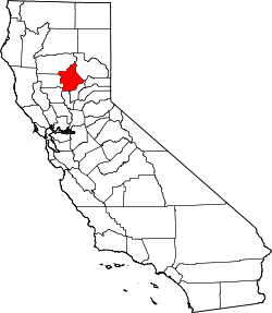
 Pulga  Pulga Location in California | |
| Coordinates: 39°48′11″N 121°26′55″W / 39.80306°N 121.44861°W | |
| Country | United States |
| State | California |
| County | Butte County |
| Elevation[1] | 1,398 ft (426 m) |
Pulga (Spanish for "Flea") is an unincorporated community in Butte County, California. It is located along the west slope of the Feather River canyon, at an elevation of 1398 feet (426 m). A variant name for the community is Big Bar. Other nearby communities include Mayaro, Poe and Parkhill. The town hosts a Caltrans highway maintenance station along State Route 70 (SR70). The place is at the mouth of the Flea Valley Creek, which gives rise to the toponym.[2]
The Union Pacific Railroad runs trains through this vicinity daily on its Canyon Division. The route was originally built by the Western Pacific Railroad and is famous for scenic views from passing trains. Vista Dome cars were designed and built with the scenery on this route in mind. Today, the line is host to a constant string of lumbering freight trains.
Driving SR70 offers scenic views of the rocky gorge. Steel truss bridges along the highway underwent seismic retrofit work in 2004 to prepare them for the inevitable California earthquake.
Cresta Powerhouse 39°49′35″N 121°24′28″W / 39.82639°N 121.40778°W and Camp Creek Powerhouse 39°49′37″N 121°25′06″W / 39.82694°N 121.41833°W are about 3 miles (4.8 km) north of Pulga on SR70. Cresta was first put on line in 1949 and Rock Creek a year later. The area near these powerhouses is named Mayaro, California, on some topographic, highway, and railroad maps. Another community name, Cresta, is about one driving mile beyond the powerhouse of the same name.
A post office was opened in 1906;[2] the ZIP Code is 95965. The community is inside area code 530.
Pulga Road is a private crossing for Union Pacific railroad. Camp Creek is an easement road that runs through the privately owned property of Pulga. Everything off the road is private property. There is no camping or RV parking in or around the town. Private property ends around south facing hill bend.
See also
References
- ↑ U.S. Geological Survey Geographic Names Information System: Pulga, California
- 1 2 Durham, David L. (1998). California's Geographic Names: A Gazetteer of Historic and Modern Names of the State. Clovis, Calif.: Word Dancer Press. p. 296. ISBN 1-884995-14-4.
- U.S. Geological Survey Geographic Names Information System: Pulga, California
- US Geological Survey, Pulga, California, 7.5 minute quadrangle, 1994.
- US Geological Survey, National Geographic Names Database.
- mysticvalleyretreat.com
- featherrivergrove.org