Flea Valley, California
Coordinates: 39°49′47″N 121°28′59″W / 39.82972°N 121.48306°W
| Flea Valley | |
|---|---|
| Former settlement | |
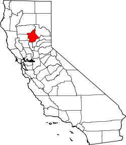
 Flea Valley Location in California | |
| Coordinates: 39°49′47″N 121°28′59″W / 39.82972°N 121.48306°W | |
| Country | United States |
| State | California |
| County | Butte County |
| Elevation[1] | 3,684 ft (1,123 m) |
Flea Valley (also, Flea Valley House) is a former settlement and mining camp[2] in Butte County, California.[1] It was located northeast of Magalia,[2] at an elevation of 3684 feet (1123 m).[1] Flea Valley still appeared on USGS maps as of 1897.[1]
Flea Valley has been noted for its unusual place name.[3]
References
- 1 2 3 4 "Flea Valley (historical)". Geographic Names Information System. United States Geological Survey.
- 1 2 Miller, Donald C. (1978). Ghost Towns of California. Boulder, Colorado: Pruett Publishing Company. p. 65. ISBN 0871085178.
- ↑ Thompson, George E. (1 July 2009). You Live Where?: Interesting and Unusual Facts about where We Live. iUniverse. p. 10. ISBN 978-1-4401-3421-0.
This article is issued from Wikipedia - version of the 5/18/2016. The text is available under the Creative Commons Attribution/Share Alike but additional terms may apply for the media files.