Port Monmouth, New Jersey
| Port Monmouth, New Jersey | |
|---|---|
| Census-designated place | |
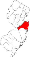
 Map of Port Monmouth, highlighted in Monmouth County. Right: Location of Monmouth County in New Jersey. | |
| Coordinates: 40°26′12″N 74°05′55″W / 40.436673°N 74.098641°WCoordinates: 40°26′12″N 74°05′55″W / 40.436673°N 74.098641°W | |
| Country |
|
| State |
|
| County | Monmouth |
| Township | Middletown |
| Area[1] | |
| • Total | 1.343 sq mi (3.477 km2) |
| • Land | 1.302 sq mi (3.371 km2) |
| • Water | 0.041 sq mi (0.106 km2) 3.04% |
| Elevation[2] | 10 ft (3 m) |
| Population (2010 Census)[3] | |
| • Total | 3,818 |
| • Density | 2,933.4/sq mi (1,132.6/km2) |
| Time zone | Eastern (EST) (UTC-5) |
| • Summer (DST) | Eastern (EDT) (UTC-4) |
| ZIP code | 07758[4] |
| Area code(s) | 732/848 |
| FIPS code | 3460360[1][5] |
| GNIS feature ID | 02389696[1][6] |
Port Monmouth is an unincorporated community and census-designated place (CDP) within Middletown Township, in Monmouth County, New Jersey, United States.[7][8][9] As of the 2010 United States Census, the CDP's population was 3,818.[3]
Geography
According to the United States Census Bureau, Port Monmouth had a total area of 1.343 square miles (3.477 km2), including 1.302 square miles (3.371 km2) of land and 0.041 square miles (0.106 km2) of water (3.04%).[1][10]
Demographics
| Historical population | |||
|---|---|---|---|
| Census | Pop. | %± | |
| 1880 | 396 | — | |
| 1890 | 754 | 90.4% | |
| 1990 | 3,558 | — | |
| 2000 | 3,742 | 5.2% | |
| 2010 | 3,818 | 2.0% | |
| Population sources: 1880-1890[11] 1900-2010[7] 2000[12] 2010[3] | |||
Census 2010
The 2010 United States Census counted 3,818 people, 1,368 households, and 997.3 families residing in the CDP. The population density was 2,933.4 per square mile (1,132.6/km2). The CDP contained 1,441 housing units at an average density of 1,107.1 per square mile (427.5/km2). The racial makeup of the CDP was 92.95% (3,549) White, 2.15% (82) Black or African American, 0.21% (8) Native American, 1.99% (76) Asian, 0.00% (0) Pacific Islander, 1.49% (57) from other races, and 1.20% (46) from two or more races. Hispanics or Latinos of any race were 7.91% (302) of the population.[3]
Out of a total of 1,368 households, 34.6% had children under the age of 18 living with them, 56.0% were married couples living together, 11.8% had a female householder with no husband present, and 27.1% were non-families. 22.4% of all households were made up of individuals, and 9.9% had someone living alone who was 65 years of age or older. The average household size was 2.78 and the average family size was 3.29.[3]
In the CDP, 24.1% of the population were under the age of 18, 8.0% from 18 to 24, 27.3% from 25 to 44, 30.4% from 45 to 64, and 10.3% who were 65 years of age or older. The median age was 39.7 years. For every 100 females the census counted 95.1 males, but for 100 females at least 18 years old, it was 91.7 males.[3]
Census 2000
As of the 2000 United States Census[5] there were 3,742 people, 1,289 households, and 964 families residing in the CDP. The population density was 2,833.1 people per square mile (1,094.5/km2). There were 1,358 housing units at an average density of 1,028.2/sq mi (397.2/km2). The racial makeup of the CDP was 95.70% White, 1.28% African American, 0.19% Native American, 0.43% Asian, 1.15% from other races, and 1.26% from two or more races. Hispanic or Latino of any race were 6.95% of the population.[12]
There were 1,289 households out of which 38.9% had children under the age of 18 living with them, 57.7% were married couples living together, 12.3% had a female householder with no husband present, and 25.2% were non-families. 21.1% of all households were made up of individuals and 11.0% had someone living alone who was 65 years of age or older. The average household size was 2.89 and the average family size was 3.39. 99% of the population in Port Monmouth.[12]
In the CDP the population was spread out with 27.4% under the age of 18, 8.5% from 18 to 24, 32.3% from 25 to 44, 21.4% from 45 to 64, and 10.5% who were 65 years of age or older. The median age was 35 years. For every 100 females there were 94.1 males. For every 100 females age 18 and over, there were 91.1 males.[12]
The median income for a household in the CDP was $53,864, and the median income for a family was $63,375. Males had a median income of $45,565 versus $30,244 for females. The per capita income for the CDP was $21,369. About 8.6% of families and 10.5% of the population were below the poverty line, including 15.3% of those under age 18 and 12.3% of those age 65 or over.[12]
Transportation
NJ Transit offers bus service to Newark on the 61 route and local bus service on the 817 route.[13]
Emergency services
Port Monmouth is served by the Port Monmouth Fire Company #1 and Port Monmouth First Aid Squad which are both located in the CDP.
In media
Port Monmouth was featured in a 1990 episode of Saturday Night Live during a Weekend Update sketch featuring Al Franken covering a cocaine deal in Port Monmouth, NJ.[14] The tugboats Ocean Prince and Newport can be seen in the footage suggesting it was actually filmed locally in New York City for the show as Port Monmouth and neighboring Belford Harbor are home to fishing vessels - which is noted by Al during the sketch. At the time of filming those tugboats were under the Amerada Hess Corporation which had a storage facility and pier in Red Hook, Brooklyn.
References
- 1 2 3 4 Gazetteer of New Jersey Places, United States Census Bureau. Accessed July 21, 2016.
- ↑ U.S. Geological Survey Geographic Names Information System: Port Monmouth Census Designated Place, Geographic Names Information System. Accessed August 8, 2012.
- 1 2 3 4 5 6 DP-1 - Profile of General Population and Housing Characteristics: 2010 Demographic Profile Data for Port Monmouth CDP, New Jersey, United States Census Bureau. Accessed August 8, 2012.
- ↑ Look Up a ZIP Code for Port Monmouth, NJ, United States Postal Service. Accessed August 8, 2012.
- 1 2 American FactFinder, United States Census Bureau. Accessed September 4, 2014.
- ↑ US Board on Geographic Names, United States Geological Survey. Accessed September 4, 2014.
- 1 2 New Jersey: 2010 - Population and Housing Unit Counts - 2010 Census of Population and Housing (CPH-2-32), United States Census Bureau, August 2012. Accessed December 16, 2012.
- ↑ GCT-PH1 - Population, Housing Units, Area, and Density: 2010 - County -- County Subdivision and Place from the 2010 Census Summary File 1 for Monmouth County, New Jersey, United States Census Bureau. Accessed December 16, 2012.
- ↑ Locality Search, State of New Jersey. Accessed April 19, 2015.
- ↑ US Gazetteer files: 2010, 2000, and 1990, United States Census Bureau. Accessed September 4, 2014.
- ↑ Report on Population of the United States at the Eleventh Census: 1890. Part I, p. 239. United States Census Bureau, 1895. Accessed October 20, 2016.
- 1 2 3 4 5 DP-1 - Profile of General Demographic Characteristics: 2000 from the Census 2000 Summary File 1 (SF 1) 100-Percent Data for Port Monmouth CDP, New Jersey, United States Census Bureau. Accessed August 8, 2012.
- ↑ Monmouth County Bus / Rail Connections, NJ Transit, backed up by the Internet Archive as of July 26, 2010. Accessed August 8, 2012.
- ↑ http://www.nbc.com/saturday-night-live/video/weekend-update-segment---al-franken/n9879