Claytons Corner, New Jersey
| Claytons Corner, New Jersey | |
|---|---|
| Unincorporated community | |
|
Intersection of Church Road and Gordons Corner Road | |
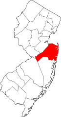
 Claytons Corner, New Jersey 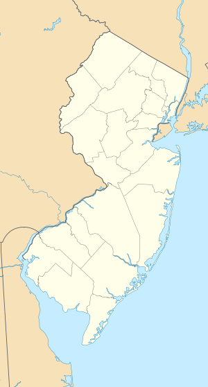 Claytons Corner, New Jersey  Claytons Corner, New Jersey Location of Claytons Corner in Monmouth County Inset: Location of county within the state of New Jersey | |
| Coordinates: 40°19′43″N 74°17′12″W / 40.32861°N 74.28667°WCoordinates: 40°19′43″N 74°17′12″W / 40.32861°N 74.28667°W | |
| Country |
|
| State |
|
| County | Monmouth |
| Township | Marlboro |
| Elevation[1] | 151 ft (46 m) |
| GNIS feature ID | 875473[1] |

Claytons Corner is an unincorporated community located within Marlboro Township in Monmouth County, New Jersey, United States.[2] The community is located along Gordons Corner Road nears its intersections with Church Road and Robertsville Road and is completely suburban in nature as the area is part of houses in planned communities.[3]
References
- 1 2 "Claytons Corner". Geographic Names Information System. United States Geological Survey.
- ↑ Locality Search, State of New Jersey. Accessed February 21, 2015.
- ↑ Google (March 31, 2016). "Aerial view of Claytons Corner" (Map). Google Maps. Google. Retrieved March 31, 2016.
This article is issued from Wikipedia - version of the 6/8/2016. The text is available under the Creative Commons Attribution/Share Alike but additional terms may apply for the media files.