Neptune City, New Jersey
| Neptune City, New Jersey | |
|---|---|
| Borough | |
| Borough of Neptune City | |
|
Center of Neptune City along Sylvania Avenue | |
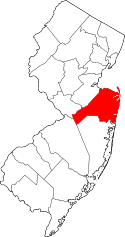
 Map of Neptune City in Monmouth County. Inset: Location of Neptune City highlighted in the State of New Jersey. | |
 Census Bureau map of Neptune City, New Jersey | |
| Coordinates: 40°12′01″N 74°02′01″W / 40.200211°N 74.03362°WCoordinates: 40°12′01″N 74°02′01″W / 40.200211°N 74.03362°W[1][2] | |
| Country |
|
| State |
|
| County | Monmouth |
| Incorporated | October 4, 1881 |
| Named for | Neptune, Roman water deity |
| Government[3] | |
| • Type | Borough |
| • Body | Borough Council |
| • Mayor | Robert J. Brown (R, term ends December 31, 2019)[4][5] |
| • Administrator / Clerk | Joel Popkin[6] |
| Area[1] | |
| • Total | 0.954 sq mi (2.470 km2) |
| • Land | 0.954 sq mi (2.470 km2) |
| • Water | 0.000 sq mi (0.000 km2) 0.00% |
| Area rank |
509th of 566 in state 43rd of 53 in county[1] |
| Elevation[7] | 23 ft (7 m) |
| Population (2010 Census)[8][9][10] | |
| • Total | 4,869 |
| • Estimate (2015)[11] | 4,803 |
| • Rank |
384th of 566 in state 33rd of 53 in county[12] |
| • Density | 5,105.0/sq mi (1,971.1/km2) |
| • Density rank |
108th of 566 in state 12th of 53 in county[12] |
| Time zone | Eastern (EST) (UTC-5) |
| • Summer (DST) | Eastern (EDT) (UTC-4) |
| ZIP code | 07753[13][14] |
| Area code(s) | 732[15] |
| FIPS code | 3402549920[1][16][17] |
| GNIS feature ID | 0885315[1][18] |
| Website |
www |

Neptune City is a borough in Monmouth County, New Jersey, United States. As of the 2010 United States Census, the borough's population was 4,869,[8][9][10] reflecting a decline of 349 (-6.7%) from the 5,218 counted in the 2000 Census, which had in turn increased by 221 (+4.4%) from the 4,997 counted in the 1990 Census.[19]
The Borough of Neptune City was incorporated on October 4, 1881, based on a referendum held on March 19, 1881. The boundaries included all of present-day Neptune City, along with what is now Avon-by-the-Sea and the southern portion of Bradley Beach. On March 23, 1900, a bill approved in the New Jersey Legislature created the Borough of Avon-by-the-Sea. On March 13, 1907, the eastern portion of Neptune City was annexed to the Borough of Bradley Beach.[20] The borough was named for Neptune, the Roman water deity, and its location on the Atlantic Ocean.[21][22]
The earliest borough hall was erected in 1902 at the northwest corner of Evergreen Avenue and Railroad Avenue (now Memorial Drive).
Geography
According to the United States Census Bureau, Neptune City borough had a total area of 0.954 square miles (2.470 km2), all of which is land.[1][2]
Unincorporated communities, localities and place names located partially or completely within the township include Neptune Heights and Ocean Grove Heights.[23]
The borough borders the Monmouth County municipalities of Avon-by-the-Sea, Bradley Beach and Bradley Beach.[24]
Demographics
| Historical population | |||
|---|---|---|---|
| Census | Pop. | %± | |
| 1900 | 1,009 | * | — |
| 1910 | 488 | * | −51.6% |
| 1920 | 539 | 10.5% | |
| 1930 | 2,258 | 318.9% | |
| 1940 | 2,392 | 5.9% | |
| 1950 | 3,073 | 28.5% | |
| 1960 | 4,013 | 30.6% | |
| 1970 | 5,502 | 37.1% | |
| 1980 | 5,276 | −4.1% | |
| 1990 | 4,997 | −5.3% | |
| 2000 | 5,218 | 4.4% | |
| 2010 | 4,869 | −6.7% | |
| Est. 2015 | 4,803 | [11][25] | −1.4% |
| Population sources: 1900-1920[26] 1900-1910[27] 1910-1930[28] 1930-1990[29] 2000[30][31] 2010[8][9][10] * = Lost territory in previous decade.[20] | |||
Census 2010
The 2010 United States Census counted 4,869 people, 2,133 households, and 1,220 families residing in the borough. The population density was 5,105.0 per square mile (1,971.1/km2). The borough contained 2,312 housing units at an average density of 2,424.0 per square mile (935.9/km2). The racial makeup of the borough was 78.00% (3,798) White, 10.62% (517) Black or African American, 0.23% (11) Native American, 4.46% (217) Asian, 0.02% (1) Pacific Islander, 3.88% (189) from other races, and 2.79% (136) from two or more races. Hispanics or Latinos of any race were 10.08% (491) of the population.[8]
Out of a total of 2,133 households, 22.4% had children under the age of 18 living with them, 38.8% were married couples living together, 13.2% had a female householder with no husband present, and 42.8% were non-families. 35.8% of all households were made up of individuals, and 11.1% had someone living alone who was 65 years of age or older. The average household size was 2.24 and the average family size was 2.95.[8]
In the borough, 18.4% of the population were under the age of 18, 7.1% from 18 to 24, 27.4% from 25 to 44, 31.7% from 45 to 64, and 15.3% who were 65 years of age or older. The median age was 43.1 years. For every 100 females the census counted 89.5 males, but for 100 females at least 18 years old, it was 86.9 males.[8]
The Census Bureau's 2006-2010 American Community Survey showed that (in 2010 inflation-adjusted dollars) median household income was $50,154 (with a margin of error of +/- $14,050) and the median family income was $72,313 (+/- $16,796). Males had a median income of $48,257 (+/- $3,972) versus $43,365 (+/- $7,250) for females. The per capita income for the borough was $31,172 (+/- $2,830). About 3.0% of families and 5.9% of the population were below the poverty line, including 6.7% of those under age 18 and 5.5% of those age 65 or over.[32]
Census 2000
As of the 2000 United States Census[16] there were 5,218 people, 2,221 households, and 1,330 families residing in the borough. The population density was 5,742.8 people per square mile (2,213.9/km2). There were 2,342 housing units at an average density of 2,577.5 per square mile (993.7/km2). The racial makeup of the borough was 83.38% White, 9.52% African American, 0.23% Native American, 2.72% Asian, 2.11% from other races, and 2.03% from two or more races. Hispanic or Latino of any race were 5.31% of the population.[30][31]
There were 2,221 households out of which 25.5% had children under the age of 18 living with them, 42.0% were married couples living together, 13.5% had a female householder with no husband present, and 40.1% were non-families. 33.5% of all households were made up of individuals and 11.7% had someone living alone who was 65 years of age or older. The average household size was 2.29 and the average family size was 2.96.[30][31]
In the borough the population was spread out with 21.5% under the age of 18, 6.5% from 18 to 24, 31.7% from 25 to 44, 24.0% from 45 to 64, and 16.4% who were 65 years of age or older. The median age was 40 years. For every 100 females there were 87.6 males. For every 100 females age 18 and over, there were 83.2 males.[30][31]
The median income for a household in the borough was $43,451, and the median income for a family was $46,393. Males had a median income of $39,578 versus $34,044 for females. The per capita income for the borough was $22,191. About 5.0% of families and 5.5% of the population were below the poverty line, including 5.8% of those under age 18 and 8.3% of those age 65 or over.[30][31]
Parks and recreation
The Neptune City Community Center offers a recreation center with a gym, game room, exercise room, computer room, TV room and a special occasion room.[33]
Neptune City also has four parks, Memorial Park which is located along the Shark River, Laird Avenue Park, the first playground built in Neptune City, Joe Freda Park, which is located on Third Avenue, and Adams Field, which is located on West Sylvania Avenue.[34]
Government
Local government
Neptune City is governed under the Borough form of New Jersey municipal government. The governing body consists of a Mayor and a Borough Council comprising six council members, with all positions elected at-large on a partisan basis as part of the November general election. A Mayor is elected directly by the voters to a four-year term of office. The Borough Council consists of six members elected to serve three-year terms on a staggered basis, with two seats coming up for election each year in a three-year cycle.[3] The Borough form of government used by Neptune City, the most common system used in the state, is a "weak mayor / strong council" government in which council members act as the legislative body with the mayor presiding at meetings and voting only in the event of a tie. The mayor can veto ordinances subject to an override by a two-thirds majority vote of the council. The mayor makes committee and liaison assignments for council members, and most appointments are made by the mayor with the advice and consent of the council.[35][36]
As of 2016, the Mayor of the Borough of Neptune City is Republican Robert J. Brown, whose term of office ends December 31, 2019.[4] Members of the Neptune City Borough Council are John "Chip" More (R, 2016), Rick Pryor (R, 2018), Pamela Renee (D, 2017), Barbara Shafer (R, 2017; elected to serve an unexpired term), Andrew Wardell (R, 2018) and Joseph Zajack (R, 2016).[37][38][39][40][41][42]
With Republican Richard Pryor and Democrat Michael Skudera tied at 602 votes after the November 2015 general election for the second of two seats,[40] the two candidates faced off in a March 2016 special election, won by Pryor by a 511-478 margin.[43]
In January 2015, Linda Brady was selected by the Borough Council from a list of three candidates nominated by the Democratic municipal committee to fill the vacant seat expiring in December 2017 of Christopher Galagher, who had been elected in November 2014 but declined to take office based on work commitments.[44] In the November 2015 general election, Republican Barbara Shafer defeated Brady and won the balance of the term of office.[40]
Federal, state and county representation
Neptune City is located in the 4th Congressional District[45] and is part of New Jersey's 11th state legislative district.[9][46][47] Prior to the 2010 Census, Neptune City had been part of the 6th Congressional District, a change made by the New Jersey Redistricting Commission that took effect in January 2013, based on the results of the November 2012 general elections.[48]
New Jersey's Fourth Congressional District is represented by Christopher Smith (R).[49] New Jersey is represented in the United States Senate by Cory Booker (D, Newark, term ends 2021)[50] and Bob Menendez (D, Paramus, 2019).[51][52]
For the 2016–2017 session (Senate, General Assembly), the 11th Legislative District of the New Jersey Legislature is represented in the State Senate by Jennifer Beck (R, Red Bank) and in the General Assembly by Joann Downey (D, Freehold Township) and Eric Houghtaling (D, Neptune Township).[53] The Governor of New Jersey is Chris Christie (R, Mendham Township).[54] The Lieutenant Governor of New Jersey is Kim Guadagno (R, Monmouth Beach).[55]
Monmouth County is governed by a Board of Chosen Freeholders consisting of five members who are elected at-large to serve three year terms of office on a staggered basis, with either one or two seats up for election each year as part of the November general election. At an annual reorganization meeting held in the beginning of January, the board selects one of its members to serve as Director and another as Deputy Director.[56] As of 2014, Monmouth County's Freeholders are Freeholder Director Lillian G. Burry (R, Colts Neck Township; term ends December 31, 2014),[57] Freeholder Deputy Director Gary J. Rich, Sr. (R, Spring Lake; 2014),[58] Thomas A. Arnone (R, Neptune City; 2016),[59] John P. Curley (R, Middletown Township; 2015)[60] and Serena DiMaso (R, Holmdel Township; 2016).[61][62] Constitutional officers elected on a countywide basis are County Clerk M. Claire French (Wall Township),[63] Sheriff Shaun Golden (Farmingdale)[64] and Surrogate Rosemarie D. Peters (Middletown Township).[65]
Politics
As of March 23, 2011, there were a total of 2,967 registered voters in Neptune City, of which 715 (24.1%) were registered as Democrats, 809 (27.3%) were registered as Republicans and 1,443 (48.6%) were registered as Unaffiliated. There were no voters registered to other parties.[66]
In the 2012 presidential election, Democrat Barack Obama received 55.6% of the vote (1,183 cast), ahead of Republican Mitt Romney with 42.2% (897 votes), and other candidates with 2.2% (46 votes), among the 2,147 ballots cast by the borough's 3,211 registered voters (21 ballots were spoiled), for a turnout of 66.9%.[67][68] In the 2008 presidential election, Democrat Barack Obama received 49.4% of the vote (1,212 cast), ahead of Republican John McCain with 42.4% (1,040 votes) and other candidates with 4.9% (119 votes), among the 2,451 ballots cast by the borough's 3,195 registered voters, for a turnout of 76.7%.[69] In the 2004 presidential election, Republican George W. Bush received 52.8% of the vote (1,185 ballots cast), outpolling Democrat John Kerry with 45.9% (1,031 votes) and other candidates with 0.7% (23 votes), among the 2,245 ballots cast by the borough's 3,106 registered voters, for a turnout percentage of 72.3.[70]
In the 2013 gubernatorial election, Republican Chris Christie received 66.6% of the vote (898 cast), ahead of Democrat Barbara Buono with 32.0% (432 votes), and other candidates with 1.4% (19 votes), among the 1,373 ballots cast by the borough's 3,247 registered voters (24 ballots were spoiled), for a turnout of 42.3%.[71][72] In the 2009 gubernatorial election, Republican Chris Christie received 56.0% of the vote (841 ballots cast), ahead of Democrat Jon Corzine with 35.3% (530 votes), Independent Chris Daggett with 7.1% (106 votes) and other candidates with 1.3% (20 votes), among the 1,501 ballots cast by the borough's 3,032 registered voters, yielding a 49.5% turnout.[73]
Education
The Neptune City School District serves students in Kindergarten through eighth grade at Woodrow Wilson School. As of the 2012-13 school year, the district's one school had an enrollment of 403 students and 31.5 classroom teachers (on an FTE basis), for a student–teacher ratio of 12.80:1.[74] Before Woodrow Wilson School was constructed, students attended Roosevelt School on Third Avenue, which was demolished after being deemed beyond repair and became the site of Joe Freda Park.[75]
Public school students in ninth through twelfth grades attend Neptune High School as part of a sending/receiving relationship with the Neptune Township Schools. The district also provides students with the opportunities to attend other high schools, such as the schools of the Monmouth County Vocational School District Academies which include: the Marine Academy of Science and Technology (MAST) located on Sandy Hook, High Technology High School located on the campus of Brookdale Community College in Lincroft, the Academy of Allied Health & Science in Neptune Township and affiliated with the Jersey Shore University Medical Center, the Communications High School located on the property of Wall High School, and Biotechnology High School located in Freehold Township.[76] Neptune City also provides the students with the opportunity to attend the Performing Arts Program at Red Bank Regional High School for Performing Arts in Little Silver or to the Academy of Information Technology and the Academy of Finance both located at the Red Bank Regional High School for Performing Arts.[77]
Landmarks
Steiner and Son's Pajama Factory was the first factory to ever be built in Neptune City, constructed in 1891 on land donated by James A. Bradley. Immanuel Steiner was a silk dealer in Austria when he emigrated to New York City in the late 1860s. He began manufacturing pajamas and nightgowns in New York City shortly thereafter. With his sons Edwin and Clarence, they sought to expand operations, opting to construct the flagship factory at the corner of Fourth and Railroad Avenue (now Memorial Drive.) The construction costs were $17,590 and the brickwork was carried out by A.A. Taylor of Asbury Park. Their flagship product, "The Universal Nightshirt" became enormously popular throughout the country. Within two years time, they constructed another nearly identical factory three blocks north (since the 1930s this has been the home of The SS Adams Novelty Company). Their first national slogan was "We Put the World To Sleep".
By 1918, Steiner and Sons had nearly 2,000 employees in factories in Neptune City, Neptune, Asbury Park, Long Branch, Keyport, Freehold, Manasquan and Toms River. They built a baseball park on the land between the two factories on Fourth and Seventh Avenues. In the spring of 1922, Babe Ruth and other members of the New York Yankees played an exhibition game there. Edwin Steiner assumed control at his father's death, and he expanded the original building considerably. The Steiner corporation had a reputation for spotlessly clean working conditions, and the quality of their products is attested to in countless period advertisements stretching all the way to California.
The first ever murder in Neptune City occurred there, which was a robbery of the payroll, in 1929. George Danielson, a 65-year-old courier from the First National Bank in Bradley Beach was shot point-blank at the employee entrance on 4th Avenue. The bandits got away with the payroll of $7,280 and were later caught and tried.[78]
In the late 1920s, the Steiner corporation purchased and merged with the Liberty Nightshirt Company, headquartered in Baltimore. The decline in demand for nightshirts was one of the reasons for the acquisition. The same circumstances forced the company to shutter most of their other area operations. Tax squabbles with the Borough of Neptune City led them to close their long-time headquarters in Neptune City in 1939 and move to Shrewsbury, Pennsylvania. They eventually went out of business.
Mario Mirabelli and his brother Michael were running a military clothing manufacturing outfit in Elizabeth at the time when they purchased the building in 1940. They expanded their operations and won considerable government contracts during the Second World War. They produced close to $11 billion worth of military clothing during the war. The Mirabelli Company continued to win military contracts after the war. Mario Mirabelli was called to testify before Congress in the late 1950s when government suppliers were accused of forcing the company to manufacture items using second-rate materials that were deemed unusable by other government manufacturing outfits. The scandal hurt Mirabelli's business and reputation. They continued to win small government contracts until the early 1960s, but eventually sold the building and went out of business.
Flea markets were held on the first floor in the late 1960s and early 1970s. Outerama, a company founded by Zenek Lapinsky in the late 1960s, continued to manufacture suits and jackets in the building until 1975 on the 2nd and 3rd floors. The bankruptcy of many of Outerama's clients led to the company's demise. The building was shuttered in 1976 and remained so for the next 25 years.
For nearly 20 years, the Borough of Neptune City sought to have the property revamped. In the early 1990s plans were underway to convert the building to retail shops and apartments, but funding was short, and the Borough foreclosed on the owners before they could realize their goal. In 2000, the building was razed and condominiums were constructed. A demolition crane was destroyed when it fell into the side of the building during the wrecking operations.
The one and only motel in the Borough of Neptune City was the Charline Motel, located on Steiner Avenue, owned and operated by Charles C. Clayton, who also owned other establishments in Wall and Bradley Beach, and several in Asbury Park.
Transportation
Roads and highways
As of May 2010, the borough had a total of 18.76 miles (30.19 km) of roadways, of which 14.12 miles (22.72 km) were maintained by the municipality, 3.43 miles (5.52 km) by Monmouth County and 1.21 miles (1.95 km) by the New Jersey Department of Transportation.[79]
Route 35 passes through, and Route 33 runs along the northern border of the city. The Route 18 freeway is immediately west of the city, and both I-195 and the Garden State Parkway are close by.
Public transportation
New Jersey Transit offers local bus service on the 836 route. Train service on the North Jersey Coast Line is available at the Bradley Beach.[80]
Religion
Neptune City has only one church, the Memorial United Methodist Church.
Notable people
People who were born in, residents of, or otherwise closely associated with Neptune City include:
- Marie Castello (1915–2008), fortune teller known as Madam Marie who was made famous in Bruce Springsteen's hit "4th of July, Asbury Park (Sandy)"[81]
- Jack Nicholson (born 1937), actor[82][83]
- Garry Tallent (born 1949), singer-songwriter[84]
References
- 1 2 3 4 5 6 2010 Census Gazetteer Files: New Jersey County Subdivisions, United States Census Bureau. Accessed May 21, 2015.
- 1 2 US Gazetteer files: 2010, 2000, and 1990, United States Census Bureau. Accessed September 4, 2014.
- 1 2 2012 New Jersey Legislative District Data Book, Rutgers University Edward J. Bloustein School of Planning and Public Policy, March 2013, p. 58.
- 1 2 Mayor's Message, Borough of Neptune City. Accessed July 17, 2015.
- ↑ 2016 New Jersey Mayors Directory, New Jersey Department of Community Affairs. Accessed June 14, 2016.
- ↑ Borough Directory, Borough of Neptune City. Accessed July 18, 2016.
- ↑ U.S. Geological Survey Geographic Names Information System: Borough of Neptune City, Geographic Names Information System. Accessed March 8, 2013.
- 1 2 3 4 5 6 DP-1 - Profile of General Population and Housing Characteristics: 2010 for Neptune City borough, Monmouth County, New Jersey, United States Census Bureau. Accessed July 31, 2012.
- 1 2 3 4 Municipalities Grouped by 2011-2020 Legislative Districts, New Jersey Department of State, p. 6. Accessed January 6, 2013.
- 1 2 3 Profile of General Demographic Characteristics: 2010 for Neptune City borough, New Jersey Department of Labor and Workforce Development. Accessed July 31, 2012.
- 1 2 PEPANNRES - Annual Estimates of the Resident Population: April 1, 2010 to July 1, 2015 - 2015 Population Estimates for New Jersey municipalities, United States Census Bureau. Accessed May 22, 2016.
- 1 2 GCT-PH1 Population, Housing Units, Area, and Density: 2010 - State -- County Subdivision from the 2010 Census Summary File 1 for New Jersey, United States Census Bureau. Accessed December 5, 2012.
- ↑ Look Up a ZIP Code for Neptune City, NJ, United States Postal Service. Accessed July 31, 2012.
- ↑ Zip Codes, State of New Jersey. Accessed August 28, 2013.
- ↑ Area Code Lookup - NPA NXX for Neptune City, NJ, Area-Codes.com. Accessed August 28, 2013.
- 1 2 American FactFinder, United States Census Bureau. Accessed September 4, 2014.
- ↑ A Cure for the Common Codes: New Jersey, Missouri Census Data Center. Accessed July 31, 2012.
- ↑ US Board on Geographic Names, United States Geological Survey. Accessed September 4, 2014.
- ↑ Table 7. Population for the Counties and Municipalities in New Jersey: 1990, 2000 and 2010, New Jersey Department of Labor and Workforce Development, February 2011. Accessed July 31, 2012.
- 1 2 Snyder, John P. The Story of New Jersey's Civil Boundaries: 1606-1968, Bureau of Geology and Topography; Trenton, New Jersey; 1969. p. 183. Accessed July 31, 2012.
- ↑ Hutchinson, Viola L. The Origin of New Jersey Place Names, New Jersey Public Library Commission, May 1945. Accessed September 9, 2015.
- ↑ Gannett, Henry. The Origin of Certain Place Names in the United States, p. 222. United States Government Printing Office, 1905. Accessed September 9, 2015.
- ↑ Locality Search, State of New Jersey. Accessed May 21, 2015.
- ↑ Areas touching Neptune City, MapIt. Accessed July 17, 2015.
- ↑ Census Estimates for New Jersey April 1, 2010 to July 1, 2015, United States Census Bureau. Accessed May 22, 2016.
- ↑ Compendium of censuses 1726-1905: together with the tabulated returns of 1905, New Jersey Department of State, 1906. Accessed October 21, 2013.
- ↑ Thirteenth Census of the United States, 1910: Population by Counties and Minor Civil Divisions, 1910, 1900, 1890, United States Census Bureau, p. 338. Accessed July 31, 2012.
- ↑ Fifteenth Census of the United States : 1930 - Population Volume I, United States Census Bureau, p. 717. Accessed July 31, 2012.
- ↑ Table 6. New Jersey Resident Population by Municipality: 1930 - 1990, New Jersey Department of Labor and Workforce Development. Accessed June 28, 2015.
- 1 2 3 4 5 Census 2000 Profiles of Demographic / Social / Economic / Housing Characteristics for Neptune City borough, New Jersey, United States Census Bureau. Accessed July 31, 2012.
- 1 2 3 4 5 DP-1: Profile of General Demographic Characteristics: 2000 - Census 2000 Summary File 1 (SF 1) 100-Percent Data for Neptune City borough, Monmouth County, New Jersey, United States Census Bureau. Accessed July 31, 2012.
- ↑ DP03: Selected Economic Characteristics from the 2006-2010 American Community Survey 5-Year Estimates for Neptune City borough, Monmouth County, New Jersey, United States Census Bureau. Accessed July 31, 2012.
- ↑ Home page, Neptune City Community Center. Accessed July 31, 2012.
- ↑ Parks and Playgrounds, Borough of Neptune City. Accessed July 31, 2012.
- ↑ Cerra, Michael F. "Forms of Government: Everything You've Always Wanted to Know, But Were Afraid to Ask", New Jersey State League of Municipalities. Accessed November 30, 2014.
- ↑ "Forms of Municipal Government in New Jersey", p. 6. Rutgers University Center for Government Studies. Accessed June 3, 2015.
- ↑ Town Council, Borough of Neptune City. Accessed July 18, 2016.
- ↑ 2016 Municipal Data Sheet, Borough of Neptune City. Accessed July 18, 2016.
- ↑ Monmouth County Directory 2016, Monmouth County, New Jersey. Accessed July 14, 2016.
- 1 2 3 November 3, 2015 General Election Official Results, Monmouth County, New Jersey, updated January 27, 2016. Accessed July 14, 2016.
- ↑ November 4, 2014 General Election Official Results, Monmouth County, New Jersey, updated November 24, 2014. Accessed July 14, 2016.
- ↑ Official Election Results - General Election November 5, 2013, Monmouth County, New Jersey Accessed July 14, 2016.
- ↑ Neptune City Special Municipal Election March 22, 2016, Monmouth County, New Jersey, updated March 24, 2016. Accessed July18, 2016.
- ↑ Beveridge, Melissa. "Brady Fills Neptune City Council Vacancy", The Coaster, February 5, 2015. Accessed July 17, 2015. "Linda Brady was sworn into office last week as the newest member of the Neptune City Borough.She replaces Christopher Gallagher, a Democrat, who won a seat in the November election but in December said he could not accept the position due to career obligations."
- ↑ Plan Components Report, New Jersey Redistricting Commission, December 23, 2011. Accessed January 6, 2013.
- ↑ 2016 New Jersey Citizen's Guide to Government, p. 61, New Jersey League of Women Voters. Accessed July 20, 2016.
- ↑ Districts by Number for 2011-2020, New Jersey Legislature. Accessed January 6, 2013.
- ↑ 2011 New Jersey Citizen's Guide to Government, p. 61, New Jersey League of Women Voters. Accessed May 22, 2015.
- ↑ Directory of Representatives: New Jersey, United States House of Representatives. Accessed January 5, 2012.
- ↑ About Cory Booker, United States Senate. Accessed January 26, 2015. "He now owns a home and lives in Newark's Central Ward community."
- ↑ Biography of Bob Menendez, United States Senate, January 26, 2015. "He currently lives in Paramus and has two children, Alicia and Robert."
- ↑ Senators of the 114th Congress from New Jersey. United States Senate. Accessed January 26, 2015. "Booker, Cory A. - (D - NJ) Class II; Menendez, Robert - (D - NJ) Class I"
- ↑ Legislative Roster 2016-2017 Session, New Jersey Legislature. Accessed January 17, 2016.
- ↑ "About the Governor". State of New Jersey. Retrieved 2010-01-21.
- ↑ "About the Lieutenant Governor". State of New Jersey. Retrieved 2010-01-21.
- ↑ Monmouth County Government, Monmouth County, New Jersey. Accessed February 4, 2014.
- ↑ Freeholder Lillian G. Burry, Monmouth County, New Jersey. Accessed February 4, 2014.
- ↑ Freeholder Gary J. Rich Sr., Monmouth County, New Jersey. Accessed February 4, 2014.
- ↑ Freeholder Director Thomas A. Arnone, Monmouth County, New Jersey. Accessed February 4, 2014.
- ↑ Freeholder John P. Curley, Monmouth County, New Jersey. Accessed February 4, 2014.
- ↑ Freeholder Deputy Director Serena DiMaso, Monmouth County, New Jersey. Accessed February 4, 2014.
- ↑ Freeholder Gary J. Rich Sr., Monmouth County, New Jersey. Accessed February 4, 2014.
- ↑ About the County Clerk, M. Claire French, Monmouth County, New Jersey. Accessed February 4, 2014.
- ↑ Sheriff Shaun Golden, Monmouth County Sheriff's Office. Accessed February 4, 2014.
- ↑ Monmouth County Surrogate, Monmouth County, New Jersey. Accessed February 4, 2014.
- ↑ Voter Registration Summary - Monmouth, New Jersey Department of State Division of Elections, March 23, 2011. Accessed December 5, 2012.
- ↑ "Presidential General Election Results - November 6, 2012 - Monmouth County" (PDF). New Jersey Department of Elections. March 15, 2013. Retrieved December 24, 2014.
- ↑ "Number of Registered Voters and Ballots Cast - November 6, 2012 - General Election Results - Monmouth County" (PDF). New Jersey Department of Elections. March 15, 2013. Retrieved December 24, 2014.
- ↑ 2008 Presidential General Election Results: Monmouth County, New Jersey Department of State Division of Elections, December 23, 2008. Accessed January 12, 2015.
- ↑ 2004 Presidential Election: Monmouth County, New Jersey Department of State Division of Elections, December 13, 2004. Accessed December 5, 2012.
- ↑ "Governor - Monmouth County" (PDF). New Jersey Department of Elections. January 29, 2014. Retrieved December 24, 2014.
- ↑ "Number of Registered Voters and Ballots Cast - November 5, 2013 - General Election Results - Monmouth County" (PDF). New Jersey Department of Elections. January 29, 2014. Retrieved December 24, 2014.
- ↑ 2009 Governor: Monmouth County, New Jersey Department of State Division of Elections, December 31, 2009. Accessed December 5, 2012.
- ↑ District information for Neptune School District, National Center for Education Statistics. Accessed March 3, 2015.
- ↑ Harnes, John A. "Small district big on community", Asbury Park Press, March 25, 2000. Accessed July 31, 2012. "Built in 1929, it's been the only school in the borough since the Roosevelt School, once at Steiner and Third avenues, was demolished several years ago."
- ↑ About, Monmouth County Vocational School District. Accessed October 21, 2013.
- ↑ Welcome to the Academy of VPA, Red Bank Regional High School. Accessed October 21, 2013. "Red Bank Regional is conveniently located in Little Silver, central Monmouth County, and accepts both in-district students, (Little Silver, Shrewsbury and Red Bank) and tuition students from out-of-district that are accepted into one of the Career and Technical Education Programs, namely: the Academy of Visual and Performing Arts (AVPA), Academy of Information Technology (AOIT), Academy of Engineering (AOE) or Academy of Finance (AOF)."
- ↑ Staff. "2 HELD IN SLAYING AT BRADLEY BEACH; Employe at Plant Victimized in Hold-Up Says Crime Was Planned in His Home. POLICE HUNTING TWO MORE First Prisoner is Now Said to Be Further Implicated in Theft of Pajama Factory Payroll.", The New York Times, August 12, 1929. Accessed July 31, 2012.
- ↑ Monmouth County Mileage by Municipality and Jurisdiction, New Jersey Department of Transportation, May 2010. Accessed July 18, 2014.
- ↑ Monmouth County Bus / Rail Connections, New Jersey Transit, backed up by the Internet Archive as of July 26, 2010. Accessed August 8, 2012.
- ↑ Staff. "Passings; Marie Castello; Psychic was a figure in Springsteen song", Los Angeles Times, July 2, 2008. Accessed January 31, 2011. "Castello, a native of Neptune City, NJ, became known worldwide in 1973 when Springsteen paid homage to her in the song '4th of July, Asbury Park (Sandy).'"
- ↑ McDougal, Dennis (October 2007). Five Easy Decades: How Jack Nicholson Became the Biggest Movie Star in Modern Times. Wiley. p. 7. ISBN 0-471-72246-4. "Jack grew up in 1940s Neptune City, about an hour's drive south of Manhattan"
- ↑ Thomas, Bob. "'Enderament's' script lured Nicholson back", The Pittsburgh Press, January 15, 1984. Accessed July 31, 2012. "As a teen ager newly arrived from Neptune City, N.J., he worked in the cartoon department at MGM, acted in little theaters and made his film debut in 1958 with The Cry Baby Killer."
- ↑ Bio, GarryTallent.com. Accessed July 31, 2012. "Born on October 27, 1949 in Detroit, Michigan, Tallent and his family eventually relocated to Neptune City, New Jersey."
External links
| Wikimedia Commons has media related to Neptune City, New Jersey. |
- Borough of Neptune City official website
- Woodrow Wilson School
- Neptune City School District's 2014–15 School Report Card from the New Jersey Department of Education
- School Data for the Neptune City School District, National Center for Education Statistics
- Neptune City Library
 |
| |||
| Neptune Township | |
Bradley Beach Avon-by-the-Sea | ||
| ||||
| | ||||