Plato Township, Kane County, Illinois
| Plato Township | |
|---|---|
| Township | |
 Location in Kane County | |
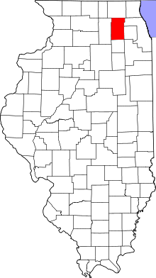 Kane County's location in Illinois | |
| Coordinates: 42°01′34″N 88°25′52″W / 42.02611°N 88.43111°WCoordinates: 42°01′34″N 88°25′52″W / 42.02611°N 88.43111°W | |
| Country |
|
| State |
|
| County | Kane |
| Established | November 6, 1849 |
| Area | |
| • Total | 33.51 sq mi (86.8 km2) |
| • Land | 33.51 sq mi (86.8 km2) |
| • Water | 0 sq mi (0 km2) 0% |
| Elevation | 922 ft (281 m) |
| Population (2010) | |
| • Total | 6,166 |
| • Density | 184/sq mi (71/km2) |
| Time zone | CST (UTC-6) |
| • Summer (DST) | CDT (UTC-5) |
| ZIP codes | 60123, 60140, 60151, 60175 |
| GNIS feature ID | 0429575 |
Plato Township is one of sixteen townships in Kane County, Illinois, USA. As of the 2010 census, its population was 6,166 and it contained 2,182 housing units.[1] It was originally named Homer Township; the name was changed to Plato on July 2, 1850.
Geography
According to the 2010 census, the township has a total area of 33.51 square miles (86.8 km2), all land.[1]
Cities, towns, villages
- Campton Hills (partial)
- Elgin (partial)
- Pingree Grove (partial)
Unincorporated towns
- Bowes at 42°00′29″N 88°23′27″W / 42.0080822°N 88.3909136°W
- Bowes Bend at 42°00′39″N 88°24′53″W / 42.0108598°N 88.4148031°W
- Chippewa at 42°01′17″N 88°24′54″W / 42.0214153°N 88.4150813°W
- Hidden Lakes at 42°01′32″N 88°24′47″W / 42.0255819°N 88.4131369°W
- McQueen at 42°03′43″N 88°23′05″W / 42.0619702°N 88.3848039°W
- North Plato at 42°03′18″N 88°27′51″W / 42.0550257°N 88.4642502°W
- Plato Center at 42°01′36″N 88°25′48″W / 42.0266929°N 88.4300818°W
- Plato Corners at 41°59′13″N 88°24′18″W / 41.9869713°N 88.40508°W
- Silent Meadow at 42°00′42″N 88°25′25″W / 42.0116932°N 88.4236923°W
- Tamara Heights at 42°00′10″N 88°25′52″W / 42.0028044°N 88.4311922°W
(This list is based on USGS data and may include former settlements.)
Airports and landing strips
- Olson Airport
Cemeteries
The township contains these five cemeteries: Plato Center, L R Baker, North Plato, Udina and Washington Memorial.
Major highways
School districts
- Central Community Unit School District 301
- Community Unit School District 300
- School District U-46
- St. Charles Community Unit School District 303
Political districts
- Illinois's 14th congressional district
- State House District 49
- State Senate District 25
References
- "Plato Township, Kane County, Illinois". Geographic Names Information System. United States Geological Survey. Retrieved 2010-06-26.
- United States Census Bureau 2009 TIGER/Line Shapefiles
- United States National Atlas
- 1 2 "Population, Housing Units, Area, and Density: 2010 - County -- County Subdivision and Place -- 2010 Census Summary File 1". United States Census. Retrieved 2013-05-28.
External links
 |
Hampshire Township | Rutland Township | | |
| Burlington Township | |
Elgin Township | ||
| ||||
| | ||||
| Virgil Township | Campton Township | St. Charles Township |
Municipalities and communities of Kane County, Illinois, United States | ||
|---|---|---|
| Cities | ||
| Villages | ||
| Townships |
| |
| CDP | ||
| Other unincorporated communities |
| |
| Footnotes | ‡This populated place also has portions in an adjacent county or counties | |
This article is issued from Wikipedia - version of the 11/6/2016. The text is available under the Creative Commons Attribution/Share Alike but additional terms may apply for the media files.