Sleepy Hollow, Illinois
| Sleepy Hollow | |
| Village | |
| Official name: Village of Sleepy Hollow | |
| Motto: "In The Heart Of The Beautiful Fox Run Valley" | |
| Country | United States |
|---|---|
| State | Illinois |
| County | Kane |
| Township | Dundee |
| Coordinates | 42°5′27″N 88°18′44″W / 42.09083°N 88.31222°WCoordinates: 42°5′27″N 88°18′44″W / 42.09083°N 88.31222°W |
| Area | 2.03 sq mi (5 km2) |
| - land | 2.00 sq mi (5 km2) |
| - water | 0.03 sq mi (0 km2) |
| Population | 3,553 (2000) |
| Density | 1,776.5/sq mi (686/km2) |
| Timezone | CST (UTC-6) |
| - summer (DST) | CDT (UTC-5) |
| Postal code | 60118 |
| Area code | 847 & 224 |
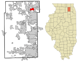 Location in Kane County and the state of Illinois. | |
| Wikimedia Commons: Sleepy Hollow, Illinois | |
| Website: http://www.sleepy-hollow.il.us | |
Sleepy Hollow is a village in Kane County, Illinois, United States 30 miles northwest of Chicago. The population was 3,553 at the 2000 census.
Various streets in the village are named after characters in Washington Irving's The Legend of Sleepy Hollow. Other streets are named after trees. Still other streets, particularly in the subdivision of Saddle Club Estates, are named after horse racing tracks. These street names include Saratoga, Churchill, Arlington and Belmont. Carol Crest is named after a resident on that street. The family was asked what they wanted the name of their street. The husband suggested Carol for his wife, hence Carol Crest.
Geography
Sleepy Hollow is located at 42°5′27″N 88°18′44″W / 42.09083°N 88.31222°W (42.090792, -88.312314).[1]
According to the 2010 census, Sleepy Hollow has a total area of 2.026 square miles (5.25 km2), of which 2 square miles (5.18 km2) (or 98.72%) is land and 0.026 square miles (0.07 km2) (or 1.28%) is water.[2]
Sleepy Hollow is generally bounded by Randall Road to the West, Illinois Route 72 to the North, Illinois Route 31 to the East and Boncosky Road to the South.
Demographics
| Historical population | |||
|---|---|---|---|
| Census | Pop. | %± | |
| 1960 | 311 | — | |
| 1970 | 1,729 | 455.9% | |
| 1980 | 2,000 | 15.7% | |
| 1990 | 3,241 | 62.1% | |
| 2000 | 3,553 | 9.6% | |
| 2010 | 3,304 | −7.0% | |
| Est. 2015 | 3,346 | [3] | 1.3% |
As of the census[5] of 2000, there were 3,553 people, 1,185 households, and 1,026 families residing in the village. The population density was 1,766.3 people per square mile (682.5/km²). There were 1,207 housing units at an average density of 600.1 per square mile (231.9/km²). The racial makeup of the village was 93.33% White, 0.65% African American, 0.06% Native American, 2.17% Asian, 0.03% Pacific Islander, 1.77% from other races, and 2.00% from two or more races. Hispanic or Latino of any race were 3.77% of the population.
There were 1,185 households out of which 45.7% had children under the age of 18 living with them, 78.8% were married couples living together, 5.7% had a female householder with no husband present, and 13.4% were non-families. 10.0% of all households were made up of individuals and 2.3% had someone living alone who was 65 years of age or older. The average household size was 3.00 and the average family size was 3.22.
In the village the population was spread out with 30.5% under the age of 18, 5.5% from 18 to 24, 28.6% from 25 to 44, 28.6% from 45 to 64, and 6.8% who were 65 years of age or older. The median age was 38 years. For every 100 females there were 102.6 males. For every 100 females age 18 and over, there were 99.1 males.
The median income for a household in the village was $91,279, and the median income for a family was $93,629. Males had a median income of $67,379 versus $40,260 for females. The per capita income for the village was $31,005. About 1.5% of families and 1.8% of the population were below the poverty line, including 1.2% of those under age 18 and 4.8% of those age 65 or over.
History
The village is on the site of Sleepy Hollow Farm, which was owned by the late J. H. McNabb, board chairman of Bell and Howell Company. McNabb's heirs sold the farm to Mr. and Mrs. Jack Polivka, who sold it in turn to Floyd T. Falese in 1953. Falese retained the services of a prominent planner and landscape architect, Raymond W. Hazekamp, who laid out a pattern of meandering roads, without curbs or sidewalks, that wound into curvilinear cul-de-sacs, avoiding the destruction of a single tree. This design retained the rural charm and naural contours of the farm and avoided taking down any existing trees.[6]
Falese developed lakes in Sleepy Hollow from existing springs and stocked them with fish. Lake Paula and Lake Sharon were first ones completed with Lake Ichabod dug in 1962. Falese created Lake Legend and Lake Jacqueline in 1967. Those lakes are still a focal point, and the village owns and maintains several of them. Falese was also a horse lover and viewed horse ownership as an element of country living. Early residents of the village could keep horses on their property with outlots used as bridle paths.
The designs were carefully selected to enhance what Falese called "the Sleepy Hollow concept of good living." Unlike other subdivision where the developer was also the exclusive builder of homes, Falese encouraged multiple builders and custom-built homes. However, in the 1960s many of the homes were prefabricated Scholz Design Homes[7] constructed by the Mark 60 Corporation.
Falese marketed lots in the unincorporated subdivision called "Sleepy Hollow Manor." In 1958, the residents voted to incorporate Sleepy Hollow as a separate village rather than being annexed to West Dundee, Illinois. In 1958, the Faleses purchased the Petitti farm, and in 1961 the Winmoor and Whitney farms added to the family holdings.[8] By 1960, Sleepy Hollow's population was 311. By 1970, it grew to 1,729. The only commercial activity was the Sleepy Hollow Resort Motel (later renamed the Chateau Louise) and Crichton's Super Mart.[9] In 1966, the Glen Oak Country Club was opened as a member-supported outdoor pool facility (which was later transferred to the Dundee Township Park District.)[10] Later, the Sleepy Hollow Elementary School was opened adjacent to the pool.
Sleepy Hollow population continues to increase as the remaining lots in Falese's original subdivision are developed and as three other adjacent subdivisions were annexed: Saddle Club Estates, and Surrey Ridge and the Bluffs.[11] Sleepy Hollow's ability to annex additional land to the west and south is limited by an agreement with Elgin, Illinois which also provides for Elgin to supply water to the village.[12] Sleepy Hollow has had its own police force since the 1960s. For years, it was a one-man force: Larry Sabatino Jr., the second Police Chief.[6] The village named a park in his memory.[13] On March 9, 2014, the Sleepy Hollow police force had its first fatal shooting in a domestic disturbance case.[14]
Although it shares its name with Washington Irving's famous short story "The Legend of Sleepy Hollow", Sleepy Hollow, Illinois is not the original town about which Irving wrote. That distinction belongs to the town of Sleepy Hollow, New York, formerly known as North Tarrytown.
Financial Troubles
In recent months, Sleepy Hollow has many financial hardships. All the money in reserves and contingency funds has been used up. Street lights are not being replaced, mowing of parks has stopped, and outside contracting has been limited as much as possible. In March 2016, Sleepy Hollow has been left with three viable options. The first option is being annexed to a neighboring municipality. The second being unification with another town to form a separate entity. The final option being dissolving the government altogether, to become an unincorporated part of Kane County. All of these options would result in the loss of the "Sleepy Hollow Concept of Good Living". [15] To keep Sleepy Hollow afloat, and keep it as its own village, officials are asking for a property tax hike.[15]At the Village Board meeting on March 7, 2016 the motion was passed to allow sheds and certain fences with restrictions.[16] (Sheds and fences have been against village code for numerous years). By allowing sheds and fences, the village will be able to generate revenue through permit costs.
Gardens
As a way to connect with residents, Sleepy Hollow operates a Community Garden which rents garden plots to residents for personal gardening. Also, Sleepy Hollow gives back to the community through the "Giving Garden" The Giving Garden grows produce which is then donated to local food pantries.[17] As part of the rental agreement for the Community Garden, renters must volunteer at the Giving Garden, as they are part of the gardening community. [18]
Notable people
- Cherise Vonae Haugen, model and actress; Miss Teen USA (1984)
- John Platt, computer scientist
External links
References
- ↑ "US Gazetteer files: 2010, 2000, and 1990". United States Census Bureau. 2011-02-12. Retrieved 2011-04-23.
- ↑ "G001 - Geographic Identifiers - 2010 Census Summary File 1". United States Census Bureau. Retrieved 2015-12-25.
- ↑ "Annual Estimates of the Resident Population for Incorporated Places: April 1, 2010 to July 1, 2015". Retrieved July 2, 2016.
- ↑ "Census of Population and Housing". Census.gov. Retrieved June 4, 2015.
- ↑ "American FactFinder". United States Census Bureau. Retrieved 2008-01-31.
- 1 2 "The History of Sleepy Hollow Illinois". Retrieved 2014-07-19.
- ↑ Scholz Design: Luxury floor plans and custom home designs
- ↑ http://www.sleepy-hollow.il.us/compplan/development.html#3a
- ↑ http://www.sleepy-hollow.il.us/quiz/howwell.html#q12
- ↑ DTPD Pools
- ↑ http://sleepy-hollow.il.us/profiles/sh_profile1.html
- ↑ http://www.sleepy-hollow.il.us/compplan/apx_landuse.html
- ↑ https://www.facebook.com/pages/Larry-Sabatino-Jr-Memorial-Park/621836324575143 Retrieved 2014-07-19
- ↑ "Sleepy Hollow police chief says shooting took toll on Department". March 14, 2014. Retrieved 2014-07-19.
- 1 2 "Village president: Sleepy Hollow may cease to exist without tax hike". Daily Herald.
- ↑ [sleepyhollowil.org/?page_id=6369 "Minutes: March 7, 2016"] Check
|url=value (help). Village of Sleepy Hollow. - ↑ sleepyhollowil.org
- ↑ http://www.sleepyhollowil.org/?page_id=5076
Municipalities and communities of Kane County, Illinois, United States | ||
|---|---|---|
| Cities | ||
| Villages | ||
| Townships |
| |
| CDP | ||
| Other unincorporated communities |
| |
| Footnotes | ‡This populated place also has portions in an adjacent county or counties | |