Virgil Township, Kane County, Illinois
| Virgil Township | |
|---|---|
| Township | |
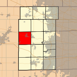 Location in Kane County | |
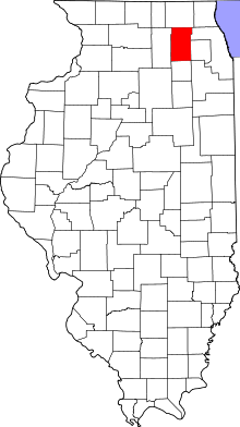 Kane County's location in Illinois | |
| Coordinates: 41°56′09″N 88°32′48″W / 41.93583°N 88.54667°WCoordinates: 41°56′09″N 88°32′48″W / 41.93583°N 88.54667°W | |
| Country |
|
| State |
|
| County | Kane |
| Established | November 6, 1849 |
| Area | |
| • Total | 35.02 sq mi (90.7 km2) |
| • Land | 35.01 sq mi (90.7 km2) |
| • Water | 0.01 sq mi (0.03 km2) 0.03% |
| Elevation | 863 ft (263 m) |
| Population (2010) | |
| • Total | 1,937 |
| • Density | 55.3/sq mi (21.4/km2) |
| Time zone | CST (UTC-6) |
| • Summer (DST) | CDT (UTC-5) |
| ZIP codes | 60119, 60151 |
| GNIS feature ID | 0429876 |
Virgil Township is one of sixteen townships in Kane County, Illinois, USA. As of the 2010 census, its population was 1,937 and it contained 766 housing units.[1] The land is primarily used for agriculture.
Geography
According to the 2010 census, the township has a total area of 35.02 square miles (90.7 km2), of which 35.01 square miles (90.7 km2) (or 99.97%) is land and 0.01 square miles (0.026 km2) (or 0.03%) is water.[1]
Cities, towns, villages
- Maple Park (all but western edge)
- Virgil
Extinct settlements
- Meredith at 41°53′58″N 88°32′25″W / 41.8994723°N 88.5403588°W
- Richardson at 41°57′59″N 88°35′08″W / 41.9664165°N 88.5856395°W
Cemeteries
The township contains these two cemeteries: Saints Peter and Paul's Catholic Cemetery and Thatcher Cemetery.
Airports and landing strips
- Aeroview Airport
- Miller/Maple Park Farm Airport
School districts
- Central Community Unit School District 301
- Kaneland Community Unit School District 302
- Sycamore Community Unit School District 427
Political districts
- Illinois's 14th congressional district
- State House District 50
- State Senate District 25
References
- "Virgil Township, Kane County, Illinois". Geographic Names Information System. United States Geological Survey. Retrieved 2010-06-26.
- United States Census Bureau 2009 TIGER/Line Shapefiles
- United States National Atlas
- 1 2 "Population, Housing Units, Area, and Density: 2010 - County -- County Subdivision and Place -- 2010 Census Summary File 1". United States Census. Retrieved 2013-05-28.
External links

Municipalities and communities of Kane County, Illinois, United States | ||
|---|---|---|
| Cities | ||
| Villages | ||
| Townships |
| |
| CDP | ||
| Other unincorporated communities |
| |
| Footnotes | ‡This populated place also has portions in an adjacent county or counties | |
This article is issued from Wikipedia - version of the 11/29/2013. The text is available under the Creative Commons Attribution/Share Alike but additional terms may apply for the media files.