Phu Chi Fa
| Phu Chi Fa | |
|---|---|
| ภูชี้ฟ้า | |
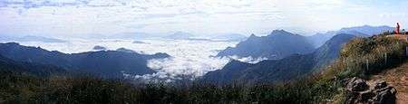 The "sea of mist" seen from Phu Chi Fa | |
| Highest point | |
| Elevation | 1,442 m (4,731 ft) |
| Listing | List of mountains in Thailand |
| Coordinates | 19°51′0″N 100°27′15″E / 19.85000°N 100.45417°ECoordinates: 19°51′0″N 100°27′15″E / 19.85000°N 100.45417°E |
| Geography | |
 Phu Chi Fa | |
| Parent range | Phi Pan Nam Range |
| Climbing | |
| First ascent | unknown |
| Easiest route | drive |
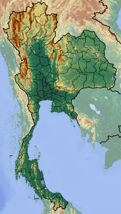
Phu Chi Fa (Thai: ภูชี้ฟ้า), also Phu Chee Fah, is a mountain area and national forest park in Thailand. It is located at the northeastern end of the Phi Pan Nam Range, 12 km to the southwest of Doi Pha Tang at the eastern edge of Thoeng District, Chiang Rai Province.
The famous cliff is part of an elevated area, the Doi Pha Mon sub-range, that rises near the border with Laos sloping towards the Mekong River. The highest point of the ridge is 1628 m high Doi Pha Mon.
With spectacular views over the surrounding mountains, it is one of the famous tourist attractions of the Thai highlands near Chiang Rai. Tourists visit the mountain especially at dawn in order to catch a glimpse of the "sea of mist", the view of the fog-surrounded hills, with heights ranging between 1,200–1,600 m to the east of the mountain.[1]
The weather on Phu Chi Fa is cool, averaging around 20° C. It has three seasons: hot, rainy, and cool, influenced by the tropical monsoon.[2]
Fauna
Phu Chi Fa is home to many animals. Mammals include barking deer, wild boar, palm civets. Birds include canaries, pheasants, and magpies.
See also
References
- ↑ "Phu Chi Fa". Thailand Sights and Attractions. Thailand Tourist Authority. Retrieved 2014-12-06.
- ↑ "Climate". Phu Chi Fa Forest Park. Thailand Dept of National Parks. Retrieved 2014-12-06.
External links
| Wikimedia Commons has media related to Phu Chi Fa. |
 Phu Chi Fa travel guide from Wikivoyage
- Phu Chi Fa, Thailand Tourism Authority
- Phu Chi Fa, Thailand Department of National Parks