Peri, Corse-du-Sud
| Peri | |
|---|---|
|
A view of the village of Peri, in spring, from the bottom of the valley of Santa Libarata | |
 Peri | |
|
Location within Corsica region 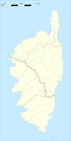 Peri | |
| Coordinates: 42°00′18″N 8°55′17″E / 42.005°N 8.9214°ECoordinates: 42°00′18″N 8°55′17″E / 42.005°N 8.9214°E | |
| Country | France |
| Region | Corsica |
| Department | Corse-du-Sud |
| Arrondissement | Ajaccio |
| Canton | Celavo-Mezzano |
| Intercommunality | Pays Ajaccien |
| Government | |
| • Mayor (2008–2014) | Xavier Lacombe |
| Area1 | 23.65 km2 (9.13 sq mi) |
| Population (2008)2 | 1,635 |
| • Density | 69/km2 (180/sq mi) |
| Time zone | CET (UTC+1) |
| • Summer (DST) | CEST (UTC+2) |
| INSEE/Postal code | 2A209 / 20167 |
| Elevation |
38–1,507 m (125–4,944 ft) (avg. 460 m or 1,510 ft) |
|
1 French Land Register data, which excludes lakes, ponds, glaciers > 1 km² (0.386 sq mi or 247 acres) and river estuaries. 2 Population without double counting: residents of multiple communes (e.g., students and military personnel) only counted once. | |

Peri is a commune in the Corse-du-Sud department of France on the island of Corsica.
Population
| Historical population | ||
|---|---|---|
| Year | Pop. | ±% |
| 1855 | 482 | — |
| 1900 | 717 | +48.8% |
| 1962 | 487 | −32.1% |
| 1968 | 493 | +1.2% |
| 1975 | 507 | +2.8% |
| 1982 | 626 | +23.5% |
| 1990 | 924 | +47.6% |
| 1999 | 1,140 | +23.4% |
| 2008 | 1,635 | +43.4% |
Attractions

Restaurant Chez Seraphin, Peri, Corsica, France
The restaurant Chez Seraphin, placed on a terrace overlooking the Corsican mountains, serves fixed lunch and dinner menus (fixed seven course dinner -cash only!).
See also
References
| Wikimedia Commons has media related to Peri (Corse-du-Sud). |
This article is issued from Wikipedia - version of the 1/28/2015. The text is available under the Creative Commons Attribution/Share Alike but additional terms may apply for the media files.