Bastelica
| Bastelica | |
|---|---|
|
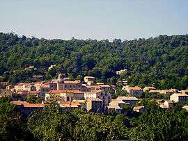
A general view of Bastelica | |
 Bastelica | |
|
Location within Corsica region 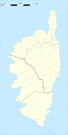 Bastelica | |
| Coordinates: 42°00′10″N 9°03′05″E / 42.0028°N 9.0514°ECoordinates: 42°00′10″N 9°03′05″E / 42.0028°N 9.0514°E | |
| Country | France |
| Region | Corsica |
| Department | Corse-du-Sud |
| Arrondissement | Ajaccio |
| Canton | Bastelica |
| Intercommunality | Vallée du Prunelli |
| Government | |
| • Mayor (2001–2020) | Jean-Baptiste Giffon |
| Area1 | 127.69 km2 (49.30 sq mi) |
| Population (2010)2 | 543 |
| • Density | 4.3/km2 (11/sq mi) |
| Time zone | CET (UTC+1) |
| • Summer (DST) | CEST (UTC+2) |
| INSEE/Postal code | 2A031 / 20119 |
| Elevation |
306–2,347 m (1,004–7,700 ft) (avg. 808 m or 2,651 ft) |
|
1 French Land Register data, which excludes lakes, ponds, glaciers > 1 km² (0.386 sq mi or 247 acres) and river estuaries. 2 Population without double counting: residents of multiple communes (e.g., students and military personnel) only counted once. | |
Bastelica is a French commune in the Corse-du-Sud department of France on the island of Corsica.[1]
It was the birthplace of Sampiero Corso.
The inhabitants of the commune are known as Bastelicais, Bastelicaises, or Bastilcacci.[2]
Geography
Bastelica is located in the interior of the island in the high valley of the Prunelli south-west of the Massif of Monte Renoso of which it shares the summit (2352 m) with Bocognano and Ghisoni. It is also part of the Regional Natural Park of Corsica. It is some 18 km east of Ajaccio (in a straight line). It has many pastures planted with chestnut trees.
Access to the commune is by the D27 from Cauro in the south-west which passes through the length of the commune and the village before continuing north to Bocognano. The D27A goes east from the village to the mountain heights but has no exit. The D3 branches from the D27 south of the village and goes south-west to join the Route nationale N196 near Ajaccio. Apart from the village there are the hamlets of Vignola and Radicale to the south. The commune is rugged and mountainous.[3][4]
Bastelica has no less than 16 adjacent communes and is one of the six communes in the Community of communes of the Valley of the Prunelli. It was once the chief town of the Canton but is now a part of the Canton of Gravona-Prunelli which has its seat in Afa.
The intersection of the 42nd parallel North and the 9th meridian East of Greenwich is in the commune (see the Degree Confluence Project).
Mapping
A list of online mapping systems can be displayed by clicking on the coordinates (latitude and longitude) in the top right hand corner of this article.
Neighbouring communes and villages
 |
Ucciani | Tavera | Ghisoni | |
| Tolla | |
Palneca | ||
| ||||
| | ||||
| Cauro | Quasquara | Tasso |
Administration

| From | To | Name | Party | Position |
|---|---|---|---|---|
| 1879 | Alexandre Bolelli | |||
| 2001 | 2020 | Jean-Baptiste Giffon | DVD |
(Not all data is known)
Demography
In 2010 the commune had 543 inhabitants. The evolution of the number of inhabitants is known from the population censuses conducted in the commune since 1793. From the 21st century, a census of communes with fewer than 10,000 inhabitants is held every five years, unlike larger communes that have a sample survey every year.[Note 1]
| 1793 | 1800 | 1806 | 1821 | 1831 | 1836 | 1841 | 1846 | 1851 |
|---|---|---|---|---|---|---|---|---|
| - | 1,790 | 1,798 | 2,017 | 2,314 | 2,375 | 2,420 | 2,528 | 2,605 |
| 1856 | 1861 | 1866 | 1872 | 1876 | 1881 | 1886 | 1891 | 1896 |
|---|---|---|---|---|---|---|---|---|
| 3,003 | 3,071 | 2,842 | 2,934 | 2,958 | 3,196 | 3,277 | 3,367 | 3,341 |
| 1901 | 1906 | 1911 | 1921 | 1926 | 1931 | 1936 | 1946 | 1954 |
|---|---|---|---|---|---|---|---|---|
| 3,582 | 3,689 | 3,938 | 3,661 | 3,925 | 4,125 | 4,152 | 3,367 | 2,172 |
| 1962 | 1968 | 1975 | 1982 | 1990 | 1999 | 2006 | 2010 | - |
|---|---|---|---|---|---|---|---|---|
| 833 | 774 | 762 | 766 | 436 | 460 | 543 | - |
Sources : Ldh/EHESS/Cassini until 1962, INSEE database from 1968 (population without double counting and municipal population from 2006)


Education
The commune has a public primary school.[6]
Sports
The Val d'Ese ski resort is located in the commune.
Culture and heritage


.JPG)
Civil heritage
- The War Memorial at Dominicacci
- Many Fountains and Lavoirs
- Boccialacce Fountain;
- Fountain-Lavoir of Piscia D'Urtolu at Stazzona;
- Fountain of Dominicacci;
- Fountain of Verga;
- Funtana Maio Fountain at Vassalacci;
- a Fountain-Lavoir called Fountain de Costa or Fountain de Tricolacci.
The commune has two sites that are registered as historical monuments:
- A Monument to Sampiero Corso (1890)
 [7] The work of the sculptor Vital Gabriel Dubray, this bronze statue is 3.50m high and stands at a crossroads in the village centre between the parish church, the school (formerly the Saint Francis Convent), and the town hall.
 - The Genovese Bridge at Zippitoli (15th century)[8] In the 16th century the bridge provided a connection from Bastelica to Ajaccio. With a single arch, it is a humpbacked bridge like most of that time. It was abandoned during the construction of the "forest road No. 1 from Cauro to Bastelica" which is today the D27 road.
Religious heritage


- Chapel of the Annunciation (the Anunciata) at Dominicacci opposite the War Memorial.
- Chapel Notre-Dame-du-Mont-Carmel called a Ghjisgiola at Vassalacci.
- Chapel Sainte-Bernadette at Radicale.
- Chapel Sant'Austinu di Basterga at Sant'Agostino.
- The Parish Church of Saint Michel is in the Santo (Santu) district at the centre of the village. In Baroque style and built in the 17th century, it is built in the form of a Latin cross. The central nave is lined with square pillars and flanked by two aisles (or lateral naves) and is extended by a choir where there is the main Altar. There are two side chapels with side altars dedicated to Saint Michel and Saint Anthony of Padua. The bell tower porch is four storeys high with a symmetrical façade on the first two floors, topped by a triangular pediment, and crowned with a cupola. The Church contains several items that are registered as historical objects:
- A Stations of the Cross (14 stations) (1905)
 [9]
[9] - A Statue: Virgin and child (19th century)[10]
- A Painting: The Calvary (17th century)[11]
- A Stoup (17th century)[12]
- An Altar and Tabernacle (17th century)[13]
- A Statue: Saint Anthony of Padua (17th century)[14]
Environmental heritage
Bastelica is part of the Regional Natural Park of Corsica in the "Land of Life" called Gravona.[15]
The commune has eight 2nd generation ZNIEFF areas:
- The Pineta-Quarceta Forest and the Punta di Forca d'Olmu mountains, an area between 522 and 1679 metres above sea level covering 3007 hectares.[16]
- The Forest of five communes and Col d'Arusula, an area of 2529 hectares of forest area lying north of the Col d'Arusula (1206m) covering over Frasseto and Guitera-les-Bains with an altitude between 789 and 1569m. The vegetation consists of green oak forests of Mediterranean type with beech and pine forests in the mountains.[17]
- The Beech forests of Bastelica, an area of 946 hectares of forest ranging between 900 and 1750m altitude.[18]
- The Chestnut-Beech Forests of Bastelica, an area wholly in Bastelica covering 1492 hectares of forest ranging between 700 and 1210m altitude.[19]
- The Cirques and glacial lakes of Monte Renoso, an area of 1762 hectares covering three communes. It is centred on Monte Renoso and lies between 1600 and 2352m altitude.[20]
- The Peaks and upper unforested slopes of Monte Renoso, an area covering eight communes lying between 950 and 2352 metres above sea level and covering 5111 hectares. It is an area traditionally used by shepherds for summer pastures and there are many sheep there in summer. The Ghisoni ski resort is on the eastern slope of Renoso and the Ese ski resort is above Bastelica.[21]
- The Pine Forests in the upper ravine of Marmano, an area of 217 hectares located west of the Col de Verde and including the upper Marmano valley.[22]
- The Beech-Pine forests of Punteniello, an area of 523 hectares of forest stretching between 1200 and 1800 m altitude.[23]
- Natura 2000 sites
- Sites of Community Importance (Dir. Habitat)
- The Massif de Renoso, an area of 6107 hectares.[24]
- Special Protection Area (Dir. Birds)
- The Territorial Forests of Corsica, an area covering 13,223 hectares between 200 and 2057 metres altitude. There are three species of protected birds: the Northern goshawk ((Corsica ssp.) Accipiter gentilis arrigonii (Kleinschmidt, 1903)), the golden eagle (Aquila chrysaetos (Linnaeus, 1758)), and the Corsican nuthatch (Sitta whiteheadi Sharpe, 1884) in the high pine forests.[25]
Notable people linked to the commune
- Sampiero Corso, born in the commune on 23 mai 1498, failed to take the island from the Genovese. Died in an ambush on 5 January 1567 near the village of Eccica in a place that took the name of "Senza Populi" or "Tamanti Populi". His first name could come from Santu pieru (Saint Peter's day).
- Alphonse d'Ornano, son of Sampiero Corso, born in Bastelica in 1548, Marshal of France during the French Wars of religion, he died at Bordeaux in 1610.
See also
Notes and references
Notes
- ↑ At the beginning of the 21st century, the methods of identification have been modified by Law No. 2002-276 of 27 February 2002, the so-called "law of local democracy" and in particular Title V "census operations" allows, after a transitional period running from 2004 to 2008, the annual publication of the legal population of the different French administrative districts. For communes with a population greater than 10,000 inhabitants, a sample survey is conducted annually and the entire territory of these communes is taken into account at the end of the period of five years. The first "legal population" after 1999 under this new law came into force on 1 January 2009 and was based on the census of 2006.
References
- ↑ Bastelica on Lion1906
- ↑ Inhabitants of Corse-du-Sud (French)
- 1 2 Bastelica on Google Maps
- ↑ Bastelica on the Géoportail from National Geographic Institute (IGN) website (French)
- ↑ List of Mayors of France (French)
- ↑ Schools in Bastelica (French)
- ↑ Ministry of Culture, Mérimée PA2A000002 Monument to Sampiero Corso (French)
- ↑ Ministry of Culture, Mérimée PA00099075 Genovese Bridge (French)
- ↑ Ministry of Culture, Palissy PM2A000463 Stations of the Cross (14 stations) (French)
- ↑ Ministry of Culture, Palissy PM2A000462 Statue: Virgin and child (French)
- ↑ Ministry of Culture, Palissy PM2A000461 Painting: The Calvary (French)
- ↑ Ministry of Culture, Palissy PM2A000460 Stoup (French)
- ↑ Ministry of Culture, Palissy PM2A000241 Altar and Tabernacle (French)
- ↑ Ministry of Culture, Palissy PM2A000061 Statue: Saint Antony of Padua (French)
- ↑ The Parc naturel régional de Corse on the INPN website (French)
- ↑ ZNIEFF 940004164 Forêt de Pineta-Quarceta et Massif Montagneux de Punta di Forca D'Olmu INPN website (French)
- ↑ ZNIEFF 940004165 Forêt des Cinq Communes et Col D'Arusula INPN website (French)
- ↑ ZNIEFF 940004165 Hetraie de Bastelica INPN website (French)
- ↑ ZNIEFF 940004167 Chataigneraie-Chenaie de Bastelica INPN website (French)
- ↑ ZNIEFF 940004167 Cirques et Lacs Glaciaires du Monte Renoso INPN website (French)
- ↑ ZNIEFF 940004167 Cretes et Hauts Versants asylvatiques du Monte Renoso INPN website (French)
- ↑ ZNIEFF 940004167 Sapinière du Haut Ravin de Marmano INPN website (French)
- ↑ ZNIEFF 940004167 Hetraie-Sapinière de Punteniello INPN website (French)
- ↑ FR9400611 Massif du Renoso INPN website (French)
- ↑ FR9410113 Forêts Territoriales de Corse INPN website (French)
| Wikimedia Commons has media related to Bastelica. |