Panabo
| Panabo | ||
|---|---|---|
| Component City | ||
| City of Panabo | ||
|
Urban core of Panabo | ||
| ||
|
Nickname(s): "Banana Capital of the Philippines" | ||
 Map of Davao del Norte with Panabo highlighted | ||
.svg.png) Panabo Location within the Philippines | ||
| Coordinates: 07°18′30″N 125°41′00″E / 7.30833°N 125.68333°ECoordinates: 07°18′30″N 125°41′00″E / 7.30833°N 125.68333°E | ||
| Country | Philippines | |
| Region | Davao Region (Region XI) | |
| Province | Davao del Norte | |
| District | 2nd District of Davao del Norte | |
| Founded | July 19, 1949 | |
| Cityhood | March 31, 2001 | |
| Barangays | 40 | |
| Government[1] | ||
| • Mayor | James G. Gamao (KG) | |
| • Vice Mayor | Janrey G. Gavina (KG) | |
| Area[2] | ||
| • Total | 251.23 km2 (97.00 sq mi) | |
| Population (2015)[3] | ||
| • Total | 184,599 | |
| • Density | 730/km2 (1,900/sq mi) | |
| Time zone | PHT (UTC+8) | |
| ZIP code | 8105 | |
| Dialing code | +63 (0)84 | |
| Income class | 3rd class city | |
| Website |
www | |


Panabo is a third-class component city (Filipino: Lungsod ng Panabo, Cebuano: Dakbayan sa Panabo) in the province of Davao del Norte, Philippines, bordering Davao City to its northeast. The city has an area of 25,123 hectares (62,080 acres).[2] According to the 2015 census, it has a population of 184,599.[4]
Panabo is a part of Davao Metropolitan Area.
Government
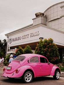
The Panabo City Hall is located about 2.23 kilometers from its boundary with Davao City.
Barangays
The city is politically subdivided into 40 barangays.[2] Quezon was formerly the sitio of Cabili; it became a barrio in 1957.[5]
- A. O. Floirendo
- Datu Abdul Dadia
- Buenavista
- Cacao
- Cagangohan
- Consolacion
- Dapco
- Gredu (Pob.)
- J.P. Laurel
- Kasilak
- Katipunan
- Katualan
- Kauswagan
- Kiotoy
- Little Panay
- Lower Panaga (Roxas)
- Mabunao
- Maduao
- Malativas
- Manay
- Nanyo
- New Malaga (Dalisay)
- New Malitbog
- New Pandan (Pob.
- New Visayas
- Quezon
- Salvacion
- San Francisco (Pob.)
- San Nicolas
- San Pedro
- San Roque
- San Vicente
- Santa Cruz
- Santo Niño (Pob.)
- Sindaton
- Southern Davao
- Tagpore
- Tibungol
- Upper Licanan
- Waterfall
History
Originally the rich lowland was inhabited by a group of stocky-haired natives called Aetas. These people led nomadic life and lived by hunting. With the use of their most essential tool, the bow and arrow—"pana-sa-boboy" as they call it—they hunted for food which primarily consisted of rootcrops and meat of wild boars.[6]
When the Christian settlers came at the beginning of the 20th century, the place was already a thriving trading community; thus, the place was already known as Taboan, which means "trading center". After the Cristian settlers began pioneering the region, the natives moved further to the hinterlands along with them their "pana-sa-boboy". This term later evolved into present day name Panabo.[6]
Legal Basis
Panabo, which was formerly a mere barangay of Tagum, then known as Magugpo during that time, became a town July 19, 1949, through Presidential Proclamation No. 236 of the President Manuel A. Roxas.
The local government unit of Panabo was created into a component city of Davao del Norte by virtue of Republic Act No. 9015 and ratified by the residents in a plebiscite held on March 31, 2001. However, its official existence as a municipal corporation took effect on with the appointment of new set of officials.
Demographics
| Population census of Panabo | ||
|---|---|---|
| Year | Pop. | ±% p.a. |
| 1990 | 110,172 | — |
| 1995 | 121,472 | +1.85% |
| 2000 | 133,950 | +2.12% |
| 2007 | 154,329 | +1.97% |
| 2010 | 174,364 | +4.54% |
| 2015 | 184,599 | +1.09% |
| Source: Philippine Statistics Authority[7] | ||
Economy

Being an agro-industrial city, Panabo is known as the "Banana Capital of the Philippines" due to numerous banana plantations scattered throughout the city. In fact, Panabo is the home of the world’s biggest banana plantation, which is owned by the Tagum Agricultural Development Company (TADECO), which covers around 6,900 hectares of banana fields and produce millions of boxes of export-quality bananas annually. The city itself cultivated 40% of its land or around 10,000 hectares into planting export-quality Cavendish bananas. Thus, banana cultivation and exportation are the main economic lifeblood of the city.
Infrastructure
There are also two privately owned port facilities in the city, which enabled them to export various fruits, such as bananas, mangoes, papayas, and pineapples, to countries like Japan, Korea, China, and countries as far in the Middle East and the European Union.
Public infrastructure includes the Freedom Park which features a unique banana inspired fountain sculpted by the world class artist Kublai Millan. The Panabo Multi-Purpose Cooperative Tourism Gymnasium, located beside the City Hall is also a public infrastructure, the gymnasium accommodates an estimated ten-thousand people and also serves as playing venue of the Philippine Basketball Association as well as serving concerts for the city.
Education
Universities:
- North Davao Colleges (private)
- University of Mindanao, Panabo Campus (private)
- Davao del Norte State College (public)
Colleges:
- ACES Polytechnic College
- Northlink Technological College, Inc.
- Valiant Technological College
- Northern Paramedical Technological College
High-schools:
- Davao del Norte State College Laboratory School (private)
- North Davao Colleges - High School Department (private)
- Maryknoll College of Panabo (private)
- Francisco Adlaon Learning Institute (private)
- Panabo SDA Learning Center (private)
- Panabo Christian School (private)
- Panabo Achievers Academy (2nd year only) (private)
- Panabo National High School (public)
- Colegio de Davao, Panabo City (Private)
- Good Shepherd Baptist School (Church School)
Sister Cities
- Within the Philippines
References
- ↑ "Official City/Municipal 2013 Election Results". Intramuros, Manila, Philippines: Commission on Elections (COMELEC). 11 September 2013. Retrieved 30 April 2014.
- 1 2 3 "Province: Davao del Norte". PSGC Interactive. Makati City, Philippines: National Statistical Coordination Board. Retrieved 29 April 2014.
- ↑ Census of Population (2015): Total Population by Province, City, Municipality and Barangay (Report). PSA. Retrieved 20 June 2016.
- ↑ Census of Population (2015): Total Population by Province, City, Municipality and Barangay (Report). PSA. Retrieved 20 June 2016.
- ↑ "An Act Converting the Sitio of Cabili, Municipality of Panabo, Province of Davao, into a Barrio of Said Municipality to Be Known As the Barrio of Quezon". LawPH.com. Retrieved 2011-04-12.
- 1 2 "City Profile". Local Government of Panabo City. Retrieved 30 April 2014.
- ↑ Census of Population (2015): Total Population by Province, City, Municipality and Barangay (Report). PSA. Retrieved 20 June 2016.
External links
| Wikimedia Commons has media related to Panabo City. |
- Panabo City official website
- Philippine Standard Geographic Code
- Philippine Census Information
- Local Governance Performance Management System
- Davao Travel and Tourism Guide
- http://www.tagumcoop.org/index.php/contactus/panabo-branch
 |
Braulio E. Dujali / Carmen | | ||
| Davao City | |
Davao Gulf | ||
| ||||
| | ||||
| Davao City | Davao Gulf Samal |
