Manay, Davao Oriental
| Manay | ||
|---|---|---|
| Municipality | ||
| ||
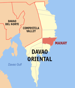 Map of Davao Oriental with Manay highlighted | ||
.svg.png) Manay Location within the Philippines | ||
| Coordinates: 07°13′N 126°32′E / 7.217°N 126.533°ECoordinates: 07°13′N 126°32′E / 7.217°N 126.533°E | ||
| Country | Philippines | |
| Region | Davao Region (Region XI) | |
| Province | Davao Oriental | |
| District | 1st district of Davao Oriental | |
| Barangays | 17 | |
| Government[1] | ||
| • Mayor | Jon Marco Dayanghirang | |
| Area[2] | ||
| • Total | 418.36 km2 (161.53 sq mi) | |
| Population (2010)[3] | ||
| • Total | 40,577 | |
| • Density | 97/km2 (250/sq mi) | |
| Time zone | PST (UTC+8) | |
| ZIP code | 8202 | |
| Dialing code | +63 (0)87 | |
| Income class | 2nd | |
| Website |
manay | |

Manay (also Man-ay) is a second class municipality in the province of Davao Oriental, Philippines. According to the 2010 census, it has a population of 40,577 people.[3]
Barangays
Manay is politically subdivided into 17 barangays.[2]
- Capasnan
- Cayawan
- Central (Pob.)
- Concepcion
- Del Pilar
- Guza
- Holy Cross
- Mabini
- Manreza
- Old Macopa
- Rizal
- San Fermin
- San Ignacio
- San Isidro
- Taocanga
- Zaragosa
- Lambog
Demographics
| Population census of Manay | ||
|---|---|---|
| Year | Pop. | ±% p.a. |
| 1990 | 33,686 | — |
| 1995 | 35,428 | +0.95% |
| 2000 | 36,697 | +0.76% |
| 2007 | 38,067 | +0.51% |
| 2010 | 40,577 | +2.35% |
| Source: National Statistics Office[3] | ||
References
- ↑ "Official City/Municipal 2013 Election Results". Intramuros, Manila, Philippines: Commission on Elections (COMELEC). 1 July 2013. Retrieved 5 September 2013.
- 1 2 "Province: DAVAO ORIENTAL". PSGC Interactive. Makati City, Philippines: National Statistical Coordination Board. Retrieved 16 April 2014.
- 1 2 3 "Total Population by Province, City, Municipality and Barangay: as of May 1, 2010" (PDF). 2010 Census of Population and Housing. National Statistics Office. Retrieved 16 April 2014.
External links
- Philippine Standard Geographic Code
- Philippine Census Information
- Local Governance Performance Management System
 |
Caraga | | ||
| Banaybanay | |
Philippine Sea | ||
| ||||
| | ||||
| Lupon | Tarragona |
Mati (capital) | |
| Municipalities | |
| Component cities | |
This article is issued from Wikipedia - version of the 12/1/2016. The text is available under the Creative Commons Attribution/Share Alike but additional terms may apply for the media files.