Oakland, Florida
- For other places with the same name, see Oakland (disambiguation).
| Oakland, Florida | |
|---|---|
| Town | |
 Location in Orange County and the state of Florida | |
| Coordinates: 28°33′16″N 81°37′52″W / 28.55444°N 81.63111°WCoordinates: 28°33′16″N 81°37′52″W / 28.55444°N 81.63111°W | |
| Country |
|
| State |
|
| County | Orange |
| Area | |
| • Total | 2.10 sq mi (5.45 km2) |
| • Land | 2.10 sq mi (5.44 km2) |
| • Water | 0.008 sq mi (.02 km2) |
| Elevation | 121 ft (37 m) |
| Population (2010) | |
| • Total | 2,538 |
| • Density | 1,200/sq mi (470/km2) |
| Time zone | Eastern (EST) (UTC-5) |
| • Summer (DST) | EDT (UTC-4) |
| ZIP codes | 34760, 34787 |
| Area code(s) | 407 |
| FIPS code | 12-50525[1] |
| GNIS feature ID | 0288004[2] |
| Website |
www |
Oakland is a town in Orange County, Florida, United States. The population was 2,538 at the 2010 Census,[3] representing a growth of 171% over the population of 936 recorded during the 2000 census. It is part of the Orlando–Kissimmee Metropolitan Statistical Area.
Geography
Oakland is located at 28°33′16″N 81°37′52″W / 28.554528°N 81.631045°W.[4]
According to the United States Census Bureau, the town has a total area of 2.10 square miles (5.45 km2), of which 2.10 square miles (5.44 km2) is land and 0.0077 square miles (0.02 km2), or 0.34%, is water.[5]
History
In 1950 Oakland had a population of 545.[6]
Demographics
| Historical population | |||
|---|---|---|---|
| Census | Pop. | %± | |
| 1910 | 211 | — | |
| 1920 | 323 | 53.1% | |
| 1930 | 379 | 17.3% | |
| 1940 | 518 | 36.7% | |
| 1950 | 548 | 5.8% | |
| 1960 | 821 | 49.8% | |
| 1970 | 672 | −18.1% | |
| 1980 | 658 | −2.1% | |
| 1990 | 700 | 6.4% | |
| 2000 | 936 | 33.7% | |
| 2010 | 2,538 | 171.2% | |
| Est. 2015 | 2,829 | [7] | 11.5% |
As of the 2010 census, there were 2,538 people, 846 households, and 685 families residing in the city. The population density was 1,209.15 person per square mile (466.54/km²). There were 931 housing units. The racial makeup of the city was 67.84% White, 20.45% African American, 0.6% Native American, 4.8% Asian, 2.87% from other races, and 3.03% from two or more races. Hispanic or Latino of any race were 10.01% of the population. Compared to the 2000 Census, the town experienced over a 10% decrease in the proportion of African Americans (which was nearly a third of the population in 2000), while the Asian population more than quadruped as a proportion of the population, and the Hispanic population tripled as a share of population.
There were 846 households out of which 40.3% had children under the age of 18 living with them, 64.9% were married couples living together, 11.7% had a female householder with no husband present, and 19.0% were non-families. 14.2% of all households were made up of individuals and 3.2% had someone living alone who was 65 years of age or older. The average household size was 2.99 and the average family size was 3.32. Compared to the 2000 Census, Oakland has become more family dominant, with a decrease in both its share of senior citizen population and non-family households.
In the town the population was spread out with 29.3% under the age of 19, 5.5% from 20 to 24, 25.7% from 25 to 44, 30% from 45 to 64, and 9.3% who were 65 years of age or older. The median age was 39 years. For every 100 females there were 93.1 males. For every 100 females age 18 and over, there were 90.5 males.
The median income for a household in the city was $100,927, and the median income for a family was $102,396. Males had a median income of $65,781 versus $54,444 for females. The per capita income for the city was $39,802. About 6.1% of families and 6.9% of the population were below the poverty line, including 5.5% of those under age 18. Oakland has seen an explosion of wealth compared to the American Community Survey numbers last released with the 2000 Census. Comparatively, the median income for households and families has more than doubled while the per capita income increased by nearly 75%. Meanwhile, poverty as a whole has stayed statistically the same.
References
- ↑ "American FactFinder". United States Census Bureau. Retrieved 2008-01-31.
- ↑ "US Board on Geographic Names". United States Geological Survey. 2007-10-25. Retrieved 2008-01-31.
- ↑ "Profile of General Population and Housing Characteristics: 2010 Demographic Profile Data (DP-1): Oakland town, Florida". U.S. Census Bureau, American Factfinder. Archived from the original on September 11, 2013. Retrieved September 21, 2012.
- ↑ "US Gazetteer files: 2010, 2000, and 1990". United States Census Bureau. 2011-02-12. Retrieved 2011-04-23.
- ↑ "Geographic Identifiers: 2010 Demographic Profile Data (G001): Oakland town, Florida". U.S. Census Bureau, American Factfinder. Archived from the original on September 11, 2013. Retrieved September 21, 2012.
- ↑ Columbia-Lippincott Gazeteer, p. 1359
- ↑ "Annual Estimates of the Resident Population for Incorporated Places: April 1, 2010 to July 1, 2015". Retrieved July 2, 2016.
- ↑ "Census of Population and Housing". Census.gov. Archived from the original on May 11, 2015. Retrieved June 4, 2015.
External links
- Town of Oakland official website
- U.S. Geological Survey Geographic Names Information System: Oakland, Florida
Municipalities and communities of Orange County, Florida, United States | ||
|---|---|---|
| Cities | 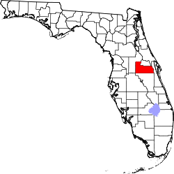 | |
| Towns | ||
| CDPs |
| |
| Unincorporated communities | ||
| Footnotes | ‡This populated place also has portions in an adjacent county or counties | |