Levy County, Florida
| Levy County, Florida | |
|---|---|
 Levy County Courthouse | |
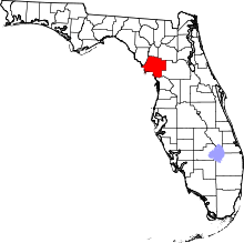 Location in the U.S. state of Florida | |
 Florida's location in the U.S. | |
| Founded | March 10, 1845 |
| Named for | David Levy Yulee |
| Seat | Bronson |
| Largest city | Williston |
| Area | |
| • Total | 1,413 sq mi (3,660 km2) |
| • Land | 1,118 sq mi (2,896 km2) |
| • Water | 295 sq mi (764 km2), 20.9% |
| Population (est.) | |
| • (2015) | 39,832 |
| • Density | 36/sq mi (14/km²) |
| Congressional district | 3rd |
| Time zone | Eastern: UTC-5/-4 |
| Website |
www |

Levy County is a county located in the U.S. state of Florida. As of the 2010 census, the population was 40,801.[1] Its county seat is Bronson.[2]
History
Levy County was created in 1845, after the Seminole Wars. It was named for David Levy, a planter elected in 1841 as the state's territorial delegate to the US House of Representatives, where he served two terms.[3] When Florida was admitted as a state, Levy was elected by the new state legislature as one of Florida's first two U.S. senators; he served from 1845 to 1851, and again from 1855 to 1861. He was the first Jewish American elected to the United States Senate.
Levy provided for long-term development in the state by constructing the first railroad across Florida, the Florida Railroad, linking the deep-water ports of Fernandina (Port of Fernandina) on the Atlantic Ocean and Cedar Key on the Gulf of Mexico. He developed a network of feeder railroads through central Florida as well. For his efforts, he was called "the father of Florida railroads."
The Rosewood Massacre occurred in Levy County in the first week of January 1923. It was a race riot in which whites from the nearby town of Sumner, reacting to the alleged rape of a white woman by a black man, burned the predominantly black town of Rosewood to the ground and killed several blacks. A film based on the incident was made in 1997, but was not filmed in Levy County.
Geography
According to the U.S. Census Bureau, the county has a total area of 1,413 square miles (3,660 km2), of which 1,118 square miles (2,900 km2) is land and 295 square miles (760 km2) (20.9%) is water.[4]
Adjacent counties
- Dixie County — west
- Gilchrist County — north
- Alachua County — northeast
- Marion County — east
- Citrus County — south
National protected areas
Demographics
| Historical population | |||
|---|---|---|---|
| Census | Pop. | %± | |
| 1850 | 465 | — | |
| 1860 | 1,781 | 283.0% | |
| 1870 | 2,018 | 13.3% | |
| 1880 | 5,767 | 185.8% | |
| 1890 | 6,586 | 14.2% | |
| 1900 | 8,603 | 30.6% | |
| 1910 | 10,361 | 20.4% | |
| 1920 | 9,921 | −4.2% | |
| 1930 | 12,456 | 25.6% | |
| 1940 | 12,550 | 0.8% | |
| 1950 | 10,637 | −15.2% | |
| 1960 | 10,364 | −2.6% | |
| 1970 | 12,756 | 23.1% | |
| 1980 | 19,870 | 55.8% | |
| 1990 | 25,923 | 30.5% | |
| 2000 | 34,450 | 32.9% | |
| 2010 | 40,801 | 18.4% | |
| Est. 2015 | 39,832 | [5] | −2.4% |
| U.S. Decennial Census[6] 1790-1960[7] 1900-1990[8] 1990-2000[9] 2010-2015[1] | |||
As of the census[10] of 2000, there were 34,450 people, 13,867 households, and 9,679 families residing in the county. The population density was 31 people per square mile (12/km²). There were 16,570 housing units at an average density of 15 per square mile (6/km²). The racial makeup of the county was 85.88% White, 10.97% Black or African American, 0.47% Native American, 0.37% Asian, 0.03% Pacific Islander, 0.96% from other races, and 1.32% from two or more races. 3.89% of the population were Hispanic or Latino of any race.
There were 13,867 households out of which 27.40% had children under the age of 18 living with them, 53.40% were married couples living together, 11.80% had a female householder with no husband present, and 30.20% were non-families. 24.90% of all households were made up of individuals and 11.60% had someone living alone who was 65 years of age or older. The average household size was 2.44 and the average family size was 2.88.
In the county the population was spread out with 23.60% under the age of 18, 6.90% from 18 to 24, 25.00% from 25 to 44, 26.60% from 45 to 64, and 17.90% who were 65 years of age or older. The median age was 41 years. For every 100 females there were 94.00 males. For every 100 females age 18 and over, there were 90.80 males.
The median income for a household in the county was $26,959, and the median income for a family was $30,899. Males had a median income of $26,029 versus $20,252 for females. The per capita income for the county was $14,746. About 15.00% of families and 18.60% of the population were below the poverty line, including 25.80% of those under age 18 and 12.90% of those age 65 or over.
Proposed Nuclear Power Plant
On April 7, 2008, Progress Energy Florida of St. Petersburg announced it had authorized Shaw and Westinghouse to purchase long-lead-time materials for up to two AP1000 nuclear reactors for its Levy County plant, a greenfield plant in Levy County, producing about 1,100 MW each.
Progress expects to apply for a Combined Construction and Operating License (COL) in the summer of 2008, according to a spokeswoman. Southern Company and SCANA, of whom each own an interest in the plant, would not reveal cost estimates, but Progress has said its plant will cost $14 billion, with $3 billion more for transmission infrastructure.
Applying for a COL does not commit the utilities to construct the plant, but it is part of the licensing process, say officials of all the utilities. The application starts a 40-month review by the Nuclear Regulatory Commission, meaning that approval could come in August 2011.
In late July, 2013 the company said it had scrapped its plan to build the plant.[11]
Politics
| Year | Republican | Democratic | Other |
|---|---|---|---|
| 2012 | 65.3% | 33.2% | 1.5% |
| 2008 | 62.6% | 35.7% | 1.7% |
| 2004 | 62.5% | 36.5% | 1.0% |
| 2000 | 53.9% | 42.4% | 3.7% |
Libraries
Mission Statement
The mission of the Levy County Public Library System is to provide access to quality information, resources, and services in a variety of formats and technologies to enrich the lives of all of the members of the communities that it serves.
The current Levy County Library Director is Lisa Brasher.
The Levy County Public Library System has five branches:
- Bronson Public Library
600 Gilbert Street Bronson, FL 32621 Phone: (352) 486-2015
- Cedar Key Public Library
460 Second Street Cedar Key, FL 32625 Phone: (352) 543-5777
- Luther Callaway Public Library
104 NE 3rd Street Chiefland, FL 32626 Phone: (352) 493-2758
- Williston Public Library
10 SE 1st Street Williston, FL 32696 Phone: (352) 528-2313
- A.F. Knotts Public Library
11 56th Street Yankeetown, FL 34498 Phone: (352) 447-4212[12]
Transportation
Airports
Railroads
Levy County has only one railroad line running throughout the county, and only within eastern Levy along US 41. The line is a former Atlantic Coast Line Railroad line that is now used by the Florida Northern Railroad for freight to the Crystal River 3 Nuclear Power Plant in Red Level, Citrus County. Notable abandoned lines include a Seaboard Air Line Railroad line that is in proximity to the existing former ACL line, a Florida Railway and Navigation Company line running parallel to State Road 24, and a third in western and southern Levy County that spans from Fanning Springs towards the Dunnellon area running along US 19-98 until it reaches Lebanon Junction, where it runs along CR 336. The segment of that line between Fanning Springs and Chiefland is part of the Nature Coast State Trail.
Major roads

 U.S. Route 19/U.S. Route 98 is the main local road through western Levy County, running south to north.
 U.S. Route 27 runs northwest to southeast from Marion County and joins US 41 in Williston on its way to High Springs.
 Alternate 27 is a bannered alternate of US 27 that runs northwest and southeast from US 27/US 41/SR 121 in Williston to US 19/US 98 in Chiefland, which it joins on its way to Perry.
 U.S. Route 41 is the main local road through eastern Levy County, running south to north. Until the north end of the concurrency with SR 121 in Williston, the road is also shared by the DeSoto Trail.
 U.S. Route 129 is an auxiliary route of US 29 that runs northeast from Chiefland, and then turns north in Trenton on its way through Jasper before heading north into Georgia.
 State Road 24 is an east to west highway through the central part of the county from Cedar Key into Alachua County. A county-suffixed alternate route can be found in Bronson.
 State Road 121 is a south to north road that runs southwest to northeast from Lebanon Junction through Williston, and then into Alachua County and beyond, as it takes a long journey through Georgia and South Carolina as a tri-state de facto auxiliary route from U.S. Route 21 in Rock Hill, South Carolina.
 State Road 320 is an east–west route connecting Manatee Springs State Park with US 19/98/Alternate US 27 in Chiefland. A county extension of the road exists north of the eastern terminus with US 19/98/ALT 27 leading to CR 339 in Newton.
 State and County Road 345 is a combined county and state road spanning from Rosewood to Chiefland.
 County Road 40 runs mostly east and west through southern Levy County. It spans from the Gulf of Mexico in Yankeetown winding along the Withlacoochee River, on the way to Dunnellon and Rainbow Lakes Estates in Marion County, where it eventually becomes State Road 40. The segment between the Gulf of Mexico and US 19-98 is officially named Follow That Dream Boulevard, after the 1962 Elvis Presley movie.
 County Road 326 runs mostly east and west through southeastern Levy County as a bi-county extension of State Road 326. It spans from a dead end at the Waccasassa River in Gulf Hammock winding northeast through US 19-98 until it reaches CR 343 where it turns east. After running through Goethe State Forest it intersects CR 337 in Morristown Junction, and then SR 121. By the time it reaches eastern Levy County it has a brief multiplex with southbound US 41 where both serve as the southern terminus of CR 323, only for CR 326 to turn east again as it eventually crosses the Levy-Marion County line, on the way to Ocala and Silver Springs. The segment between I-75 (Exit 358) and SR 40 becomes a state road.
 County Road 336 is a bi-county road that runs mostly southeast and northwest through southwestern Levy County in two segments. It spans from CR 347 southwest of Chiefland, along various local streets, and even overlaps CR 345, then runs southeast toward SR 24 at Otter Creek. From there it is hidden along local streets that merge with US 19-98, which completely overshadows it until the at-grade interchange with SR 121 in Lebanon Junction, where it is exposed again running through the southern segment of Goethe State Forest, and later crosses the Levy-Marion County line, where it overlaps CR 40 all the way to Dunnellon.
 County Road 337 is a tri-county road that runs south and north through central Levy County, as well as southwestern Alachua and eastern Gilchrist counties. It spans from CR 336 in Goethe State Forest and runs primarily along the eastern outskirts of the forest occasionally entering some forest land. North of the forest area, it enters the city of Bronson, where it intersects US Alternate 27, SR 24 and CR 32. Further north of the city limits it crosses the Levy-Alachua County line.
Communities
Cities
Towns
Unincorporated communities
- Andrews
- East Bronson
- East Williston
- Ellzey
- Fowlers Bluff
- Gulf Hammock
- Lebanon Station
- Manatee Road
- Raleigh
- Rosewood
- Turkeytown
- Usher
- Williston Highlands
See also
References
- 1 2 "State & County QuickFacts". United States Census Bureau. Retrieved June 14, 2014.
- ↑ "Find a County". National Association of Counties. Retrieved 2011-06-07.
- ↑ Publications of the Florida Historical Society. Florida Historical Society. 1908. p. 32.
- ↑ "US Gazetteer files: 2010, 2000, and 1990". United States Census Bureau. 2011-02-12. Retrieved 2011-04-23.
- ↑ "County Totals Dataset: Population, Population Change and Estimated Components of Population Change: April 1, 2010 to July 1, 2015". Retrieved July 2, 2016.
- ↑ "U.S. Decennial Census". United States Census Bureau. Retrieved June 14, 2014.
- ↑ "Historical Census Browser". University of Virginia Library. Retrieved June 14, 2014.
- ↑ "Population of Counties by Decennial Census: 1900 to 1990". United States Census Bureau. Retrieved June 14, 2014.
- ↑ "Census 2000 PHC-T-4. Ranking Tables for Counties: 1990 and 2000" (PDF). United States Census Bureau. Retrieved June 14, 2014.
- ↑ "American FactFinder". United States Census Bureau. Retrieved 2011-05-14.
- ↑ Florida Power & Light asks to continue to collect for Turkey Point expansion, by Mary Ellen Klas and Herald Times, 6 August 2013
- ↑ "Levy County Library System". Retrieved 2016-10-21.
External links
| Wikimedia Commons has media related to Levy County, Florida. |
Newspapers and media
- Levy County Journal
- Cedar Key Beacon
- Chiefland Citizen
- HardisonInk.com
- Williston Pioneer
- LCJ archives maintained by University of Florida
Government links/Constitutional offices
- Levy County official website
- Levy County Supervisor of Elections
- Levy County Property Appraiser
- Levy County Sheriff's Office
- Levy County Tax Collector
Special districts
- Levy County School Board
- Suwannee River Water Management District
- Southwest Florida Water Management District
Judicial branch
- Levy County Clerk of Courts
- Office of the State Attorney, 8th Judicial Circuit of Florida serving Alachua, Baker, Bradford, Gilchrist, Levy, and Union counties
- Circuit and County Court for the 8th Judicial Circuit of Florida
Tourism links/Chambers of Commerce
- Levy County Visitors Bureau
- Withlacoochee/Gulf Area Chamber of Commerce
- Cedar Key Chamber of Commerce
- Greater Chiefland Chamber of Commerce
- Fanning Springs Chamber of Commerce
- Cedar Key Scrub State Preserve
- Cedar Keys National Wildlife Refuge
- Goethe State Forest
- Manatee Springs State Park
 |
Gilchrist County | Alachua County | | |
| Dixie County | |
Marion County | ||
| ||||
| | ||||
| Gulf of Mexico | Citrus County |
Municipalities and communities of Levy County, Florida, United States | ||
|---|---|---|
| Cities | | |
| Towns | ||
| CDPs | ||
| Unincorporated communities | ||
| Footnotes | ‡This populated place also has portions in an adjacent county or counties | |
Coordinates: 29°17′N 82°47′W / 29.28°N 82.79°W