Killarney, Florida
| Killarney, Florida | |
|---|---|
| Unincorporated community | |
|
Killarney Station a bike shop used on the two rail-trails that terminate at Killarney, | |
 Killarney, Florida | |
| Coordinates: 28°32′50″N 81°39′01″W / 28.54722°N 81.65028°WCoordinates: 28°32′50″N 81°39′01″W / 28.54722°N 81.65028°W | |
| Country | United States |
| State | Florida |
| County | Orange |
| Elevation | 131 ft (40 m) |
| Time zone | Eastern (EST) (UTC-5) |
| • Summer (DST) | EDT (UTC-4) |
| ZIP code | 34740 |
| Area code(s) | 407 & 321 |
| GNIS feature ID | 295390[1] |

Killarney is an unincorporated community in Orange County, Florida, United States.[1] Its ZIP code is 34740.[2] The community is located west of Oakland, south of Lake Apopka, north of John's Lake, and east of the Lake-Orange County Line.
The main roads through Killarney are State Road 50, Old CR 50, and County Road 438. The West Orange Trail and South Lake-Lake Minneola Scenic Trail terminate within the community. Florida's Turnpike also runs though Killarney, but has no interchanges there. The nearest interchange is with SR 50 in nearby Oakland.
History
A post office called Killarney was established in 1887.[3] The community was named after Killarney, in Ireland.[4]
Notes
- 1 2 "Killarney, Florida". Geographic Names Information System. United States Geological Survey.
- ↑ United States Postal Service (2012). "USPS - Look Up a ZIP Code". Retrieved 2012-02-15.
- ↑ "Orange County". Jim Forte Postal History. Retrieved 7 June 2015.
- ↑ Clark, Alisson (May 10, 1999). "What's in a name?". Ocala Star-Banner. pp. 3C. Retrieved 7 June 2015.
Municipalities and communities of Orange County, Florida, United States | ||
|---|---|---|
| Cities | 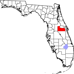 | |
| Towns | ||
| CDPs |
| |
| Unincorporated communities | ||
| Footnotes | ‡This populated place also has portions in an adjacent county or counties | |
This article is issued from Wikipedia - version of the 11/30/2016. The text is available under the Creative Commons Attribution/Share Alike but additional terms may apply for the media files.