Franklin County, Florida
| Franklin County, Florida | |
|---|---|
 Franklin County Courthouse | |
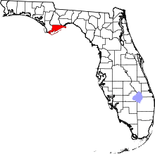 Location in the U.S. state of Florida | |
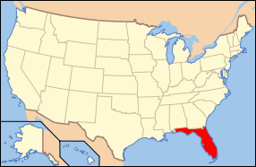 Florida's location in the U.S. | |
| Founded | February 8, 1832 |
| Named for | Benjamin Franklin |
| Seat | Apalachicola |
| Largest community | Eastpoint |
| Area | |
| • Total | 1,026 sq mi (2,657 km2) |
| • Land | 535 sq mi (1,386 km2) |
| • Water | 492 sq mi (1,274 km2), 47.9% |
| Population (est.) | |
| • (2015) | 11,761 |
| • Density | 22/sq mi (8/km²) |
| Congressional district | 2nd |
| Time zone | Eastern: UTC-5/-4 |
| Website |
www |
Franklin County is a county along the Gulf of Mexico in the Florida panhandle of the U.S. state of Florida. As of the 2010 census, the population was 11,549,[1] making it the third-least populous county in Florida. The county seat is Apalachicola.[2]
The county includes several large preserved areas and rivers and has been home to commercial timber and fishing industry. More recently it has become popular for tourism and retirement. It includes several rivers, state parks, and islands.
History
The entire coast line of Franklin County was inhabited by Native Americans for about 12,000 years. Life along the coast was good since seafood was abundant. They traded with the Native Americans in Tallahassee for clay and other items not available on the coast. One style of pottery first found in Carrabelle is named Carrabelle Punctuated. A clay pot was made and, while still damp, the potter would take a small stick of a similar object and press the end of the stick into the clay numerous times until the entire pot was covered with small indentations. It was then placed into a shallow pit, covered with small tree branches, and fired. The result was a decorated water resistant pot.
Franklin County was founded in 1832.[3] It was named for Benjamin Franklin.[4]
The second largest town in Franklin County is Carrabelle, 25 miles east of Apalachiola on the Carrabelle River.
During World War II most of Franklin County was used by the U.S. military for jungle training. The beaches and islands were ideal for amphibious training. When the war ended and the military left, Lanark Village was established from the remaining Officer's quarters.
Geography
According to the U.S. Census Bureau, the county has a total area of 1,026 square miles (2,660 km2), of which 535 square miles (1,390 km2) is land and 492 square miles (1,270 km2) (47.9%) is water.[5]
Franklin County includes part of Tate's Hell State Forest. Bald Point State Park is nearby. The county's river's include the Carrabelle River and its tributaries the New River (Florida Panhandle) and Crooked River (Florida), visited by paddlers. The extreme eastern tip of the county is bordered by the Ochlockonee River.
Adjacent counties
- Liberty County, Florida - north
- Wakulla County, Florida - northeast
- Gulf County, Florida - west (southern part of the county is in the CST)
National protected areas
Barrier Islands
Also, St. James Island, while part of the mainland, is technically an island, being separated from the rest of Franklin County by rivers and an estuary.
Historic sites
Demographics
| Historical population | |||
|---|---|---|---|
| Census | Pop. | %± | |
| 1840 | 1,030 | — | |
| 1850 | 1,561 | 51.6% | |
| 1860 | 1,904 | 22.0% | |
| 1870 | 1,256 | −34.0% | |
| 1880 | 1,791 | 42.6% | |
| 1890 | 3,308 | 84.7% | |
| 1900 | 4,890 | 47.8% | |
| 1910 | 5,201 | 6.4% | |
| 1920 | 5,318 | 2.2% | |
| 1930 | 6,283 | 18.1% | |
| 1940 | 5,991 | −4.6% | |
| 1950 | 5,814 | −3.0% | |
| 1960 | 6,576 | 13.1% | |
| 1970 | 7,065 | 7.4% | |
| 1980 | 7,661 | 8.4% | |
| 1990 | 8,967 | 17.0% | |
| 2000 | 11,057 | 23.3% | |
| 2010 | 11,549 | 4.4% | |
| Est. 2015 | 11,761 | [6] | 1.8% |
| U.S. Decennial Census[7] 1790-1960[8] 1900-1990[9] 1990-2000[10] 2010-2015[1] | |||
As of the census[11] of 2000, there were 11,057 people, 4,096 households, and 2,727 families residing in the county. The population density was 20 people per square mile (8/km²). There were 7,180 housing units at an average density of 13 per square mile (5/km²). The racial makeup of the county was 81.24% White, 16.32% Black or African American, 0.45% Native American, 0.20% Asian, 0.02% Pacific Islander, 0.43% from other races, and 1.34% from two or more races. 2.42% of the population were Hispanic or Latino of any race.
There were 4,096 households out of which 24.80% had children under the age of 18 living with them, 52.50% were married couples] living together, 9.80% had a female householder with no husband present, and 33.40% were non-families. 28.70% of all households were made up of individuals and 11.80% had someone living alone who was 65 years of age or older. The average household size was 2.28 and the average family size was 2.77.
In the county the population was spread out with 18.00% under the age of 18, 7.60% from 18 to 24, 30.80% from 25 to 44, 27.80% from 45 to 64, and 15.70% who were 65 years of age or older. The median age was 41 years. For every 100 females there were 129.60 males. For every 100 females age 18 and over, there were 135.70 males.
The median income for a household in the county was $26,756, and the median income for a family was $31,157. Males had a median income of $25,101 versus $20,494 for females. The per capita income for the county was $16,140. About 11.80% of families and 17.70% of the population were below the poverty line, including 23.20% of those under age 18 and 13.90% of those age 65 or over.
Education
Franklin County residents are within the Franklin County School District. All Students K-12 attend the Franklin County School at Eastpoint, FL, except those attending the Apalachicola Bay Charter School or other private schools.
Libraries
The Franklin County Public Library works with the Wilderness Coast Public Libraries. The FCPL has two library branches.
- Carrabelle
- Eastpoint
Politics
Voter Registration
According to the Secretary of State's office, Democrats comprise a majority of registered voters in Franklin County.
| Franklin County Voter Registration & Party Enrollment as of September 30, 2015[12] | |||||
|---|---|---|---|---|---|
| Political Party | Total Voters | Percentage | |||
| Democratic | 4,425 | 61.36% | |||
| Republican | 1,894 | 26.26% | |||
| Independent | 755 | 10.47% | |||
| Third Parties | 138 | 1.91% | |||
| Total | 7,212 | 100.00% | |||
Statewide Elections
| Year | Republican | Democratic | Third Parties |
|---|---|---|---|
| 2012 | 64.98% 3,570 | 33.58% 1,845 | 1.44% 79 |
| 2008 | 63.12% 3,818 | 35.28% 2,134 | 1.60% 97 |
| 2004 | 58.54% 3,472 | 40.48% 2,401 | 0.97% 58 |
| 2000 | 52.83% 2,454 | 44.07% 2,047 | 3.10% 144 |
| 1996 | 34.21% 1,563 | 45.85% 2,095 | 19.94% 911 |
| 1992 | 37.96% 1,660 | 35.08% 1,534 | 26.96% 1,179 |
| Year | Republican | Democratic | Third Parties |
|---|---|---|---|
| 2014 | 58.17% 2,505 | 37.92% 1,633 | 3.91% 168 |
| 2010 | 47.72% 1,938 | 47.89% 1,945 | 4.39% 178 |
| 2006 | 49.89% 1,981 | 46.69% 1,854 | 3.42% 136 |
| 2002 | 47.81% 1,819 | 50.75% 1,931 | 1.45% 55 |
| 1998 | 56.08% 1,536 | 43.92% 1,203 | 0.00% 0 |
| 1994 | 33.43% 1,324 | 66.57% 2,636 | 0.00% 0 |
Communities
Cities
Census-designated place
Unincorporated communities
Transportation
Airports
- Apalachicola Regional
- Carrabelle-Thompson Airport
- St. George Island Airport
See also
References
- 1 2 "State & County QuickFacts". United States Census Bureau. Retrieved February 12, 2014.
- ↑ "Find a County". National Association of Counties. Retrieved 2011-06-07.
- ↑ Publications of the Florida Historical Society. Florida Historical Society. 1908. p. 31.
- ↑ Gannett, Henry (1905). The Origin of Certain Place Names in the United States. Govt. Print. Off. p. 131.
- ↑ "US Gazetteer files: 2010, 2000, and 1990". United States Census Bureau. 2011-02-12. Retrieved 2011-04-23.
- ↑ "County Totals Dataset: Population, Population Change and Estimated Components of Population Change: April 1, 2010 to July 1, 2015". Retrieved July 2, 2016.
- ↑ "U.S. Decennial Census". United States Census Bureau. Retrieved June 13, 2014.
- ↑ "Historical Census Browser". University of Virginia Library. Retrieved June 13, 2014.
- ↑ "Population of Counties by Decennial Census: 1900 to 1990". United States Census Bureau. Retrieved June 13, 2014.
- ↑ "Census 2000 PHC-T-4. Ranking Tables for Counties: 1990 and 2000" (PDF). United States Census Bureau. Retrieved June 13, 2014.
- ↑ "American FactFinder". United States Census Bureau. Retrieved 2011-05-14.
- ↑ http://dos.myflorida.com/elections/data-statistics/voter-registration-statistics/voter-registration-monthly-reports/voter-registration-current-by-county/
External links
| Wikimedia Commons has media related to Franklin County, Florida. |
Government links/constitutional offices
- Franklin County Board of County Commissioners
- Franklin County Clerk of Court
- Franklin County Supervisor of Elections
- Franklin County Property Appraiser
- Franklin County Sheriff's Office
- Franklin County Tax Collector
Special districts
Judicial branch
- Franklin County Clerk of Courts
- Public Defender, 2nd Judicial Circuit of Florida serving Franklin, Gadsden, Jefferson, Leon, Liberty, and Wakulla counties
- Office of the State Attorney, 2nd Judicial Circuit of Florida
- Circuit and County Court for the 2nd Judicial Circuit of Florida
Tourism links
- Apalachicola Bay Chamber of Commerce
- Franklin County Tourist Development Council
- Carrabelle Area Chamber of Commerce
- St. George Island Visitor Center & Lighthouse Museum
 |
Liberty County | Wakulla County | | |
| Gulf County | |
|||
| ||||
| | ||||
| Gulf of Mexico |
Municipalities and communities of Franklin County, Florida, United States | ||
|---|---|---|
| Cities | | |
| CDPs | ||
| Unincorporated communities | ||
Coordinates: 29°48′N 84°49′W / 29.80°N 84.82°W