Nipton, California
| Nipton | |
|---|---|
| Unincorporated community | |
|
Nipton, California | |
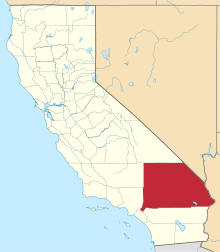
 Nipton Location within the state of California | |
| Coordinates: 35°28′0″N 115°16′20″W / 35.46667°N 115.27222°WCoordinates: 35°28′0″N 115°16′20″W / 35.46667°N 115.27222°W | |
| Country | United States |
| State | California |
| County | San Bernardino |
| Elevation[1] | 3,031 ft (924 m) |
| Time zone | Pacific (UTC-8) |
| • Summer (DST) | PDT (UTC-7) |
| ZIP codes | 92364 |
| Area codes | 442/760 |
| FIPS code | 06-51490 |
| GNIS feature ID | 246562 |
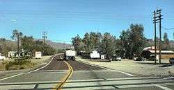
Nipton is an unincorporated community in San Bernardino County, California, on the northeastern border of Mojave National Preserve, approximately 12 miles southeast of Primm, Nevada and the Ivanpah Solar Power Facility. It is accessible via Nevada State Route 164 (also known as Nipton Road).
History
Nipton was founded on February 9, 1905, with the coming of the first train on the newly constructed San Pedro, Los Angeles & Salt Lake Railroad. It was called "Nippeno Camp" following a nearby discovery of gold. The name was changed to Nipton when the San Pedro, Los Angeles & Salt Lake Railroad merged with the Union Pacific Railroad around 1910. In addition to being a cattle-loading station for several local ranches, the town and depot also supplied numerous mines in the area, becoming a social center for the sparse population of the region.
Community facilities
Early facilities included a school, a U.S. post office, a voter precinct, and several small businesses. A five-room adobe hotel was built in the Mexican Territorial style in 1910.
Nipton also has two historic residences, the Nippeno House and the Hermitage House.
Climate
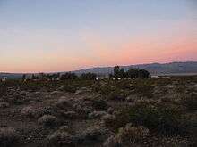
The area has a lot of sunshine year round due to its stable descending air and high pressure. According to the Köppen Climate Classification system, Nipton has a mild desert climate, abbreviated "Bwh" on climate maps.[2]
References
- ↑ "Nipton". Geographic Names Information System. United States Geological Survey. Retrieved April 8, 2015.
- ↑ Climate Summary for Nipton, California
External links
- A description of Nipton
- Nipton, A Ghost Town, Going Green, NY Times, April 30, 2014
| Wikimedia Commons has media related to Nipton, California. |