Sunfair, California
Not to be confused with Sunfair Heights, California.
| Sunfair | |
|---|---|
| Unincorporated community | |
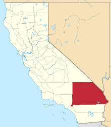
 Sunfair Location within the state of California | |
| Coordinates: 34°9′50″N 116°14′50″W / 34.16389°N 116.24722°WCoordinates: 34°9′50″N 116°14′50″W / 34.16389°N 116.24722°W | |
| Country | United States |
| State | California |
| County | San Bernardino |
| Elevation | 2,412 ft (735 m) |
| Time zone | Pacific (PST) (UTC-8) |
| • Summer (DST) | PDT (UTC-7) |
| ZIP codes | 92277 |
| Area code(s) | 760 |
| GNIS feature ID | 250092[1] |
Sunfair is an unincorporated community in the Mojave Desert, within San Bernardino County, California.
The community is about 3.5 miles (5.6 km) northeast of Joshua Tree. State Route 62 traverses the area south of Sunfair in an east-west direction. Sunfair lies near the northern border of Joshua Tree National Park[2]
The community is served by the Morongo Unified School District.[3]
The Hi-Desert Medical Center is located here.
Area landmarks
Other nearby geographic features include:
- Hi Desert Airport (FAA ID: L80) at 5500 Sunfair Road near the south extent of the community 34°09′15″N 116°15′07″W / 34.15417°N 116.25194°W.[4]
- Sunfair Heights, California — community to the north.
- Coyote Lake at 35°04′13″N 116°45′14″W / 35.07028°N 116.75389°W.[2]
- Panorama Heights, a community to the south, at 34°07′27″N 116°13′12″W / 34.12417°N 116.22000°W.[2]
See also
- Populated places in the Mojave Desert
References
- ↑ U.S. Geological Survey Geographic Names Information System: Sunfair
- 1 2 3 Sunfair, California, 7.5-minute quadrangle, US Geological Survey, 1993.
- ↑ US Department of Education, National Center for Educational Statistics, Common Core of Data files, 2006.
- ↑ Airport Facility Directory: Southwest US, US Department of Transportation, Federal Aviation Administration, (unknown year).
This article is issued from Wikipedia - version of the 8/17/2016. The text is available under the Creative Commons Attribution/Share Alike but additional terms may apply for the media files.