Twin Peaks, California
For the hills in San Francisco, California, see Twin Peaks (San Francisco).
| Twin Peaks, California | |
|---|---|
| Unincorporated community | |
 Twin Peaks, California | |
| Coordinates: 34°14′20″N 117°14′01″W / 34.23889°N 117.23361°WCoordinates: 34°14′20″N 117°14′01″W / 34.23889°N 117.23361°W | |
| Country | United States |
| State | California |
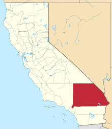
| County | San Bernardino |
| Elevation | 5,777 ft (1,761 m) |
| Time zone | Pacific (PST) (UTC-8) |
| • Summer (DST) | PDT (UTC-7) |
| ZIP code | 92391 |
| Area code(s) | 909 |
| GNIS feature ID | 1661596[1] |
Twin Peaks is an unincorporated community in San Bernardino County, California, United States, located on California State Route 189 2.5 miles (4.0 km) west-southwest of Lake Arrowhead. Twin Peaks has a post office with ZIP code 92391, which opened in 1916.[2][3]
Climate
According to the Köppen Climate Classification system, Twin Peaks has a warm-summer Mediterranean climate, abbreviated "Csa" on climate maps.[4]
References
- ↑ "US Board on Geographic Names". United States Geological Survey. 2007-10-25. Retrieved 2008-01-31.
- ↑ ZIP Code Lookup
- ↑ Durham, David L. (1998). California's Geographic Names: A Gazetteer of Historic and Modern Names of the State. Quill Driver Books. p. 1478. ISBN 1-884995-14-4.
- ↑ Climate Summary for Twin Peaks, California
This article is issued from Wikipedia - version of the 10/29/2016. The text is available under the Creative Commons Attribution/Share Alike but additional terms may apply for the media files.