Cadiz, California
| Cadiz | |
|---|---|
| Unincorporated community | |
|
Salt evaporation ponds near Cadiz | |
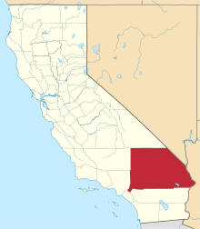
 Cadiz Location within the state of California | |
| Coordinates: 34°31′12″N 115°30′46″W / 34.52000°N 115.51278°WCoordinates: 34°31′12″N 115°30′46″W / 34.52000°N 115.51278°W | |
| Country | United States |
| State | California |
| County | San Bernardino |
| Founded | 1883 |
| Elevation[1] | 791 ft (241 m) |
| Time zone | Pacific (PST) (UTC-8) |
| • Summer (DST) | PDT (UTC-7) |
| ZIP codes | 92304 |
| Area codes | 442/760 |
| FIPS code | 06-09472 |
| GNIS feature ID | 239977 |

Cadiz is a small unincorporated community in the Mojave Desert in San Bernardino County, California. It is located just south of the Marble Mountains near the National Trails Highway. Cadiz is home to a former railroad stop, and is situated at 34° 31' 12" North latitude and 115° 30' 46" West longitude, at an elevation of 791 feet (241 m). It is northeast of the Sheep Hole Mountains and can be accessed by road from the historic Route 66 at Chambless.
History
The town was named in 1883 by Lewis Kingman, a locating engineer for the Atlantic and Pacific Railroad. It is the third in a string of alphabetically named railroad stations in the Mojave Desert.[2]
Climate
This area has a large amount of sunshine year round due to its stable descending air and high pressure.
Current activity
Cadiz, Inc., a Los Angeles-based land and water-resource-management company, owns more than 35,000 acres (140 km2) around Cadiz. The Cadiz Valley area overlies a large aquifer and is located approximately 30 miles (48 km) north of the Colorado River Aqueduct.
The ZIP Code is 92304 and the community is inside area code 760.
Railroads
Cadiz is served by the BNSF Railway's Southern Transcon line that runs from Los Angeles to Chicago. It was previously the Atchison, Topeka and Santa Fe Railway line. From Cadiz, the Arizona & California Railroad runs over a former ATSF line to Phoenix via Parker, Arizona.
In September 2013, Cadiz, Inc. had negotiated the Arizona & California Railroad for trackage rights for a tourist train operation between Cadiz and Parker. The train is projected to be powered by a steam locomotive, listing Santa Fe 3751 as the potential engine. The plans also require a new station and museum in Cadiz.[3]
Cadiz Airstrip
Cadiz Airstrip (CA90) is situated south of the railroad tracks and has one paved runway 8/26 with a length of 5,280 feet (1,610 m). The airstrip is accessible through a dirt road and has no buildings.[4]
See also
| Wikimedia Commons has media related to Cadiz, California. |
References
- ↑ "Cadiz". Geographic Names Information System. United States Geological Survey. Retrieved April 12, 2015.
- ↑ Gudde, Erwin; William Bright (2004). California Place Names (Fourth ed.). University of California Press. p. 11. ISBN 0-520-24217-3.
- ↑ "Cadiz Inc. Announces Agreement to Operate Steam Powered Excursion Train on the Arizona & California Railroad". Business Wire. 2013-09-19. Retrieved 2016-04-10.
- ↑ http://www.airnav.com/airport/CA90