Halloran Springs, California
| Halloran Springs | |
|---|---|
| unincorporated community | |
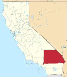
 Halloran Springs Location within the state of California | |
| Coordinates: 35°22′21″N 115°53′26″W / 35.37250°N 115.89056°WCoordinates: 35°22′21″N 115°53′26″W / 35.37250°N 115.89056°W | |
| Country | United States |
| State | California |
| County | San Bernardino |
| Elevation[1] | 2,986 ft (910 m) |
| Time zone | Pacific (PST) (UTC-8) |
| • Summer (DST) | PDT (UTC-7) |
| ZIP code | 92309 |
| Area codes | 442/760 |
| FIPS code | 06-31736 |
| GNIS feature ID | 1667018 |
Halloran Springs is an unincorporated community in the Mojave Desert in San Bernardino County, California, United States. It is located on Interstate 15 between Baker, California and Las Vegas, Nevada approximately 15 miles (24 km) northeast of Baker.
The stretch of road near Halloran Springs has been the site of numerous accidents over the years, especially on Sunday night and early Monday morning, as tourists returning to Southern California from weekends in Las Vegas often fall asleep at the wheel on this stretch of highway.
The ZIP code is 92309 and the community is inside area codes 442 and 760.
As of the end of year 2014, the human population of Halloran Springs is one.
Notes
- ↑ "Halloran Springs". Geographic Names Information System. United States Geological Survey. Retrieved April 12, 2015.
This article is issued from Wikipedia - version of the 4/13/2015. The text is available under the Creative Commons Attribution/Share Alike but additional terms may apply for the media files.