New Braintree, Massachusetts
| New Braintree, Massachusetts | ||
|---|---|---|
| Town | ||
|
New Braintree Center | ||
| ||
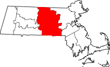
 Location in Worcester County and the state of Massachusetts. | ||
| Coordinates: 42°19′00″N 72°07′35″W / 42.31667°N 72.12639°WCoordinates: 42°19′00″N 72°07′35″W / 42.31667°N 72.12639°W | ||
| Country | United States | |
| State | Massachusetts | |
| County | Worcester | |
| Settled | 1709 | |
| Incorporated | 1775 | |
| Government | ||
| • Type | Open town meeting | |
| Area | ||
| • Total | 20.9 sq mi (54.0 km2) | |
| • Land | 20.7 sq mi (53.6 km2) | |
| • Water | 0.2 sq mi (0.4 km2) | |
| Elevation | 945 ft (288 m) | |
| Population (2010) | ||
| • Total | 999 | |
| • Density | 48/sq mi (19/km2) | |
| Time zone | Eastern (UTC-5) | |
| • Summer (DST) | Eastern (UTC-4) | |
| ZIP code | 01531 | |
| Area code(s) | 508 / 774 | |
| FIPS code | 25-45105 | |
| GNIS feature ID | 0619484 | |


Congregational Church
New Braintree is a town in Worcester County, Massachusetts, United States. The population was 999 at the 2010 census.
History
New Braintree was first settled in 1709 and was officially incorporated in 1751. The town's lands were formerly a part of the Quaboag Plantation.[1]
It has been the home of the Massachusetts State Police Academy since 1992. Governor Michael Dukakis had proposed and began construction of a controversial state prison in the late 1980s on this site, but was met with heavy opposition by the town and a group called C.O.S.T. (Conserve Our Small Town). Governor William Weld was elected and ceased the construction of the prison. The state police training academy now occupies the grounds and buildings of the former Seventh-day Adventist Pioneer Valley Academy. In the photo shown, one can see the school's former boys' and girls' dormitories with the cafeteria in between and the water tower to the right of the boys' dormitory. The school opened its doors in September 1965 and closed in June 1983.
Geography
According to the United States Census Bureau, the town has a total area of 20.9 square miles (54 km2), of which 20.7 square miles (54 km2) is land and 0.2 square miles (0.52 km2), or 0.72%, is water.
New Braintree is bordered by Barre to the north, Oakham to the east, Spencer to the southeast, West Brookfield and North Brookfield to the south, Ware to the southwest and Hardwick to the west.
Demographics
| Historical population | ||
|---|---|---|
| Year | Pop. | ±% |
| 1850 | 852 | — |
| 1860 | 805 | −5.5% |
| 1870 | 640 | −20.5% |
| 1880 | 610 | −4.7% |
| 1890 | 573 | −6.1% |
| 1900 | 500 | −12.7% |
| 1910 | 464 | −7.2% |
| 1920 | 394 | −15.1% |
| 1930 | 407 | +3.3% |
| 1940 | 439 | +7.9% |
| 1950 | 478 | +8.9% |
| 1960 | 509 | +6.5% |
| 1970 | 631 | +24.0% |
| 1980 | 671 | +6.3% |
| 1990 | 881 | +31.3% |
| 2000 | 927 | +5.2% |
| 2010 | 999 | +7.8% |
| * = population estimate. Source: United States Census records and Population Estimates Program data.[2][3][4][5][6][7][8][9][10][11] | ||
As of the census[12] of 2000, there were 927 people, 318 households, and 267 families residing in the town. The population density was 44.8 people per square mile (17.3/km²). There were 328 housing units at an average density of 15.8 per square mile (6.1/km²). The racial makeup of the town was 99.14% White, 0.22% African American, 0.11% Native American, 0.11% Asian, and 0.43% from two or more races. Hispanic or Latino of any race were 0.32% of the population.
There were 318 households out of which 41.8% had children under the age of 18 living with them, 70.4% were married couples living together, 8.2% had a female householder with no husband present, and 16.0% were non-families. 13.2% of all households were made up of individuals and 5.0% had someone living alone who was 65 years of age or older. The average household size was 2.92 and the average family size was 3.14.
In the town the population was spread out with 29.3% under the age of 18, 5.8% from 18 to 24, 29.7% from 25 to 44, 26.6% from 45 to 64, and 8.5% who were 65 years of age or older. The median age was 38 years. For every 100 females there were 102.8 males. For every 100 females age 18 and over, there were 102.8 males.
The median income for a household in the town was $54,844, and the median income for a family was $60,417. Males had a median income of $41,477 versus $26,136 for females. The per capita income for the town was $21,072. About 4.0% of families and 4.6% of the population were below the poverty line, including 3.5% of those under age 18 and 2.6% of those age 65 or over.
The town's only restaurant, Reed's Country Store, has been owned and operated by Edward and Susan Reed since 1977. Breakfast and lunch is served here and it has been a central town gathering point for years. Every September for the past 38 years the town has had a Country Fair in the Town Center.
Government
| County-level state agency heads | |
|---|---|
| Clerk of Courts: | Dennis P. McManus (D) |
| District Attorney: | Joseph D. Early, Jr. (D) |
| Register of Deeds: | Anthony J. Vigliotti (D) |
| Register of Probate: | Stephanie K. Fattman (R) |
| County Sheriff: | Lew Evangelidis (R) |
| State government | |
| State Representative(s): | Donnie Berthiaume (R) |
| State Senator(s): | Anne M. Gobi (D) |
| Governor's Councilor(s): | Jen Caissie (R) |
| Federal government | |
| U.S. Representative(s): | James P. McGovern (D-2nd District), |
| U.S. Senators: | Elizabeth Warren (D), Ed Markey (D) |
Notable people
- Charles Allen, congressman, established a law practice in New Braintree
- Thaddeus Bowman, minuteman, buried in the cemetery at the Congregational Church in New Braintree
- Charles Delano, US Representative from Massachusetts, born in New Braintree
- Alexander DeWitt, US Representative from Massachusetts, born in New Braintree
- Jonathan Fisher, Congregational minister born in New Braintree
- Rufus Putnam, general in the Continental Army, lived in New Braintree
References
- ↑ "Brief History of Quaboag Plantation". West Brookfield Historical Society. Retrieved 28 February 2014.
- ↑ "TOTAL POPULATION (P1), 2010 Census Summary File 1". American FactFinder, All County Subdivisions within Massachusetts. United States Census Bureau. 2010.
- ↑ "Massachusetts by Place and County Subdivision - GCT-T1. Population Estimates". United States Census Bureau. Retrieved July 12, 2011.
- ↑ "1990 Census of Population, General Population Characteristics: Massachusetts" (PDF). US Census Bureau. December 1990. Table 76: General Characteristics of Persons, Households, and Families: 1990. 1990 CP-1-23. Retrieved July 12, 2011.
- ↑ "1980 Census of the Population, Number of Inhabitants: Massachusetts" (PDF). US Census Bureau. December 1981. Table 4. Populations of County Subdivisions: 1960 to 1980. PC80-1-A23. Retrieved July 12, 2011.
- ↑ "1950 Census of Population" (PDF). Bureau of the Census. 1952. Section 6, Pages 21-10 and 21-11, Massachusetts Table 6. Population of Counties by Minor Civil Divisions: 1930 to 1950. Retrieved July 12, 2011.
- ↑ "1920 Census of Population" (PDF). Bureau of the Census. Number of Inhabitants, by Counties and Minor Civil Divisions. Pages 21-5 through 21-7. Massachusetts Table 2. Population of Counties by Minor Civil Divisions: 1920, 1910, and 1920. Retrieved July 12, 2011.
- ↑ "1890 Census of the Population" (PDF). Department of the Interior, Census Office. Pages 179 through 182. Massachusetts Table 5. Population of States and Territories by Minor Civil Divisions: 1880 and 1890. Retrieved July 12, 2011.
- ↑ "1870 Census of the Population" (PDF). Department of the Interior, Census Office. 1872. Pages 217 through 220. Table IX. Population of Minor Civil Divisions, &c. Massachusetts. Retrieved July 12, 2011.
- ↑ "1860 Census" (PDF). Department of the Interior, Census Office. 1864. Pages 220 through 226. State of Massachusetts Table No. 3. Populations of Cities, Towns, &c. Retrieved July 12, 2011.
- ↑ "1850 Census" (PDF). Department of the Interior, Census Office. 1854. Pages 338 through 393. Populations of Cities, Towns, &c. Retrieved July 12, 2011.
- ↑ "American FactFinder". United States Census Bureau. Retrieved 2008-01-31.
External links
| Wikimedia Commons has media related to New Braintree, Massachusetts. |
- Town of New Braintree official website
- New Braintree information at Mass.gov
- New Braintree Historical Society
- New Braintree Country Fair