Ashburnham, Massachusetts
| Ashburnham, Massachusetts | ||
|---|---|---|
| Town | ||
|
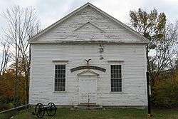
Historical Society Meeting House | ||
| ||
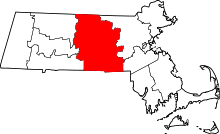
 Location in Worcester County and the state of Massachusetts. | ||
| Coordinates: 42°38′10″N 71°54′30″W / 42.63611°N 71.90833°WCoordinates: 42°38′10″N 71°54′30″W / 42.63611°N 71.90833°W | ||
| Country | United States | |
| State | Massachusetts | |
| County | Worcester | |
| Settled | 1736 | |
| Incorporated | 1765 | |
| Government | ||
| • Type | Open town meeting | |
| • Town Administrator | Douglas Briggs | |
| Area | ||
| • Total | 41.0 sq mi (106.2 km2) | |
| • Land | 38.7 sq mi (100.2 km2) | |
| • Water | 2.3 sq mi (6.0 km2) | |
| Elevation | 1,028 ft (313 m) | |
| Population (2010) | ||
| • Total | 6,081 | |
| • Density | 157.1/sq mi (60.7/km2) | |
| Time zone | Eastern (UTC−5) | |
| • Summer (DST) | Eastern (UTC−4) | |
| ZIP code | 01430 | |
| Area code | 351 / 978 | |
| FIPS code | 25-01885 | |
| GNIS feature ID | 0618356 | |
| Website | www.ashburnham-ma.gov | |

Ashburnham is a town in Worcester County, Massachusetts. At the 2010 census the town population was 6,081. It is home to Cushing Academy, a private preparatory school.
It contains the census-designated place of South Ashburnham, Massachusetts.
History
Ashburnham was first settled in 1736, and was officially incorporated in 1765. The name is of British origin, possibly drawn from the Earl of Ashburnham, in Pembrey, or the Sussex community of Ashburnham.
Ashburnam was originally made up of the lands granted to officers and soldiers of a 1690 expedition to Canada. It was called the Plantation of Dorchester-Canada until it was incorporated.
Geography and transportation
According to the United States Census Bureau, the town has a total area of 41.0 square miles (106 km2), of which 38.7 square miles (100 km2) is land and 2.3 square miles (6.0 km2) (5.68%) is water. Ashburnham has two distinct topographical areas, hilly to the east and relatively flat high ground to the west. To the east, Mount Watatic and Little Watatic Mountain rise in the northeastern part of town, with Jewell Hill to the southeast and Blood Hill rising just over the town line. In the western part of town are several lakes, including Lake Wampanoag, Sunset Lake, Lake Watatic, Wallace Pond, and the Upper & Lower Naukeag Lakes, all of which (except Lake Wampanoag) feed into the headwaters of the Millers River, which flows westward towards the Connecticut River. Several brooks also feed into these lakes and ponds, along with several others between the hills in the eastern part of town. Several areas scattered around the town are protected as part of Ashburnham State Forest, as well as two smaller areas which are parts of Mount Watatic State Wildlife Management Area and a small portion of the High Ridge Wildlife Management Area to the south.
Though it is over fifteen miles west of the easternmost portions of Worcester County, it nonetheless is the northeast corner of the county, bordering Middlesex County to the east, and Cheshire County, New Hampshire and Hillsborough County, New Hampshire to the north. Ashburnham is bordered by Rindge, New Hampshire and New Ipswich, New Hampshire to the north, Ashby to the east, Westminster and a small portion of Fitchburg to the southeast, Gardner to the southwest, and Winchendon to the west. The town's center lies seven miles from downtown Fitchburg, 29 miles north of Worcester, and fifty miles northwest of Boston. There are several small villages within town, the most notable being North and South Ashburnham.
There are no interstates or limited-access highways within the town of Ashburnham, with the nearest being Route 2, the major east-west route through northern Massachusetts, which passes through Fitchburg and Westminster. Route 12 passes from east to west through town, entering from Westminster and passing west towards Winchendon. The northern terminus of Route 101, which passes from Gardner towards the north before terminating at Route 119, which passes from Ashby before entering New Hampshire and becoming New Hampshire Route 119. Routes 12 &101 share a short, 150-yard concurrency in the center of town. There are no stoplights in town.
An abandoned section of the Springfield Terminal Railroad passes through the town, splitting in South Ashburnham, part of which returns towards Gardner, the other part heading through Winchendon towards New Hampshire. A line of the Montachusett Regional Transit Authority (MART) serves the town. MART[1] also operates fixed-route bus services, shuttle services, as well as paratransit services for Ashburnham and the Montachusett Region.
There are two general aviation airports nearby, Fitchburg Municipal Airport and Gardner Municipal Airport, with the nearest national air service being at Manchester-Boston Regional Airport in New Hampshire.
Demographics
| Historical population | ||
|---|---|---|
| Year | Pop. | ±% |
| 1850 | 1,875 | — |
| 1860 | 2,108 | +12.4% |
| 1870 | 2,172 | +3.0% |
| 1880 | 1,666 | −23.3% |
| 1890 | 2,074 | +24.5% |
| 1900 | 1,882 | −9.3% |
| 1910 | 2,107 | +12.0% |
| 1920 | 2,012 | −4.5% |
| 1930 | 2,079 | +3.3% |
| 1940 | 2,255 | +8.5% |
| 1950 | 2,603 | +15.4% |
| 1960 | 2,758 | +6.0% |
| 1970 | 3,484 | +26.3% |
| 1980 | 4,075 | +17.0% |
| 1990 | 5,433 | +33.3% |
| 2000 | 5,546 | +2.1% |
| 2010 | 6,081 | +9.6% |
| * = population estimate. Source: United States Census records and Population Estimates Program data.[2][3][4][5][6][7][8][9][10][11] | ||
As of the census[12] of 2000, there were 5,546 people, 1,929 households, and 1,541 families residing in the town. The population density was 143.4 people per square mile (55.4/km²). There were 2,204 housing units at an average density of 57.0 per square mile (22.0/km²). The racial makeup of the town was 97.66% White, 0.22% African American, 0.04% Native American, 0.61% Asian, 0.31% from other races, and 1.17% from two or more races. Hispanic or Latino of any race were 1.66% of the population. 19.5% were of Irish, 15.9% French, 13.7% French Canadian, 9.4% Italian, 7.0% English, 6.6% Finnish and 5.6% American ancestry according to Census 2000.
There were 1,929 households out of which 42.0% had children under the age of 18 living with them, 66.8% were married couples living together, 9.3% had a female householder with no husband present, and 20.1% were non-families. 15.6% of all households were made up of individuals and 5.4% had someone living alone who was 65 years of age or older. The average household size was 2.87 and the average family size was 3.20.
In the town the age distribution of the population shows 29.0% under the age of 18, 6.7% from 18 to 24, 30.9% from 25 to 44, 24.5% from 45 to 64, and 8.9% who were 65 years of age or older. The median age was 37 years. For every 100 females there were 103.2 males. For every 100 females age 18 and over, there were 99.3 males.
According to the 2010 census, the median household income was $76,250 and the average household income was $81,324. The per capita household income was $29,044. About 4.8% of families and 6.4% of the population were below the poverty line, including 6.8% of those under age 18 and 6.4% of those age 65 or over. The median house cost was $266,347.
Government
| Clerk of Courts: | Dennis P. McManus |
|---|---|
| District Attorney: | Joseph D. Early, Jr. (D) |
| Register of Deeds: | Kathleen R. Daigneault (D) |
| Register of Probate: | Stephen Abraham (D) |
| County Sheriff: | Lew Evangelidis (R) |
| State government | |
| State Representative(s): | Jonathan Zlotnik (D) |
| State Senator(s): | Anne Gobi (D) |
| Governor's Councilor(s): | Jen Caissie (R) |
| Federal government | |
| U.S. Representative(s): | Niki Tsongas (D-3rd District), |
| U.S. Senators: | Elizabeth Warren (D), Ed Markey (D) |
Educational institutions
Private:
Public:
- John R. Briggs Elementary
- Overlook Middle School
- Oakmont Regional High School
Points of interest
- Ashburnham is the starting point for the Wapack Trail and Massachusetts Midstate Trail.
- Cambridge Grant Historic District
- Mount Watatic was named as one of the 1,000 places to visit in Massachusetts by the Great Places in Massachusetts Commission.[13]
- Frederick historic piano collection[14]
Notable people
- Ivers Whitney Adams, founder and President of the Boston Red Stockings, Boston's first baseball team; as well as the Boston Base Ball Club, the first professional Baseball franchise in Boston. He also gave to the town its own water supply as well as commissioned Bela Pratt to design the Schoolboy Statue of 1850, now on the corner of Main and School Streets.
- Melvin O. Adams, lawyer for Lizzie Borden, was born in Ashburnham.
- Nate Berkus, designer and TV personality; graduated from Cushing Academy.
- Bette Davis, legendary actress of film, television and theater. She lived in Ashburnham while attending Cushing Academy, graduating in 1927. In 1999, Davis was placed second, after Katharine Hepburn, on the American Film Institute's list of the greatest female stars of all time (AFI's 100 Years…100 Stars).
- Isaac Hill (1788–1851), New Hampshire State Representative, New Hampshire State Senator, Comptroller of the United States Treasury in the Andrew Jackson administration, U.S. Senator from NH, and Governor of New Hampshire.
- Harrison Carroll Hobart, Wisconsin politician.
- Amos Pollard, defender of the Alamo.
- Cassius Clement Stearns (1838–1910), composer of church music.
- Jigme Khesar Namgyal Wangchuck, King of the Kingdom of Bhutan; graduated from Cushing Academy.
See also
References
- ↑ mrta.us
- ↑ "TOTAL POPULATION (P1), 2010 Census Summary File 1". American FactFinder, All County Subdivisions within Massachusetts. United States Census Bureau. 2010.
- ↑ "Massachusetts by Place and County Subdivision - GCT-T1. Population Estimates". United States Census Bureau. Retrieved July 12, 2011.
- ↑ "1990 Census of Population, General Population Characteristics: Massachusetts" (PDF). US Census Bureau. December 1990. Table 76: General Characteristics of Persons, Households, and Families: 1990. 1990 CP-1-23. Retrieved July 12, 2011.
- ↑ "1980 Census of the Population, Number of Inhabitants: Massachusetts" (PDF). US Census Bureau. December 1981. Table 4. Populations of County Subdivisions: 1960 to 1980. PC80-1-A23. Retrieved July 12, 2011.
- ↑ "1950 Census of Population" (PDF). Bureau of the Census. 1952. Section 6, Pages 21-10 and 21-11, Massachusetts Table 6. Population of Counties by Minor Civil Divisions: 1930 to 1950. Retrieved July 12, 2011.
- ↑ "1920 Census of Population" (PDF). Bureau of the Census. Number of Inhabitants, by Counties and Minor Civil Divisions. Pages 21-5 through 21-7. Massachusetts Table 2. Population of Counties by Minor Civil Divisions: 1920, 1910, and 1920. Retrieved July 12, 2011.
- ↑ "1890 Census of the Population" (PDF). Department of the Interior, Census Office. Pages 179 through 182. Massachusetts Table 5. Population of States and Territories by Minor Civil Divisions: 1880 and 1890. Retrieved July 12, 2011.
- ↑ "1870 Census of the Population" (PDF). Department of the Interior, Census Office. 1872. Pages 217 through 220. Table IX. Population of Minor Civil Divisions, &c. Massachusetts. Retrieved July 12, 2011.
- ↑ "1860 Census" (PDF). Department of the Interior, Census Office. 1864. Pages 220 through 226. State of Massachusetts Table No. 3. Populations of Cities, Towns, &c. Retrieved July 12, 2011.
- ↑ "1850 Census" (PDF). Department of the Interior, Census Office. 1854. Pages 338 through 393. Populations of Cities, Towns, &c. Retrieved July 12, 2011.
- ↑ "American FactFinder". United States Census Bureau. Archived from the original on 2013-09-11. Retrieved 2008-01-31.
- ↑ "1,000 places to visit in Massachusetts". Boston.com. 2010-07-26. Retrieved 2014-01-27.
- ↑ frederickcollection.org
External links
| Wikimedia Commons has media related to Ashburnham, Massachusetts. |